
COR Corvallis, Oregon, USA - Earthquake Result Viewer
| ||||||||||||||||||
| ||||||||||||||||||
| ||||||||||||||||||
|
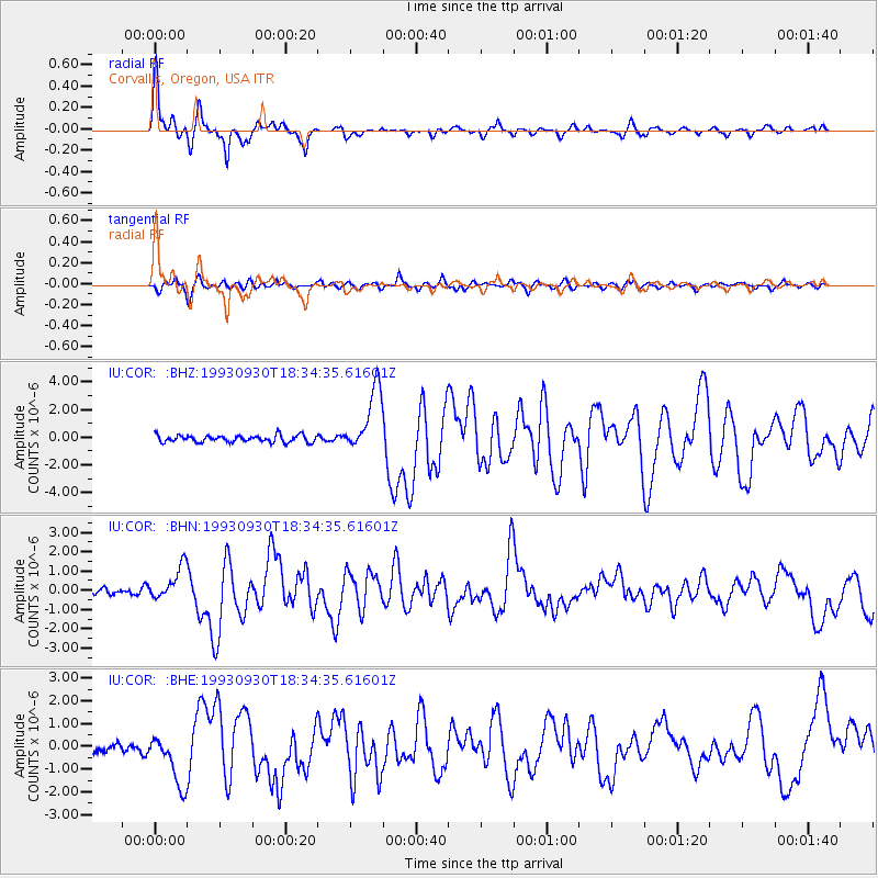
Signal To Noise
| Channel | StoN | STA | LTA |
| IU:COR: :BHN:19930930T18:34:35.61601Z | 4.5139456 | 8.725453E-7 | 1.9329991E-7 |
| IU:COR: :BHE:19930930T18:34:35.61601Z | 6.6413903 | 1.1280737E-6 | 1.6985504E-7 |
| IU:COR: :BHZ:19930930T18:34:35.61601Z | 9.214773 | 2.3056728E-6 | 2.502148E-7 |
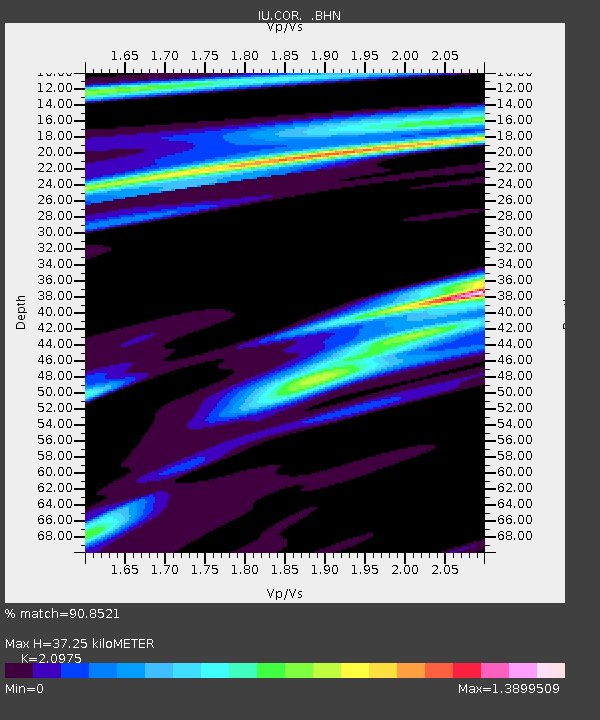
| Arrivals | |
| Ps | 6.6 SECOND |
| PpPs | 16 SECOND |
| PsPs/PpSs | 23 SECOND |

