
COR Corvallis, Oregon, USA - Earthquake Result Viewer
| ||||||||||||||||||
| ||||||||||||||||||
| ||||||||||||||||||
|
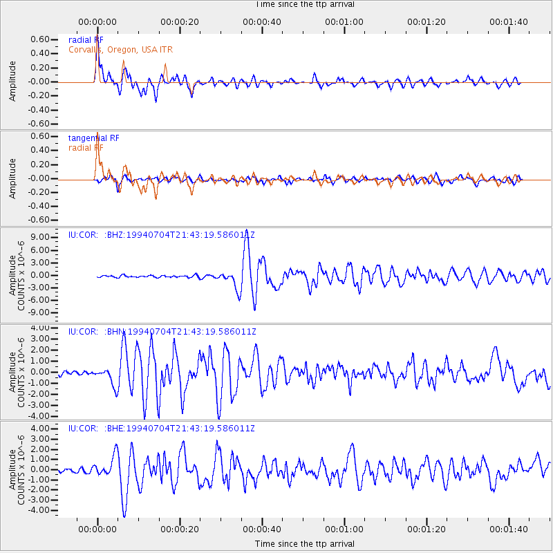
Signal To Noise
| Channel | StoN | STA | LTA |
| IU:COR: :BHN:19940704T21:43:19.586011Z | 3.367062 | 8.1933416E-7 | 2.43338E-7 |
| IU:COR: :BHE:19940704T21:43:19.586011Z | 6.3769107 | 1.0685017E-6 | 1.6755789E-7 |
| IU:COR: :BHZ:19940704T21:43:19.586011Z | 9.90504 | 2.28342E-6 | 2.3053113E-7 |
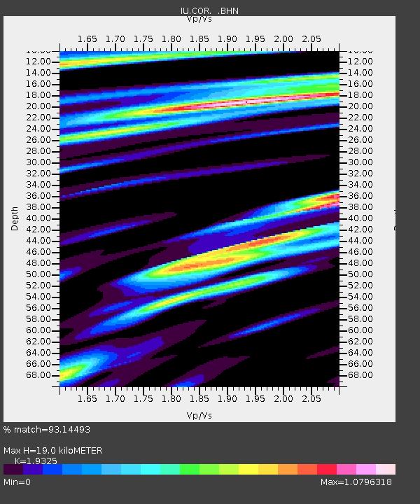
| Arrivals | |
| Ps | 2.9 SECOND |
| PpPs | 7.9 SECOND |
| PsPs/PpSs | 11 SECOND |

