MVL Millersville University, PA - Earthquake Result Viewer
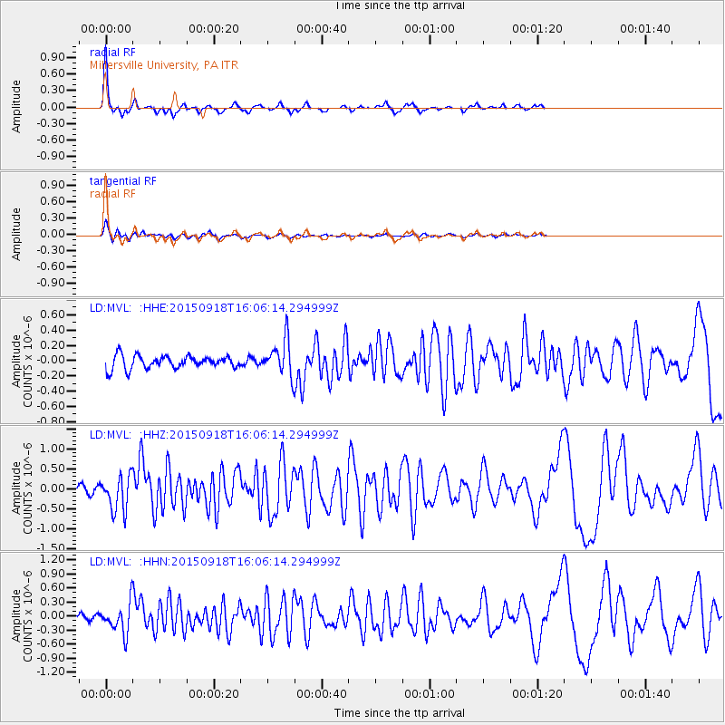
Earthquake location: Northern Mid-Atlantic Ridge
Earthquake latitude/longitude: 15.3/-46.0
Earthquake time(UTC): 2015/09/18 (261) 15:59:42 GMT
Earthquake Depth: 10 km
Earthquake Magnitude: 6.0 MWW, 5.9 MWB, 6.0 MWC
Earthquake Catalog/Contributor: NEIC PDE/NEIC COMCAT
Network: LD Lamont-Doherty Cooperative Seismographic Network
Station: MVL Millersville University, PA
Lat/Lon: 40.00 N/76.35 W
Elevation: 91 m
Distance: 36.2 deg
Az: 318.853 deg
Baz: 124.24 deg
Ray Param: 0.07683
Estimated Moho Depth: 39.25 km
Estimated Crust Vp/Vs: 1.83
Assumed Crust Vp: 6.419 km/s
Estimated Crust Vs: 3.503 km/s
Estimated Crust Poisson's Ratio: 0.29
Radial Match: 86.300224 %
Radial Bump: 263
Transverse Match: 79.723976 %
Transverse Bump: 336
SOD ConfigId: 7422571
Insert Time: 2019-04-20 22:13:26.227 +0000
GWidth: 2.5
Max Bumps: 400
Tol: 0.001

Signal To Noise

ChannelStoNSTALTA
LD:MVL: :HHZ:20150918T16:06:14.294999Z5.04954.4979572E-78.907728E-8
LD:MVL: :HHN:20150918T16:06:14.294999Z3.91070633.1881348E-78.152325E-8
LD:MVL: :HHE:20150918T16:06:14.294999Z2.78079442.352846E-78.461057E-8
Arrivals
Ps5.5 SECOND
PpPs16 SECOND
PsPs/PpSs22 SECOND