WUPA West Chester University of Pennsylvania - Earthquake Result Viewer
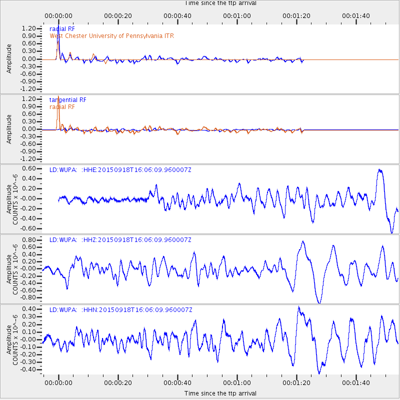
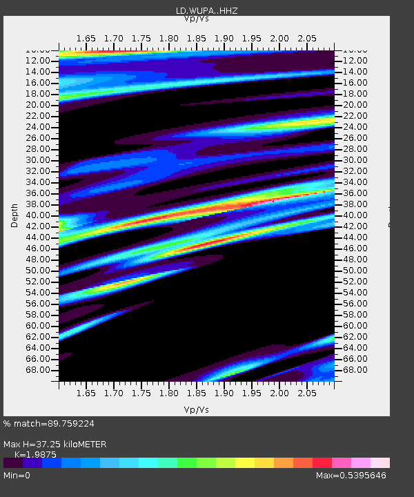
Earthquake location: Northern Mid-Atlantic Ridge
Earthquake latitude/longitude: 15.3/-46.0
Earthquake time(UTC): 2015/09/18 (261) 15:59:42 GMT
Earthquake Depth: 10 km
Earthquake Magnitude: 6.0 MWW, 5.9 MWB, 6.0 MWC
Earthquake Catalog/Contributor: NEIC PDE/NEIC COMCAT
Network: LD Lamont-Doherty Cooperative Seismographic Network
Station: WUPA West Chester University of Pennsylvania
Lat/Lon: 39.93 N/75.61 W
Elevation: 86 m
Distance: 35.7 deg
Az: 319.314 deg
Baz: 125.09 deg
Ray Param: 0.07710643
Estimated Moho Depth: 37.25 km
Estimated Crust Vp/Vs: 1.99
Assumed Crust Vp: 6.287 km/s
Estimated Crust Vs: 3.164 km/s
Estimated Crust Poisson's Ratio: 0.33
Radial Match: 89.759224 %
Radial Bump: 330
Transverse Match: 47.42184 %
Transverse Bump: 400
SOD ConfigId: 7422571
Insert Time: 2019-04-20 22:13:33.876 +0000
GWidth: 2.5
Max Bumps: 400
Tol: 0.001

Signal To Noise

ChannelStoNSTALTA
LD:WUPA: :HHZ:20150918T16:06:09.960007Z4.21910142.1732265E-75.150923E-8
LD:WUPA: :HHN:20150918T16:06:09.960007Z1.79650747.735532E-84.3058723E-8
LD:WUPA: :HHE:20150918T16:06:09.960007Z3.40440251.1964916E-73.514542E-8
Arrivals
Ps6.2 SECOND
PpPs17 SECOND
PsPs/PpSs23 SECOND