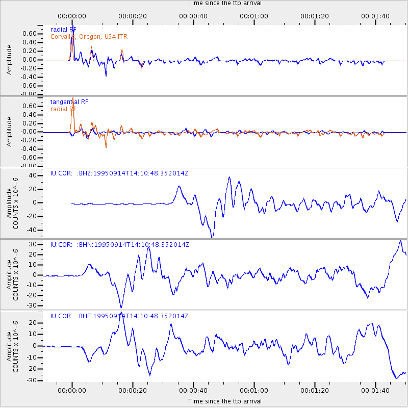
COR Corvallis, Oregon, USA - Earthquake Result Viewer
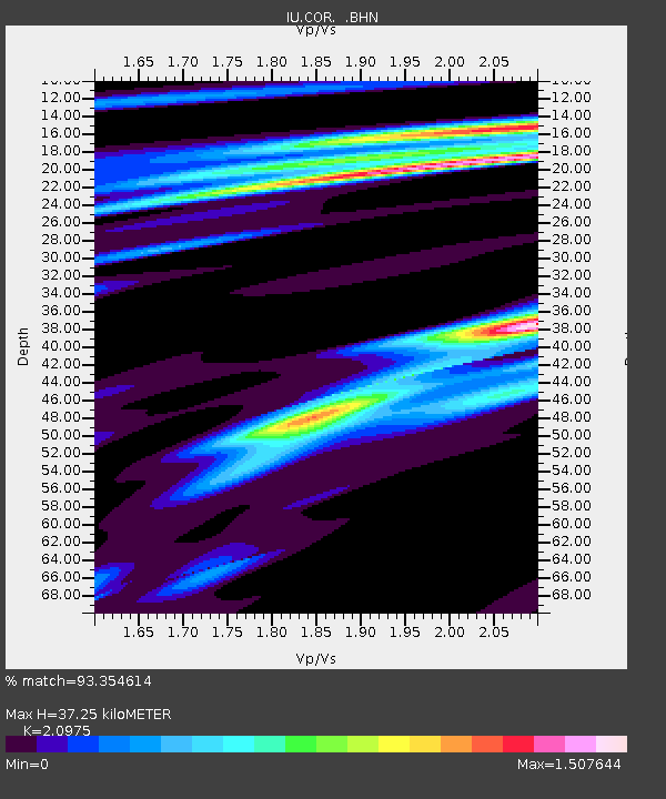
Earthquake location: Near Coast Of Guerrero, Mexico
Earthquake latitude/longitude: 16.8/-98.6
Earthquake time(UTC): 1995/09/14 (257) 14:04:31 GMT
Earthquake Depth: 21 km
Earthquake Magnitude: 6.4 MB, 7.2 MS, 7.2 UNKNOWN, 7.5 MW
Earthquake Catalog/Contributor: WHDF/NEIC
Network: IU Global Seismograph Network (GSN - IRIS/USGS)
Station: COR Corvallis, Oregon, USA
Lat/Lon: 44.59 N/123.30 W
Elevation: 121 m
Distance: 34.6 deg
Az: 328.271 deg
Baz: 135.187 deg
Ray Param: 0.077631034
Estimated Moho Depth: 37.25 km
Estimated Crust Vp/Vs: 2.10
Assumed Crust Vp: 6.566 km/s
Estimated Crust Vs: 3.13 km/s
Estimated Crust Poisson's Ratio: 0.35
Radial Match: 93.354614 %
Radial Bump: 332
Transverse Match: 73.206345 %
Transverse Bump: 400
SOD ConfigId: 6273
Insert Time: 2010-03-04 20:06:26.259 +0000
GWidth: 2.5
Max Bumps: 400
Tol: 0.001

Signal To Noise

ChannelStoNSTALTA
IU:COR: :BHN:19950914T14:10:48.352014Z8.6214392.269602E-62.6325097E-7
IU:COR: :BHE:19950914T14:10:48.352014Z10.1575832.7422516E-62.6997085E-7
IU:COR: :BHZ:19950914T14:10:48.352014Z16.067446.823759E-64.2469486E-7
Arrivals
Ps6.7 SECOND
PpPs16 SECOND
PsPs/PpSs23 SECOND