
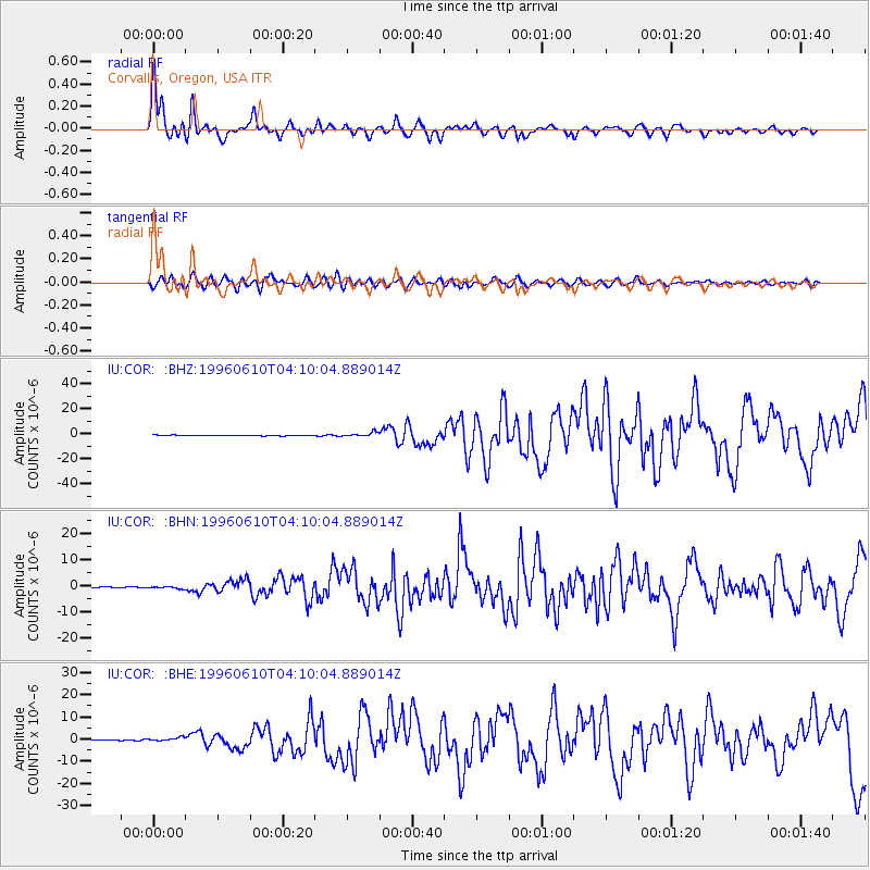
COR Corvallis, Oregon, USA - Earthquake Result Viewer
| ||||||||||||||||||
| ||||||||||||||||||
| ||||||||||||||||||
|
Signal To Noise
| Channel | StoN | STA | LTA |
| IU:COR: :BHN:19960610T04:10:04.889014Z | 2.4226193 | 4.263172E-7 | 1.7597367E-7 |
| IU:COR: :BHE:19960610T04:10:04.889014Z | 3.4971812 | 8.1081043E-7 | 2.3184685E-7 |
| IU:COR: :BHZ:19960610T04:10:04.889014Z | 6.227547 | 1.7560134E-6 | 2.8197513E-7 |
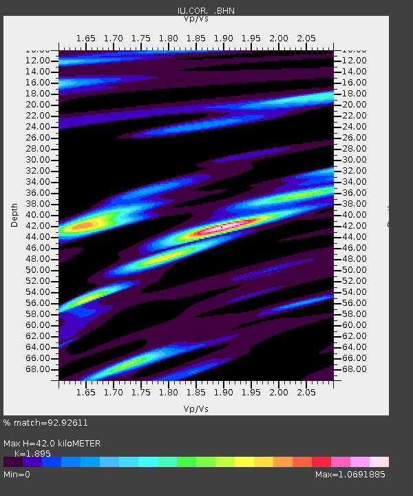
| Arrivals | |
| Ps | 6.2 SECOND |
| PpPs | 17 SECOND |
| PsPs/PpSs | 23 SECOND |

