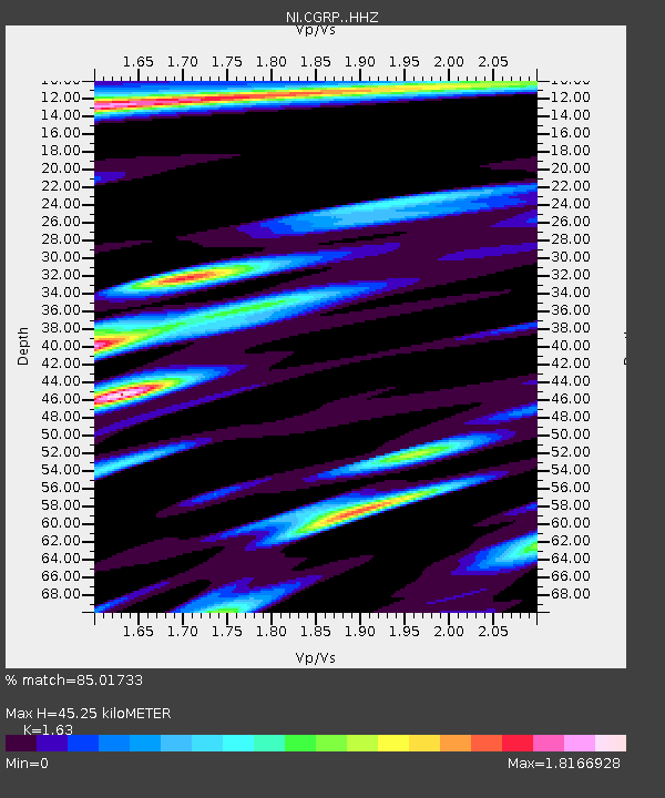
CGRP Cima Grappa - Earthquake Result Viewer
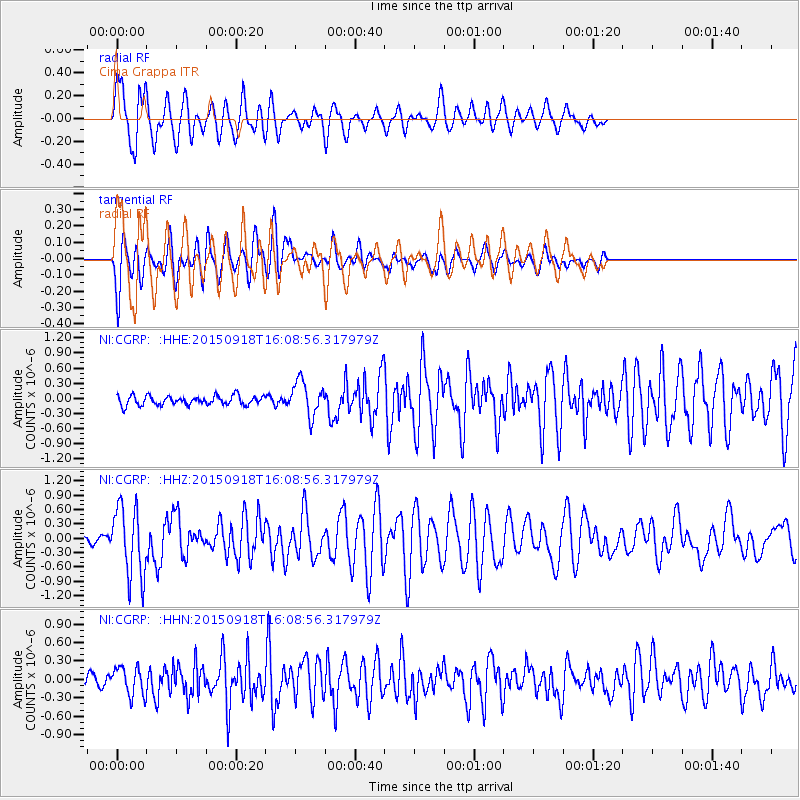
Earthquake location: Northern Mid-Atlantic Ridge
Earthquake latitude/longitude: 15.3/-46.0
Earthquake time(UTC): 2015/09/18 (261) 15:59:42 GMT
Earthquake Depth: 10 km
Earthquake Magnitude: 6.0 MWW, 5.9 MWB, 6.0 MWC
Earthquake Catalog/Contributor: NEIC PDE/NEIC COMCAT
Network: NI North-East Italy Broadband Network
Station: CGRP Cima Grappa
Lat/Lon: 45.88 N/11.80 E
Elevation: 1757 m
Distance: 56.9 deg
Az: 44.902 deg
Baz: 257.225 deg
Ray Param: 0.06386533
Estimated Moho Depth: 45.25 km
Estimated Crust Vp/Vs: 1.63
Assumed Crust Vp: 6.155 km/s
Estimated Crust Vs: 3.776 km/s
Estimated Crust Poisson's Ratio: 0.20
Radial Match: 85.01733 %
Radial Bump: 400
Transverse Match: 80.61333 %
Transverse Bump: 400
SOD ConfigId: 7422571
Insert Time: 2019-04-20 22:15:09.750 +0000
GWidth: 2.5
Max Bumps: 400
Tol: 0.001

Signal To Noise

ChannelStoNSTALTA
NI:CGRP: :HHZ:20150918T16:08:56.317979Z10.5325657.3465014E-76.975036E-8
NI:CGRP: :HHN:20150918T16:08:56.317979Z2.66850352.291505E-78.587229E-8
NI:CGRP: :HHE:20150918T16:08:56.317979Z3.65573763.378733E-79.2422745E-8
Arrivals
Ps4.9 SECOND
PpPs18 SECOND
PsPs/PpSs23 SECOND