
COR Corvallis, Oregon, USA - Earthquake Result Viewer
| ||||||||||||||||||
| ||||||||||||||||||
| ||||||||||||||||||
|
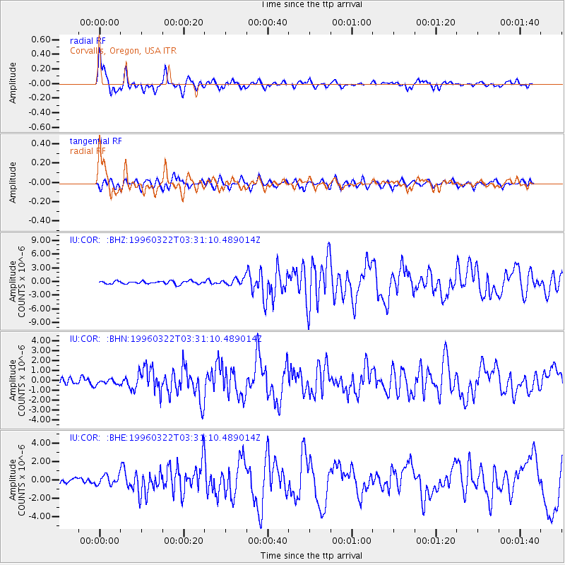
Signal To Noise
| Channel | StoN | STA | LTA |
| IU:COR: :BHN:19960322T03:31:10.489014Z | 0.59341204 | 2.3273411E-7 | 3.9219648E-7 |
| IU:COR: :BHE:19960322T03:31:10.489014Z | 1.7462114 | 5.129539E-7 | 2.9375246E-7 |
| IU:COR: :BHZ:19960322T03:31:10.489014Z | 2.4102783 | 7.753712E-7 | 3.2169365E-7 |
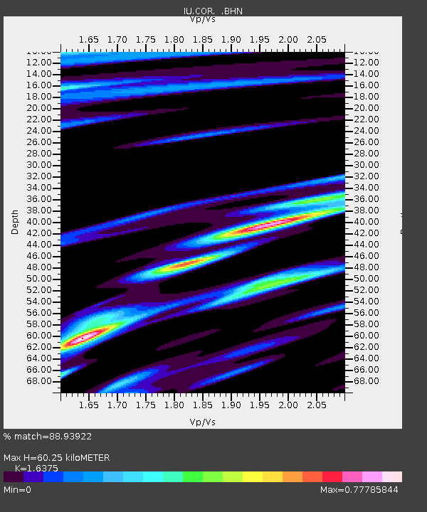
| Arrivals | |
| Ps | 6.4 SECOND |
| PpPs | 22 SECOND |
| PsPs/PpSs | 29 SECOND |

