You are here: Home > Network List > TA - USArray Transportable Network (new EarthScope stations) Stations List
> Station J26L Joseph Creek, AK, USA > Earthquake Result Viewer
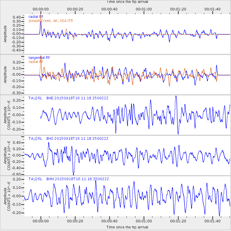
J26L Joseph Creek, AK, USA - Earthquake Result Viewer
*The percent match for this event was below the threshold and hence no stack was calculated.
| Earthquake location: |
Northern Mid-Atlantic Ridge |
| Earthquake latitude/longitude: |
15.3/-46.0 |
| Earthquake time(UTC): |
2015/09/18 (261) 15:59:42 GMT |
| Earthquake Depth: |
10 km |
| Earthquake Magnitude: |
6.0 MWW, 5.9 MWB, 6.0 MWC |
| Earthquake Catalog/Contributor: |
NEIC PDE/NEIC COMCAT |
|
| Network: |
TA USArray Transportable Network (new EarthScope stations) |
| Station: |
J26L Joseph Creek, AK, USA |
| Lat/Lon: |
64.50 N/143.56 W |
| Elevation: |
1144 m |
|
| Distance: |
79.6 deg |
| Az: |
334.133 deg |
| Baz: |
76.594 deg |
| Ray Param: |
$rayparam |
*The percent match for this event was below the threshold and hence was not used in the summary stack. |
|
| Radial Match: |
58.550213 % |
| Radial Bump: |
400 |
| Transverse Match: |
58.729424 % |
| Transverse Bump: |
400 |
| SOD ConfigId: |
7422571 |
| Insert Time: |
2019-04-20 22:17:14.907 +0000 |
| GWidth: |
2.5 |
| Max Bumps: |
400 |
| Tol: |
0.001 |
|
Signal To Noise
| Channel | StoN | STA | LTA |
| TA:J26L: :BHZ:20150918T16:11:18.350022Z | 3.5825062 | 1.938843E-7 | 5.411974E-8 |
| TA:J26L: :BHN:20150918T16:11:18.350022Z | 0.5895137 | 3.4168973E-8 | 5.796128E-8 |
| TA:J26L: :BHE:20150918T16:11:18.350022Z | 1.2036127 | 6.275607E-8 | 5.2139754E-8 |
| Arrivals |
| Ps | |
| PpPs | |
| PsPs/PpSs | |


