You are here: Home > Network List > IU - Global Seismograph Network (GSN - IRIS/USGS) Stations List
> Station COR Corvallis, Oregon, USA > Earthquake Result Viewer
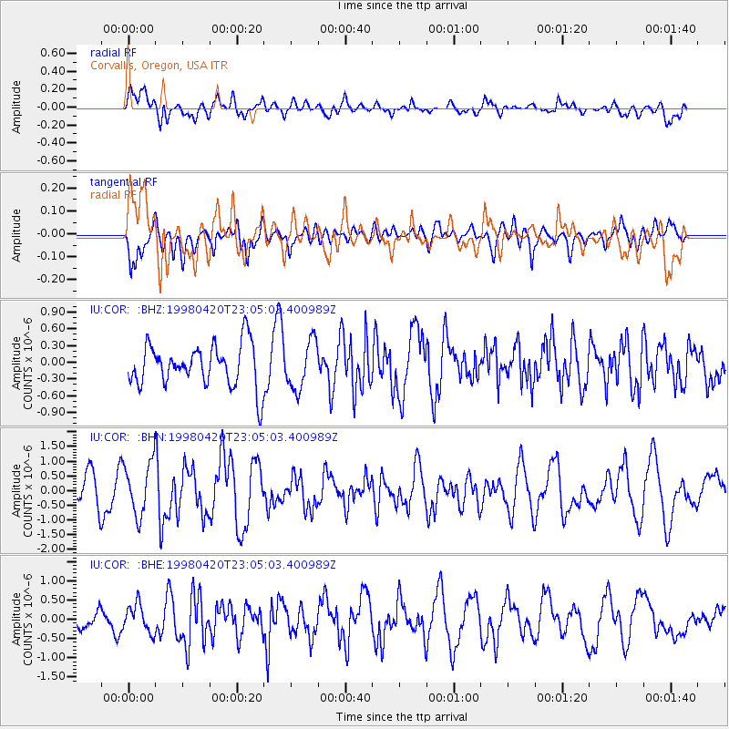
COR Corvallis, Oregon, USA - Earthquake Result Viewer
*The percent match for this event was below the threshold and hence no stack was calculated.
| Earthquake location: |
Guerrero, Mexico |
| Earthquake latitude/longitude: |
18.5/-101.2 |
| Earthquake time(UTC): |
1998/04/20 (110) 22:59:14 GMT |
| Earthquake Depth: |
67 km |
| Earthquake Magnitude: |
5.9 MB, 6.0 UNKNOWN, 5.9 MW |
| Earthquake Catalog/Contributor: |
WHDF/NEIC |
|
| Network: |
IU Global Seismograph Network (GSN - IRIS/USGS) |
| Station: |
COR Corvallis, Oregon, USA |
| Lat/Lon: |
44.59 N/123.30 W |
| Elevation: |
121 m |
|
| Distance: |
31.9 deg |
| Az: |
329.407 deg |
| Baz: |
137.484 deg |
| Ray Param: |
$rayparam |
*The percent match for this event was below the threshold and hence was not used in the summary stack. |
|
| Radial Match: |
61.133774 % |
| Radial Bump: |
400 |
| Transverse Match: |
60.384533 % |
| Transverse Bump: |
400 |
| SOD ConfigId: |
4480 |
| Insert Time: |
2010-03-04 20:10:49.531 +0000 |
| GWidth: |
2.5 |
| Max Bumps: |
400 |
| Tol: |
0.001 |
|
Signal To Noise
| Channel | StoN | STA | LTA |
| IU:COR: :BHN:19980420T23:05:03.400989Z | 1.8576221 | 8.977552E-7 | 4.832819E-7 |
| IU:COR: :BHE:19980420T23:05:03.400989Z | 1.1098263 | 3.6771146E-7 | 3.313234E-7 |
| IU:COR: :BHZ:19980420T23:05:03.400989Z | 1.138761 | 4.3096026E-7 | 3.7844663E-7 |
| Arrivals |
| Ps | |
| PpPs | |
| PsPs/PpSs | |


