
HNR Honiara, Solomon Islands - Earthquake Result Viewer
| ||||||||||||||||||
| ||||||||||||||||||
| ||||||||||||||||||
|
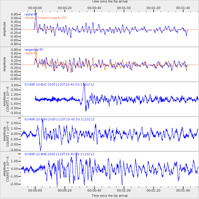
Signal To Noise
| Channel | StoN | STA | LTA |
| IU:HNR:10:BHN:20051110T19:40:59.311021Z | 5.493307 | 1.3399175E-6 | 2.4391818E-7 |
| IU:HNR:10:BHE:20051110T19:40:59.311021Z | 0.7822791 | 2.4436673E-7 | 3.1237795E-7 |
| IU:HNR:10:BHZ:20051110T19:40:59.311021Z | 7.454399 | 1.6054602E-6 | 2.1537083E-7 |
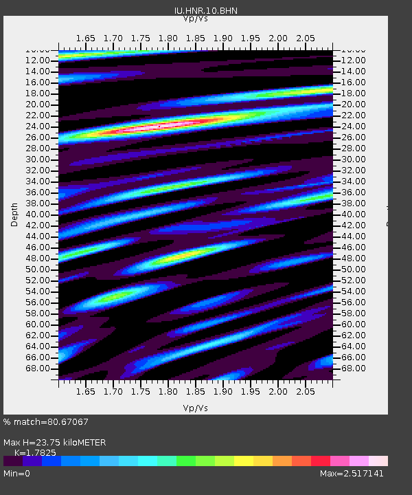
| Arrivals | |
| Ps | 3.1 SECOND |
| PpPs | 10 SECOND |
| PsPs/PpSs | 13 SECOND |

