You are here: Home > Network List > TA - USArray Transportable Network (new EarthScope stations) Stations List
> Station MSTX Muleshoe, TX, USA > Earthquake Result Viewer
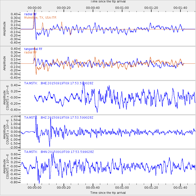
MSTX Muleshoe, TX, USA - Earthquake Result Viewer
*The percent match for this event was below the threshold and hence no stack was calculated.
| Earthquake location: |
Near Coast Of Central Chile |
| Earthquake latitude/longitude: |
-31.1/-71.6 |
| Earthquake time(UTC): |
2015/09/19 (262) 09:07:08 GMT |
| Earthquake Depth: |
23 km |
| Earthquake Magnitude: |
6.1 MWP |
| Earthquake Catalog/Contributor: |
NEIC PDE/NEIC COMCAT |
|
| Network: |
TA USArray Transportable Network (new EarthScope stations) |
| Station: |
MSTX Muleshoe, TX, USA |
| Lat/Lon: |
33.97 N/102.77 W |
| Elevation: |
1167 m |
|
| Distance: |
71.1 deg |
| Az: |
332.964 deg |
| Baz: |
152.023 deg |
| Ray Param: |
$rayparam |
*The percent match for this event was below the threshold and hence was not used in the summary stack. |
|
| Radial Match: |
68.39171 % |
| Radial Bump: |
400 |
| Transverse Match: |
64.97067 % |
| Transverse Bump: |
400 |
| SOD ConfigId: |
7422571 |
| Insert Time: |
2019-04-20 22:41:22.688 +0000 |
| GWidth: |
2.5 |
| Max Bumps: |
400 |
| Tol: |
0.001 |
|
Signal To Noise
| Channel | StoN | STA | LTA |
| TA:MSTX: :BHZ:20150919T09:17:53.599028Z | 7.7932053 | 7.414086E-7 | 9.5135256E-8 |
| TA:MSTX: :BHN:20150919T09:17:53.599028Z | 4.2601323 | 3.7303167E-7 | 8.756339E-8 |
| TA:MSTX: :BHE:20150919T09:17:53.599028Z | 2.540646 | 2.426263E-7 | 9.549788E-8 |
| Arrivals |
| Ps | |
| PpPs | |
| PsPs/PpSs | |


