You are here: Home > Network List > TA - USArray Transportable Network (new EarthScope stations) Stations List
> Station H17A Grant Village (NPS), Yellowstone Nt. Park, WY, USA > Earthquake Result Viewer
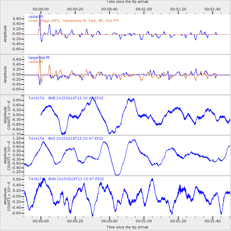
H17A Grant Village (NPS), Yellowstone Nt. Park, WY, USA - Earthquake Result Viewer
*The percent match for this event was below the threshold and hence no stack was calculated.
| Earthquake location: |
Off Coast Of Central Chile |
| Earthquake latitude/longitude: |
-30.6/-72.2 |
| Earthquake time(UTC): |
2015/09/19 (262) 13:08:57 GMT |
| Earthquake Depth: |
14 km |
| Earthquake Magnitude: |
5.6 MB |
| Earthquake Catalog/Contributor: |
NEIC PDE/NEIC ALERT |
|
| Network: |
TA USArray Transportable Network (new EarthScope stations) |
| Station: |
H17A Grant Village (NPS), Yellowstone Nt. Park, WY, USA |
| Lat/Lon: |
44.40 N/110.58 W |
| Elevation: |
2400 m |
|
| Distance: |
82.4 deg |
| Az: |
333.302 deg |
| Baz: |
147.278 deg |
| Ray Param: |
$rayparam |
*The percent match for this event was below the threshold and hence was not used in the summary stack. |
|
| Radial Match: |
52.652405 % |
| Radial Bump: |
400 |
| Transverse Match: |
24.583263 % |
| Transverse Bump: |
400 |
| SOD ConfigId: |
7422571 |
| Insert Time: |
2019-04-20 23:01:41.386 +0000 |
| GWidth: |
2.5 |
| Max Bumps: |
400 |
| Tol: |
0.001 |
|
Signal To Noise
| Channel | StoN | STA | LTA |
| TA:H17A: :BHZ:20150919T13:20:47.650Z | 2.0913968 | 8.3549116E-7 | 3.9948955E-7 |
| TA:H17A: :BHN:20150919T13:20:47.650Z | 1.3596673 | 5.157906E-7 | 3.7935058E-7 |
| TA:H17A: :BHE:20150919T13:20:47.650Z | 1.5814713 | 7.952301E-7 | 5.0284194E-7 |
| Arrivals |
| Ps | |
| PpPs | |
| PsPs/PpSs | |


