You are here: Home > Network List > TA - USArray Transportable Network (new EarthScope stations) Stations List
> Station KSCO Kaye Shedlock's, Cheyenne Wells, CO, USA > Earthquake Result Viewer
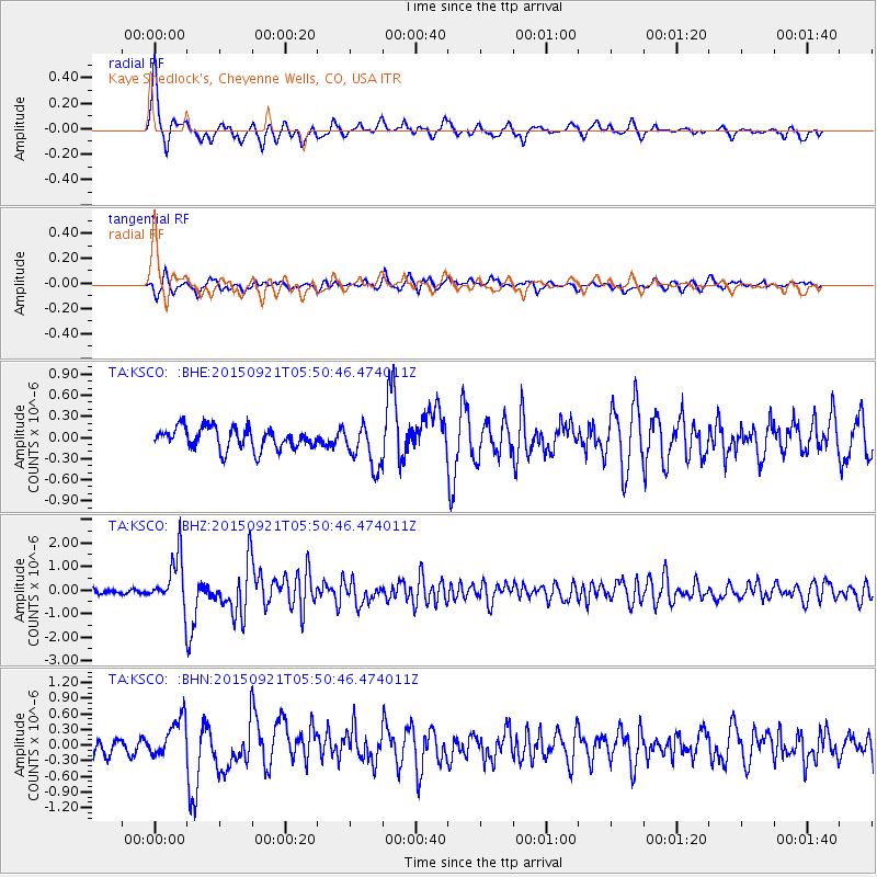
KSCO Kaye Shedlock's, Cheyenne Wells, CO, USA - Earthquake Result Viewer

| Earthquake location: |
Near Coast Of Central Chile |
| Earthquake latitude/longitude: |
-31.6/-71.7 |
| Earthquake time(UTC): |
2015/09/21 (264) 05:39:33 GMT |
| Earthquake Depth: |
23 km |
| Earthquake Magnitude: |
6.3 MWP |
| Earthquake Catalog/Contributor: |
NEIC PDE/NEIC COMCAT |
|
| Network: |
TA USArray Transportable Network (new EarthScope stations) |
| Station: |
KSCO Kaye Shedlock's, Cheyenne Wells, CO, USA |
| Lat/Lon: |
39.01 N/102.63 W |
| Elevation: |
1382 m |
|
| Distance: |
75.9 deg |
| Az: |
335.625 deg |
| Baz: |
153.122 deg |
| Ray Param: |
0.051333725 |
| Estimated Moho Depth: |
24.0 km |
| Estimated Crust Vp/Vs: |
1.84 |
| Assumed Crust Vp: |
6.242 km/s |
| Estimated Crust Vs: |
3.388 km/s |
| Estimated Crust Poisson's Ratio: |
0.29 |
|
| Radial Match: |
86.88388 % |
| Radial Bump: |
355 |
| Transverse Match: |
60.157955 % |
| Transverse Bump: |
338 |
| SOD ConfigId: |
7422571 |
| Insert Time: |
2019-04-20 23:12:26.704 +0000 |
| GWidth: |
2.5 |
| Max Bumps: |
400 |
| Tol: |
0.001 |
|
Signal To Noise
| Channel | StoN | STA | LTA |
| TA:KSCO: :BHZ:20150921T05:50:46.474011Z | 12.718234 | 1.0717811E-6 | 8.4271214E-8 |
| TA:KSCO: :BHN:20150921T05:50:46.474011Z | 2.1760652 | 3.6902097E-7 | 1.6958177E-7 |
| TA:KSCO: :BHE:20150921T05:50:46.474011Z | 2.0707586 | 3.1492416E-7 | 1.5208154E-7 |
| Arrivals |
| Ps | 3.3 SECOND |
| PpPs | 11 SECOND |
| PsPs/PpSs | 14 SECOND |


