You are here: Home > Network List > TA - USArray Transportable Network (new EarthScope stations) Stations List
> Station M53A WI Miller and Sons, Farmdale, OH, USA > Earthquake Result Viewer
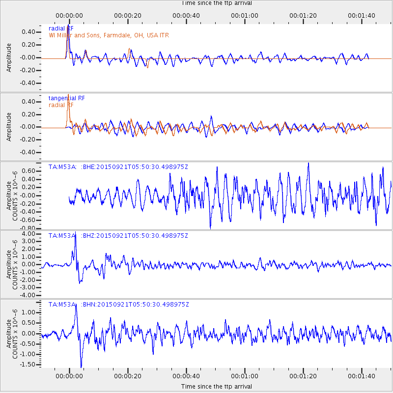
M53A WI Miller and Sons, Farmdale, OH, USA - Earthquake Result Viewer
*The percent match for this event was below the threshold and hence no stack was calculated.
| Earthquake location: |
Near Coast Of Central Chile |
| Earthquake latitude/longitude: |
-31.6/-71.7 |
| Earthquake time(UTC): |
2015/09/21 (264) 05:39:33 GMT |
| Earthquake Depth: |
23 km |
| Earthquake Magnitude: |
6.3 MWP |
| Earthquake Catalog/Contributor: |
NEIC PDE/NEIC COMCAT |
|
| Network: |
TA USArray Transportable Network (new EarthScope stations) |
| Station: |
M53A WI Miller and Sons, Farmdale, OH, USA |
| Lat/Lon: |
41.44 N/80.68 W |
| Elevation: |
334 m |
|
| Distance: |
73.1 deg |
| Az: |
352.969 deg |
| Baz: |
172.013 deg |
| Ray Param: |
$rayparam |
*The percent match for this event was below the threshold and hence was not used in the summary stack. |
|
| Radial Match: |
78.58361 % |
| Radial Bump: |
400 |
| Transverse Match: |
67.69096 % |
| Transverse Bump: |
400 |
| SOD ConfigId: |
7422571 |
| Insert Time: |
2019-04-20 23:12:38.618 +0000 |
| GWidth: |
2.5 |
| Max Bumps: |
400 |
| Tol: |
0.001 |
|
Signal To Noise
| Channel | StoN | STA | LTA |
| TA:M53A: :BHZ:20150921T05:50:30.498975Z | 7.2170553 | 1.5832397E-6 | 2.1937475E-7 |
| TA:M53A: :BHN:20150921T05:50:30.498975Z | 6.6464844 | 6.969319E-7 | 1.0485723E-7 |
| TA:M53A: :BHE:20150921T05:50:30.498975Z | 1.3026239 | 1.9801043E-7 | 1.5200891E-7 |
| Arrivals |
| Ps | |
| PpPs | |
| PsPs/PpSs | |


