You are here: Home > Network List > UW - Pacific Northwest Regional Seismic Network Stations List
> Station MRBL Marblemount, WA, USA > Earthquake Result Viewer
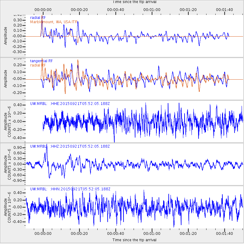
MRBL Marblemount, WA, USA - Earthquake Result Viewer
*The percent match for this event was below the threshold and hence no stack was calculated.
| Earthquake location: |
Near Coast Of Central Chile |
| Earthquake latitude/longitude: |
-31.6/-71.7 |
| Earthquake time(UTC): |
2015/09/21 (264) 05:39:33 GMT |
| Earthquake Depth: |
23 km |
| Earthquake Magnitude: |
6.3 MWP |
| Earthquake Catalog/Contributor: |
NEIC PDE/NEIC COMCAT |
|
| Network: |
UW Pacific Northwest Regional Seismic Network |
| Station: |
MRBL Marblemount, WA, USA |
| Lat/Lon: |
48.52 N/121.48 W |
| Elevation: |
75 m |
|
| Distance: |
91.3 deg |
| Az: |
329.485 deg |
| Baz: |
139.326 deg |
| Ray Param: |
$rayparam |
*The percent match for this event was below the threshold and hence was not used in the summary stack. |
|
| Radial Match: |
56.148804 % |
| Radial Bump: |
400 |
| Transverse Match: |
68.82415 % |
| Transverse Bump: |
400 |
| SOD ConfigId: |
7422571 |
| Insert Time: |
2019-04-20 23:14:08.423 +0000 |
| GWidth: |
2.5 |
| Max Bumps: |
400 |
| Tol: |
0.001 |
|
Signal To Noise
| Channel | StoN | STA | LTA |
| UW:MRBL: :HHZ:20150921T05:52:05.188Z | 3.9545176 | 4.6447084E-7 | 1.17453226E-7 |
| UW:MRBL: :HHN:20150921T05:52:05.188Z | 1.0656025 | 1.3885314E-7 | 1.3030481E-7 |
| UW:MRBL: :HHE:20150921T05:52:05.188Z | 1.1482629 | 1.2351813E-7 | 1.0756956E-7 |
| Arrivals |
| Ps | |
| PpPs | |
| PsPs/PpSs | |


