
KMBO Kilima Mbogo, Kenya - Earthquake Result Viewer
| ||||||||||||||||||
| ||||||||||||||||||
| ||||||||||||||||||
|
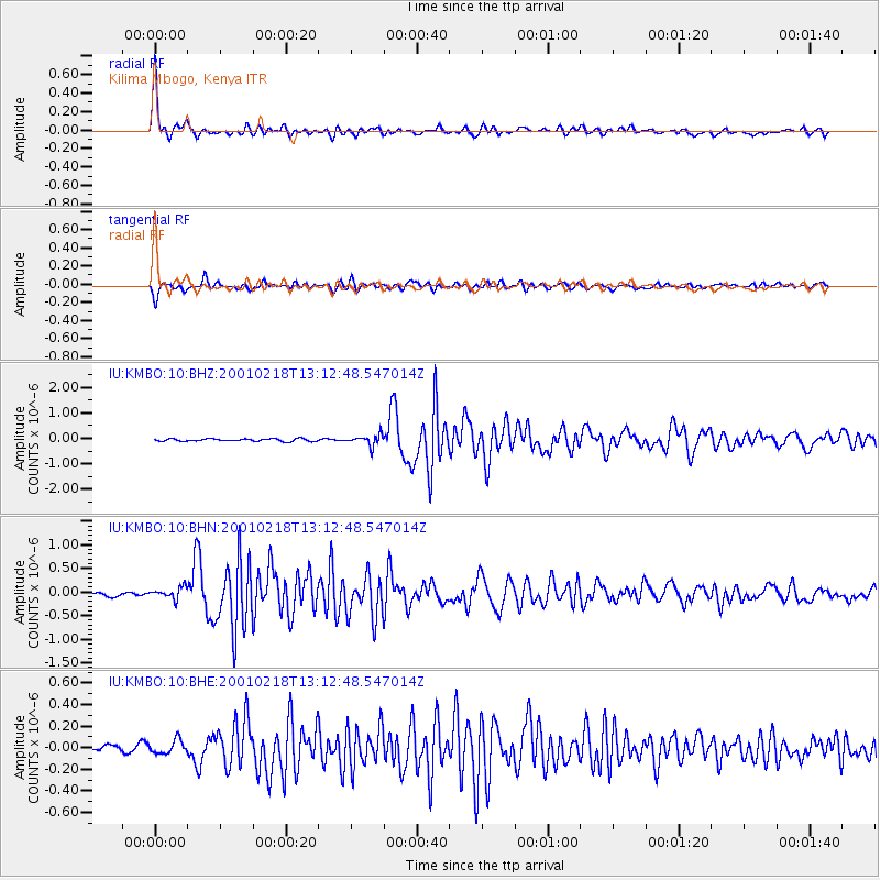
Signal To Noise
| Channel | StoN | STA | LTA |
| IU:KMBO:10:BHN:20010218T13:12:48.547014Z | 4.1424613 | 1.3080148E-7 | 3.157579E-8 |
| IU:KMBO:10:BHE:20010218T13:12:48.547014Z | 1.9729545 | 6.2689175E-8 | 3.177426E-8 |
| IU:KMBO:10:BHZ:20010218T13:12:48.547014Z | 4.2160172 | 2.1046544E-7 | 4.992044E-8 |
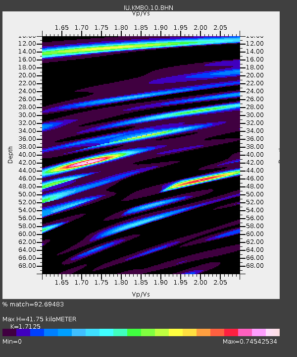
| Arrivals | |
| Ps | 4.8 SECOND |
| PpPs | 16 SECOND |
| PsPs/PpSs | 21 SECOND |

