You are here: Home > Network List > TA - USArray Transportable Network (new EarthScope stations) Stations List
> Station 121A Cookes Peak, Deming, NM, USA > Earthquake Result Viewer
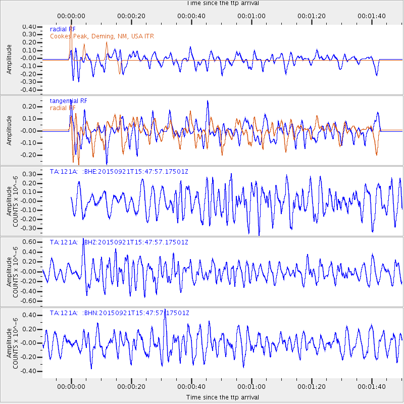
121A Cookes Peak, Deming, NM, USA - Earthquake Result Viewer
*The percent match for this event was below the threshold and hence no stack was calculated.
| Earthquake location: |
Near Coast Of Central Chile |
| Earthquake latitude/longitude: |
-31.0/-71.8 |
| Earthquake time(UTC): |
2015/09/21 (264) 15:37:08 GMT |
| Earthquake Depth: |
26 km |
| Earthquake Magnitude: |
5.4 mww |
| Earthquake Catalog/Contributor: |
NEIC PDE/us |
|
| Network: |
TA USArray Transportable Network (new EarthScope stations) |
| Station: |
121A Cookes Peak, Deming, NM, USA |
| Lat/Lon: |
32.53 N/107.79 W |
| Elevation: |
1652 m |
|
| Distance: |
71.8 deg |
| Az: |
328.497 deg |
| Baz: |
147.924 deg |
| Ray Param: |
$rayparam |
*The percent match for this event was below the threshold and hence was not used in the summary stack. |
|
| Radial Match: |
53.79229 % |
| Radial Bump: |
400 |
| Transverse Match: |
48.245686 % |
| Transverse Bump: |
400 |
| SOD ConfigId: |
7422571 |
| Insert Time: |
2019-04-20 23:22:54.565 +0000 |
| GWidth: |
2.5 |
| Max Bumps: |
400 |
| Tol: |
0.001 |
|
Signal To Noise
| Channel | StoN | STA | LTA |
| TA:121A: :BHZ:20150921T15:47:57.17501Z | 2.456669 | 2.1538602E-7 | 8.7674E-8 |
| TA:121A: :BHN:20150921T15:47:57.17501Z | 0.673376 | 7.6166216E-8 | 1.1311097E-7 |
| TA:121A: :BHE:20150921T15:47:57.17501Z | 0.8747689 | 8.8476526E-8 | 1.01142746E-7 |
| Arrivals |
| Ps | |
| PpPs | |
| PsPs/PpSs | |


