You are here: Home > Network List > IU - Global Seismograph Network (GSN - IRIS/USGS) Stations List
> Station KMBO Kilima Mbogo, Kenya > Earthquake Result Viewer
KMBO Kilima Mbogo, Kenya - Earthquake Result Viewer

| Earthquake location: |
Minahassa Peninsula, Sulawesi |
| Earthquake latitude/longitude: |
0.8/124.7 |
| Earthquake time(UTC): |
2004/06/30 (182) 23:37:25 GMT |
| Earthquake Depth: |
91 km |
| Earthquake Magnitude: |
6.0 MB, 6.3 MW, 6.2 MW |
| Earthquake Catalog/Contributor: |
WHDF/NEIC |
|
| Network: |
IU Global Seismograph Network (GSN - IRIS/USGS) |
| Station: |
KMBO Kilima Mbogo, Kenya |
| Lat/Lon: |
1.13 S/37.25 E |
| Elevation: |
1960 m |
|
| Distance: |
87.5 deg |
| Az: |
268.845 deg |
| Baz: |
89.158 deg |
| Ray Param: |
0.043103665 |
| Estimated Moho Depth: |
41.0 km |
| Estimated Crust Vp/Vs: |
1.76 |
| Assumed Crust Vp: |
6.601 km/s |
| Estimated Crust Vs: |
3.74 km/s |
| Estimated Crust Poisson's Ratio: |
0.26 |
|
| Radial Match: |
91.60306 % |
| Radial Bump: |
400 |
| Transverse Match: |
73.22826 % |
| Transverse Bump: |
400 |
| SOD ConfigId: |
2459 |
| Insert Time: |
2010-03-04 20:23:36.407 +0000 |
| GWidth: |
2.5 |
| Max Bumps: |
400 |
| Tol: |
0.001 |
|
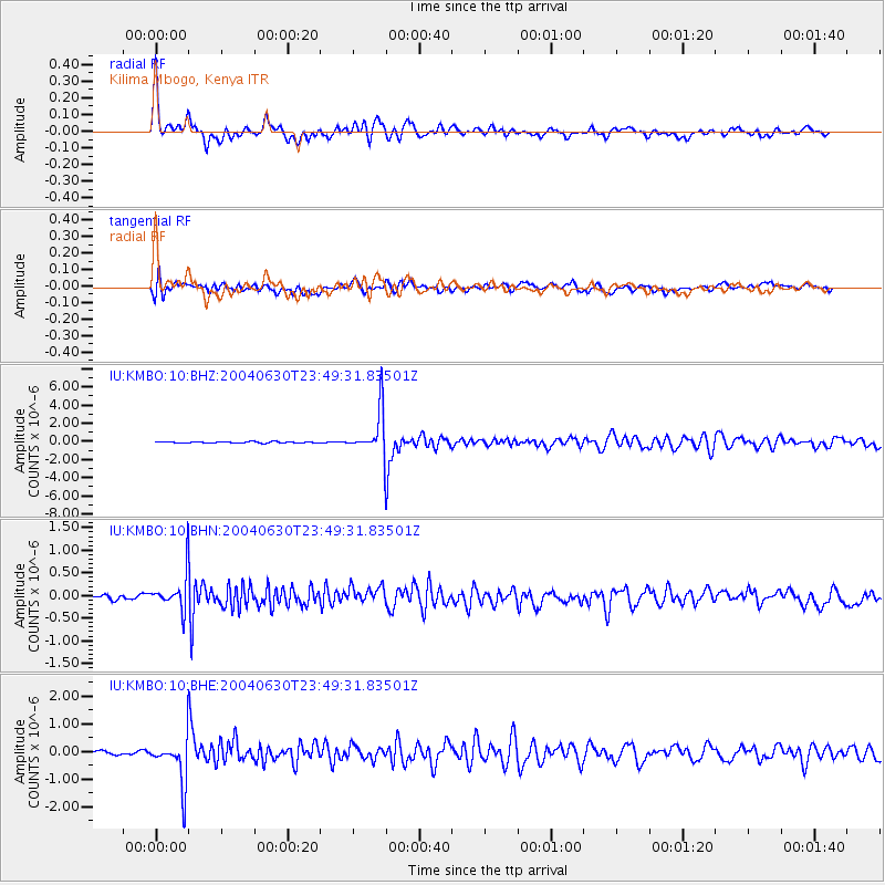
Signal To Noise
| Channel | StoN | STA | LTA |
| IU:KMBO:10:BHN:20040630T23:49:31.83501Z | 4.8341126 | 4.0048425E-7 | 8.284545E-8 |
| IU:KMBO:10:BHE:20040630T23:49:31.83501Z | 15.480499 | 8.2453454E-7 | 5.3262788E-8 |
| IU:KMBO:10:BHZ:20040630T23:49:31.83501Z | 35.128654 | 2.4697063E-6 | 7.030461E-8 |
| Arrivals |
| Ps | 4.9 SECOND |
| PpPs | 17 SECOND |
| PsPs/PpSs | 22 SECOND |


