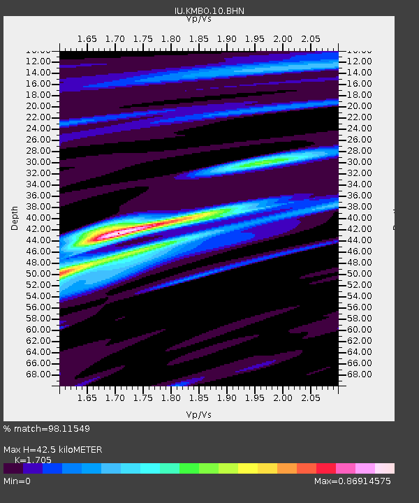
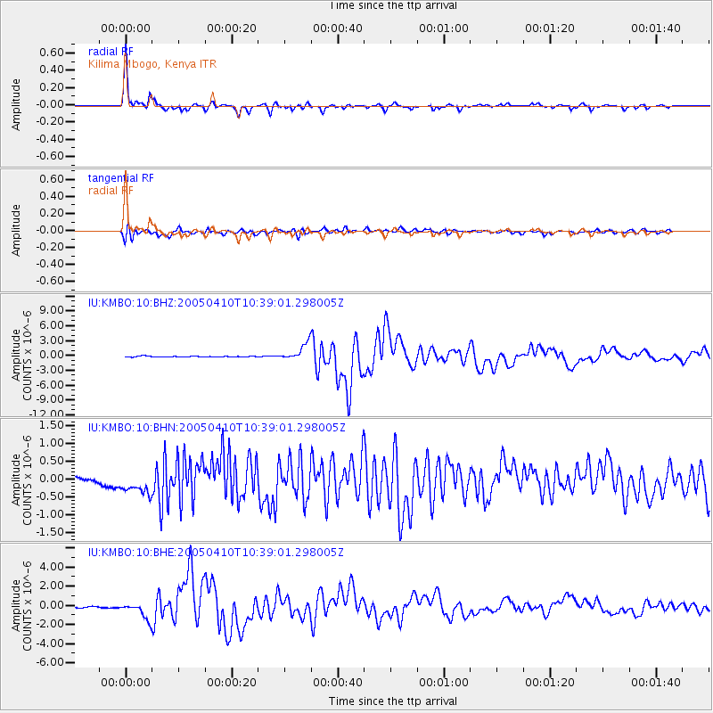
KMBO Kilima Mbogo, Kenya - Earthquake Result Viewer

Earthquake location: Southern Sumatra, Indonesia
Earthquake latitude/longitude: -1.6/99.6
Earthquake time(UTC): 2005/04/10 (100) 10:29:11 GMT
Earthquake Depth: 19 km
Earthquake Magnitude: 6.4 MB, 6.7 MS, 6.7 MW, 6.6 MW
Earthquake Catalog/Contributor: WHDF/NEIC
Network: IU Global Seismograph Network (GSN - IRIS/USGS)
Station: KMBO Kilima Mbogo, Kenya
Lat/Lon: 1.13 S/37.25 E
Elevation: 1960 m
Distance: 62.3 deg
Az: 269.592 deg
Baz: 91.257 deg
Ray Param: 0.060273238
Estimated Moho Depth: 42.5 km
Estimated Crust Vp/Vs: 1.71
Assumed Crust Vp: 6.601 km/s
Estimated Crust Vs: 3.871 km/s
Estimated Crust Poisson's Ratio: 0.24
Radial Match: 98.11549 %
Radial Bump: 299
Transverse Match: 85.32929 %
Transverse Bump: 400
SOD ConfigId: 2459
Insert Time: 2010-03-04 20:24:35.708 +0000
GWidth: 2.5
Max Bumps: 400
Tol: 0.001

Signal To Noise

ChannelStoNSTALTA
IU:KMBO:10:BHN:20050410T10:39:01.298005Z3.70925283.7680243E-71.01584455E-7
IU:KMBO:10:BHE:20050410T10:39:01.298005Z9.1489138.8122493E-79.632017E-8
IU:KMBO:10:BHZ:20050410T10:39:01.298005Z21.2900161.7185573E-68.072128E-8
Arrivals
Ps4.8 SECOND
PpPs17 SECOND
PsPs/PpSs21 SECOND