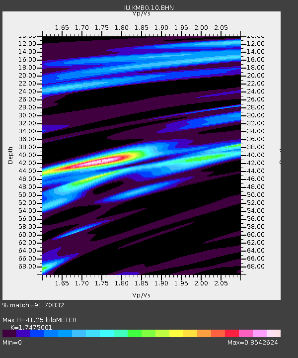
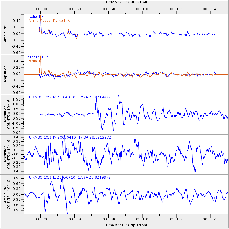
KMBO Kilima Mbogo, Kenya - Earthquake Result Viewer

Earthquake location: Southern Sumatra, Indonesia
Earthquake latitude/longitude: -1.6/99.7
Earthquake time(UTC): 2005/04/10 (100) 17:24:39 GMT
Earthquake Depth: 30 km
Earthquake Magnitude: 5.9 MB, 6.2 MS, 6.4 MW, 6.1 MW
Earthquake Catalog/Contributor: WHDF/NEIC
Network: IU Global Seismograph Network (GSN - IRIS/USGS)
Station: KMBO Kilima Mbogo, Kenya
Lat/Lon: 1.13 S/37.25 E
Elevation: 1960 m
Distance: 62.4 deg
Az: 269.562 deg
Baz: 91.199 deg
Ray Param: 0.06017243
Estimated Moho Depth: 41.25 km
Estimated Crust Vp/Vs: 1.75
Assumed Crust Vp: 6.601 km/s
Estimated Crust Vs: 3.777 km/s
Estimated Crust Poisson's Ratio: 0.26
Radial Match: 91.70832 %
Radial Bump: 317
Transverse Match: 66.230804 %
Transverse Bump: 400
SOD ConfigId: 2459
Insert Time: 2010-03-04 20:24:37.186 +0000
GWidth: 2.5
Max Bumps: 400
Tol: 0.001

Signal To Noise

ChannelStoNSTALTA
IU:KMBO:10:BHN:20050410T17:34:28.821997Z0.81494761.1695025E-71.4350645E-7
IU:KMBO:10:BHE:20050410T17:34:28.821997Z4.38714463.515373E-78.0128956E-8
IU:KMBO:10:BHZ:20050410T17:34:28.821997Z7.8352216.6086267E-78.4345125E-8
Arrivals
Ps4.9 SECOND
PpPs16 SECOND
PsPs/PpSs21 SECOND