KMBO Kilima Mbogo, Kenya - Earthquake Result Viewer
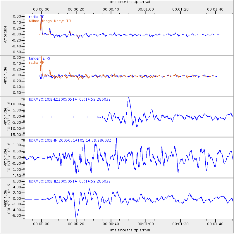
Earthquake location: Northern Sumatra, Indonesia
Earthquake latitude/longitude: 0.6/98.5
Earthquake time(UTC): 2005/05/14 (134) 05:05:18 GMT
Earthquake Depth: 34 km
Earthquake Magnitude: 6.4 MB, 6.8 MS, 6.8 MW, 6.8 MW
Earthquake Catalog/Contributor: WHDF/NEIC
Network: IU Global Seismograph Network (GSN - IRIS/USGS)
Station: KMBO Kilima Mbogo, Kenya
Lat/Lon: 1.13 S/37.25 E
Elevation: 1960 m
Distance: 61.2 deg
Az: 268.403 deg
Baz: 88.72 deg
Ray Param: 0.060951684
Estimated Moho Depth: 41.5 km
Estimated Crust Vp/Vs: 1.76
Assumed Crust Vp: 6.601 km/s
Estimated Crust Vs: 3.756 km/s
Estimated Crust Poisson's Ratio: 0.26
Radial Match: 98.752525 %
Radial Bump: 224
Transverse Match: 92.16901 %
Transverse Bump: 400
SOD ConfigId: 2455
Insert Time: 2010-03-04 20:24:49.842 +0000
GWidth: 2.5
Max Bumps: 400
Tol: 0.001

Signal To Noise

ChannelStoNSTALTA
IU:KMBO:10:BHN:20050514T05:14:59.28603Z0.427927974.3228535E-81.0101825E-7
IU:KMBO:10:BHE:20050514T05:14:59.28603Z1.4917471.2519561E-78.39255E-8
IU:KMBO:10:BHZ:20050514T05:14:59.28603Z2.25988582.1838198E-79.6634075E-8
Arrivals
Ps5.0 SECOND
PpPs17 SECOND
PsPs/PpSs22 SECOND