KMBO Kilima Mbogo, Kenya - Earthquake Result Viewer
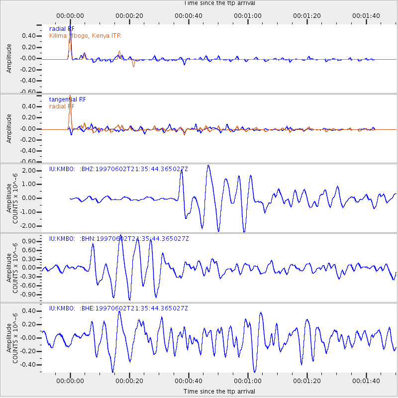
Earthquake location: South Sandwich Islands Region
Earthquake latitude/longitude: -57.8/-25.5
Earthquake time(UTC): 1997/06/02 (153) 21:24:38 GMT
Earthquake Depth: 33 km
Earthquake Magnitude: 5.9 MB, 5.8 MS, 6.1 UNKNOWN, 6.1 MW
Earthquake Catalog/Contributor: WHDF/NEIC
Network: IU Global Seismograph Network (GSN - IRIS/USGS)
Station: KMBO Kilima Mbogo, Kenya
Lat/Lon: 1.13 S/37.25 E
Elevation: 1960 m
Distance: 74.8 deg
Az: 67.039 deg
Baz: 209.567 deg
Ray Param: 0.052036285
Estimated Moho Depth: 44.5 km
Estimated Crust Vp/Vs: 1.70
Assumed Crust Vp: 6.601 km/s
Estimated Crust Vs: 3.883 km/s
Estimated Crust Poisson's Ratio: 0.24
Radial Match: 96.19091 %
Radial Bump: 252
Transverse Match: 83.77379 %
Transverse Bump: 400
SOD ConfigId: 6273
Insert Time: 2010-03-04 20:25:53.017 +0000
GWidth: 2.5
Max Bumps: 400
Tol: 0.001

Signal To Noise

ChannelStoNSTALTA
IU:KMBO: :BHN:19970602T21:35:44.365027Z1.11021886.508355E-85.8622277E-8
IU:KMBO: :BHE:19970602T21:35:44.365027Z0.702578546.645307E-89.458455E-8
IU:KMBO: :BHZ:19970602T21:35:44.365027Z0.42382364.3788354E-81.03317404E-7
Arrivals
Ps4.9 SECOND
PpPs18 SECOND
PsPs/PpSs22 SECOND