KMBO Kilima Mbogo, Kenya - Earthquake Result Viewer
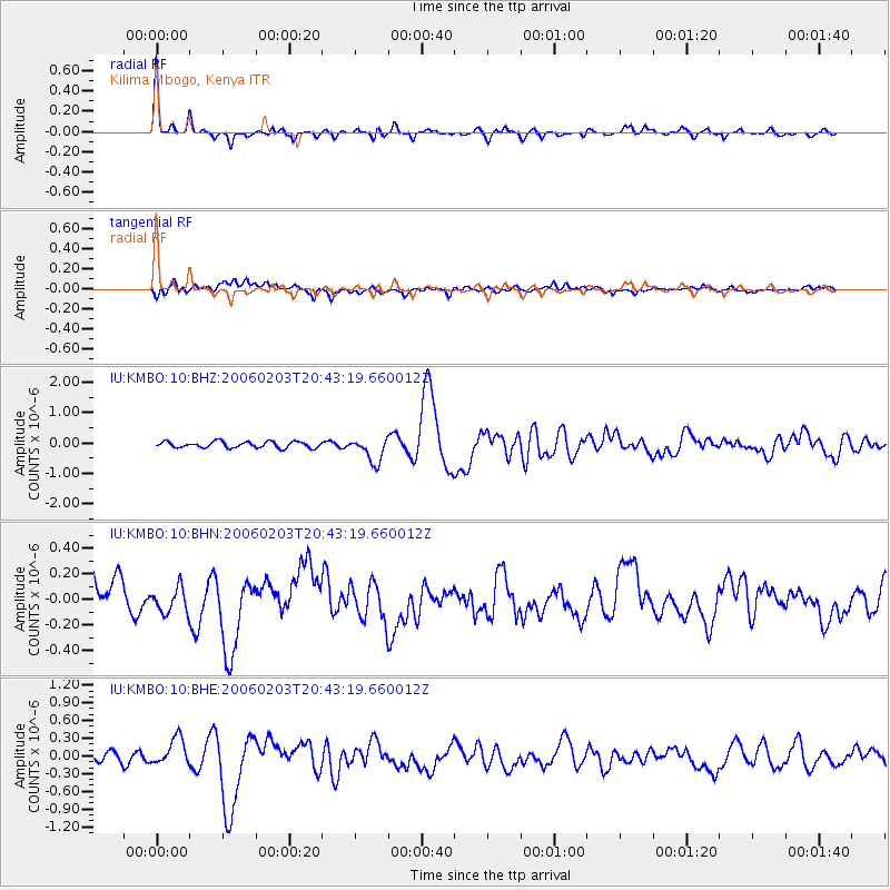
Earthquake location: Andaman Islands, India Region
Earthquake latitude/longitude: 11.9/92.4
Earthquake time(UTC): 2006/02/03 (034) 20:34:12 GMT
Earthquake Depth: 30 km
Earthquake Magnitude: 5.6 MB, 5.9 MS, 6.1 MW, 6.0 MW
Earthquake Catalog/Contributor: WHDF/NEIC
Network: IU Global Seismograph Network (GSN - IRIS/USGS)
Station: KMBO Kilima Mbogo, Kenya
Lat/Lon: 1.13 S/37.25 E
Elevation: 1960 m
Distance: 56.3 deg
Az: 260.578 deg
Baz: 74.962 deg
Ray Param: 0.06419061
Estimated Moho Depth: 38.5 km
Estimated Crust Vp/Vs: 1.83
Assumed Crust Vp: 6.601 km/s
Estimated Crust Vs: 3.607 km/s
Estimated Crust Poisson's Ratio: 0.29
Radial Match: 91.79718 %
Radial Bump: 309
Transverse Match: 70.99596 %
Transverse Bump: 400
SOD ConfigId: 4977
Insert Time: 2010-03-04 20:26:36.457 +0000
GWidth: 2.5
Max Bumps: 400
Tol: 0.001

Signal To Noise

ChannelStoNSTALTA
IU:KMBO:10:BHN:20060203T20:43:19.660012Z0.778751731.0002278E-71.2843988E-7
IU:KMBO:10:BHE:20060203T20:43:19.660012Z3.2013582.3039524E-77.1967975E-8
IU:KMBO:10:BHZ:20060203T20:43:19.660012Z3.94900734.0775677E-71.03255516E-7
Arrivals
Ps5.1 SECOND
PpPs16 SECOND
PsPs/PpSs21 SECOND