You are here: Home > Network List > US - United States National Seismic Network Stations List
> Station EGMT Eagleton, Montana, USA > Earthquake Result Viewer
EGMT Eagleton, Montana, USA - Earthquake Result Viewer
*The percent match for this event was below the threshold and hence no stack was calculated.
| Earthquake location: |
Tonga Islands |
| Earthquake latitude/longitude: |
-19.3/-175.5 |
| Earthquake time(UTC): |
2015/05/20 (140) 00:30:51 GMT |
| Earthquake Depth: |
180 km |
| Earthquake Magnitude: |
6.0 MWP |
| Earthquake Catalog/Contributor: |
NEIC PDE/NEIC COMCAT |
|
| Network: |
US United States National Seismic Network |
| Station: |
EGMT Eagleton, Montana, USA |
| Lat/Lon: |
48.02 N/109.75 W |
| Elevation: |
1055 m |
|
| Distance: |
89.0 deg |
| Az: |
37.73 deg |
| Baz: |
239.425 deg |
| Ray Param: |
$rayparam |
*The percent match for this event was below the threshold and hence was not used in the summary stack. |
|
| Radial Match: |
56.20894 % |
| Radial Bump: |
400 |
| Transverse Match: |
49.944843 % |
| Transverse Bump: |
400 |
| SOD ConfigId: |
976571 |
| Insert Time: |
2015-06-03 00:38:21.862 +0000 |
| GWidth: |
2.5 |
| Max Bumps: |
400 |
| Tol: |
0.001 |
|
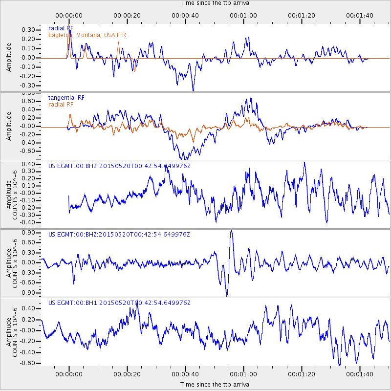
Signal To Noise
| Channel | StoN | STA | LTA |
| US:EGMT:00:BHZ:20150520T00:42:54.649976Z | 2.2019663 | 2.0143885E-7 | 9.148135E-8 |
| US:EGMT:00:BH1:20150520T00:42:54.649976Z | 1.8944374 | 1.9791231E-7 | 1.0447023E-7 |
| US:EGMT:00:BH2:20150520T00:42:54.649976Z | 4.224628 | 2.8632604E-7 | 6.7775446E-8 |
| Arrivals |
| Ps | |
| PpPs | |
| PsPs/PpSs | |


