You are here: Home > Network List > CI - Caltech Regional Seismic Network Stations List
> Station GSC Goldstone, Goldstone Lake, CA, USA > Earthquake Result Viewer
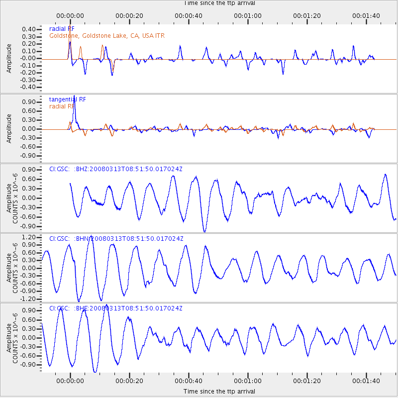
GSC Goldstone, Goldstone Lake, CA, USA - Earthquake Result Viewer
*The percent match for this event was below the threshold and hence no stack was calculated.
| Earthquake location: |
Kuril Islands |
| Earthquake latitude/longitude: |
43.1/146.5 |
| Earthquake time(UTC): |
2008/03/13 (073) 08:41:07 GMT |
| Earthquake Depth: |
53 km |
| Earthquake Magnitude: |
5.6 MB, 5.4 MW, 5.3 MW |
| Earthquake Catalog/Contributor: |
WHDF/NEIC |
|
| Network: |
CI Caltech Regional Seismic Network |
| Station: |
GSC Goldstone, Goldstone Lake, CA, USA |
| Lat/Lon: |
35.30 N/116.81 W |
| Elevation: |
1000 m |
|
| Distance: |
71.2 deg |
| Az: |
59.1 deg |
| Baz: |
309.754 deg |
| Ray Param: |
$rayparam |
*The percent match for this event was below the threshold and hence was not used in the summary stack. |
|
| Radial Match: |
59.731384 % |
| Radial Bump: |
400 |
| Transverse Match: |
91.39832 % |
| Transverse Bump: |
381 |
| SOD ConfigId: |
2504 |
| Insert Time: |
2010-02-25 23:48:53.156 +0000 |
| GWidth: |
2.5 |
| Max Bumps: |
400 |
| Tol: |
0.001 |
|
Signal To Noise
| Channel | StoN | STA | LTA |
| CI:GSC: :BHN:20080313T08:51:50.017024Z | 1.9233271 | 8.233466E-7 | 4.2808455E-7 |
| CI:GSC: :BHE:20080313T08:51:50.017024Z | 1.6101316 | 6.896775E-7 | 4.2833608E-7 |
| CI:GSC: :BHZ:20080313T08:51:50.017024Z | 1.2333574 | 3.904473E-7 | 3.165727E-7 |
| Arrivals |
| Ps | |
| PpPs | |
| PsPs/PpSs | |


