
Station 7A TRTF - Little North Mountain, Virginia USA
Network: 7A - Mid-Atlantic Geophysical Integrative Collaboration
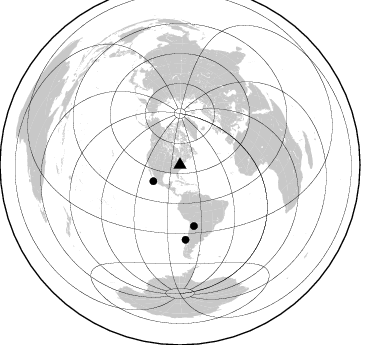
Nearby stations (2 deg radius)

| Station | Name | (Lat, Lon) | Start / End | Elevation |
| TRTF | Little North Mountain, Virginia USA | (38.56, -78.97) | 2013-10-26 / 2015-07-25 | 437 m |
| Crust2 Type: | P1,orogen/46km, Urals, Tethian Orogen, 2 km seds. |
| Thickness Estimate: | 38 km |
| Thickness StdDev: | 4.3 km |
| Vp/Vs Estimate: | 1.86 |
| Vp/Vs StdDev: | 0.13 |
| Vs Estimate: | 3.307 km/s |
| Poisson's Ratio: | 0.30 |
| Peak Value: | 0.02 |
| Assumed Vp: | 6.159 km/s |
| Ps Weight: | 0.33333334 |
| PpPs Weight: | 0.33333334 |
| PsPs Weight: | 0.33333328 |
| Residual Complexity: | 0.683 |
| Nearby stations H: | +- |
| (2.0 deg) Vp/Vs: | +- |
1 with match > 90% ( 7.142857 %) and 3 with match > 80% ( 21.428572 %) out of 14.
Download stack as xyz text file.
Azimuth Distribution of Events:
Prior Results for this Station
| Study | Thickness | Vp/Vs | Vp | Vs | Poissons Ratio | Extra |
| EARS | 38 km | 1.86 | 6.159 km/s | 3.307 km/s | 0.30 | |
| Crust2.0 | 46 km | 1.76 | 6.159 km/s | 3.507 km/s | 0.26 | P1,orogen/46km, Urals, Tethian Orogen, 2 km seds. |
| Global Maxima | 38 km | 1.86 | 6.159 km/s | 3.307 km/s | 0.30 | amp=0.024142414 |
| Local Maxima 1 | 50 km | 1.83 | 6.159 km/s | 3.37 km/s | 0.29 | amp=0.014377306 |
| Local Maxima 2 | 45 km | 1.61 | 6.159 km/s | 3.831 km/s | 0.18 | amp=0.013888854 |
| Local Maxima 3 | 34 km | 2.10 | 6.159 km/s | 2.936 km/s | 0.35 | amp=0.012926423 |
| Local Maxima 4 | 42 km | 1.73 | 6.159 km/s | 3.565 km/s | 0.25 | amp=0.011540906 |
| Predicted Arrivals for vertical incidence (zero ray parameter) | |
| Ps | 5.39 SECOND |
| PpPs | 17.89 SECOND |
| PsPs/PpSs | 23.29 SECOND |
Events Processed for this Station
Download zip of receiver functions as SAC
Plot maxima for each earthquake.
Events Used in the Stack
(3 events)| Radial Match | Distance | Baz | FERegion | Time | Lat/Lon | Depth | Magnitude |
| 95.04577 | 74.7 deg | 175.69 deg | Near Coast Of Central Chile | 2015/06/20 02:10:06 GMT | (-36.3, -73.8) | 10 km | 6.4 MO |
| 87.569496 | 31.2 deg | 238.592 deg | Off Coast Of Jalisco, Mexico | 2015/02/22 14:23:14 GMT | (18.7, -106.8) | 10 km | 6.2 MO |
| 86.526794 | 62.4 deg | 167.241 deg | Jujuy Province, Argentina | 2015/02/11 18:57:22 GMT | (-23.1, -66.7) | 223 km | 6.7 MWW, 6.7 MWC, 6.7 MWB, 6.9 MI |
Losers
(11 events)| Radial Match | Distance | Baz | FERegion | Time | Lat/Lon | Depth | Magnitude | Reason |
| 86.77571 | 31.9 deg | 107.762 deg | Northern Mid-Atlantic Ridge | 2014/07/27 01:28:38 GMT | (23.8, -45.6) | 10 km | 5.6 MB, 6.0 MWB, 6.6 MI | |
| 80.01748 | 48.9 deg | 178.762 deg | Near Coast Of Peru | 2015/04/01 16:45:21 GMT | (-10.6, -78.0) | 48 km | 5.5 MW | |
| 77.1124 | 94.2 deg | 329.118 deg | Near East Coast Of Honshu, Japan | 2015/05/12 21:12:58 GMT | (38.9, 142.0) | 39 km | 6.8 MWP, 6.8 MI | |
| 73.70233 | 38.5 deg | 73.79 deg | Azores Islands, Portugal | 2015/04/30 06:29:57 GMT | (38.6, -29.1) | 10 km | 4.7 MW, 4.6 mb, 3.7 MS | |
| 68.58489 | 76.2 deg | 207.86 deg | Easter Island Region | 2014/11/01 10:59:55 GMT | (-31.8, -111.2) | 10 km | 6.0 MWP | |
| 64.13313 | 57.4 deg | 169.167 deg | Northern Chile | 2015/03/23 04:51:37 GMT | (-18.4, -69.4) | 128 km | 6.1 MWP, 6.1 MO | |
| 64.07116 | 77.2 deg | 199.196 deg | Southeast Of Easter Island | 2014/11/17 11:27:05 GMT | (-36.0, -102.2) | 10 km | 5.4 MW, 5.0 mb, 4.7 MS | |
| 60.22139 | 49.1 deg | 322.956 deg | Southern Alaska | 2015/06/24 22:32:20 GMT | (61.7, -152.0) | 105 km | 5.7 MB, 6.2 MB | |
| 51.399155 | 35.8 deg | 175.775 deg | Colombia | 2015/02/22 12:56:24 GMT | (2.7, -76.5) | 151 km | 5.6 MB | |
| 49.358616 | 51.0 deg | 177.213 deg | Near Coast Of Peru | 2014/11/15 00:18:40 GMT | (-12.7, -76.7) | 46 km | 5.6 MB | |
| 45.731033 | 93.2 deg | 329.869 deg | Near East Coast Of Honshu, Japan | 2015/02/17 04:46:38 GMT | (40.2, 141.9) | 40 km | 5.8 MB |

