
Station 8G EC09 - EC09
Network: 8G - 2016 Pedernales Earthquake Aftershock Deployment Ecuador
Nearby stations (2 deg radius)
| Station | Name | (Lat, Lon) | Start / End | Elevation |
| EC09 | EC09 | (-0.96, -80.22) | 2016-05-01 / 2017-05-10 | 95 m |
| Crust2 Type: | S1,continental slope, margin, transition 1 km seds. |
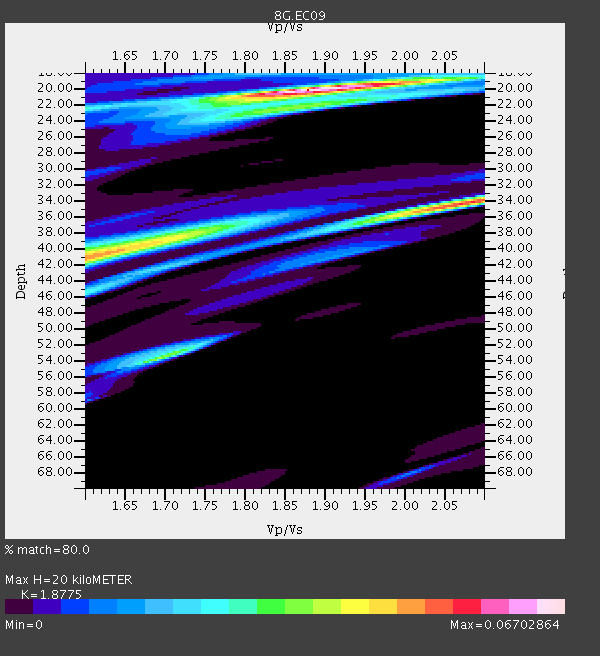
| Thickness Estimate: | 20 km |
| Thickness StdDev: | 14 km |
| Vp/Vs Estimate: | 1.88 |
| Vp/Vs StdDev: | 0.10 |
| Vs Estimate: | 3.293 km/s |
| Poisson's Ratio: | 0.30 |
| Peak Value: | 0.07 |
| Assumed Vp: | 6.183 km/s |
| Ps Weight: | 0.33333334 |
| PpPs Weight: | 0.33333334 |
| PsPs Weight: | 0.33333328 |
| Residual Complexity: | 0.703 |
| Nearby stations H: | +- |
| (2.0 deg) Vp/Vs: | +- |
0 with match > 90% ( 0.0 %) and 2 with match > 80% ( 11.764706 %) out of 17.
Download stack as xyz text file.
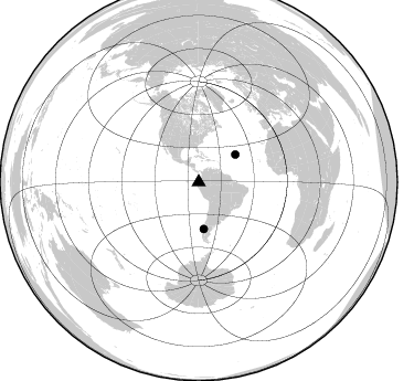
Azimuth Distribution of Events:
Prior Results for this Station
| Study | Thickness | Vp/Vs | Vp | Vs | Poissons Ratio | Extra |
| EARS | 20 km | 1.88 | 6.183 km/s | 3.293 km/s | 0.30 | |
| Crust2.0 | 23 km | 1.81 | 6.183 km/s | 3.422 km/s | 0.28 | S1,continental slope, margin, transition 1 km seds. |
| Global Maxima | 20 km | 1.88 | 6.183 km/s | 3.293 km/s | 0.30 | amp=0.06702864 |
| Local Maxima 1 | 34 km | 2.07 | 6.183 km/s | 2.987 km/s | 0.35 | amp=0.053867687 |
| Local Maxima 2 | 41 km | 1.60 | 6.183 km/s | 3.864 km/s | 0.18 | amp=0.042407587 |
| Local Maxima 3 | 54 km | 1.69 | 6.183 km/s | 3.653 km/s | 0.23 | amp=0.03691703 |
| Local Maxima 4 | 38 km | 1.74 | 6.183 km/s | 3.553 km/s | 0.25 | amp=0.026156466 |
| Predicted Arrivals for vertical incidence (zero ray parameter) | |
| Ps | 2.84 SECOND |
| PpPs | 9.31 SECOND |
| PsPs/PpSs | 12.15 SECOND |
Events Processed for this Station
Download zip of receiver functions as SAC
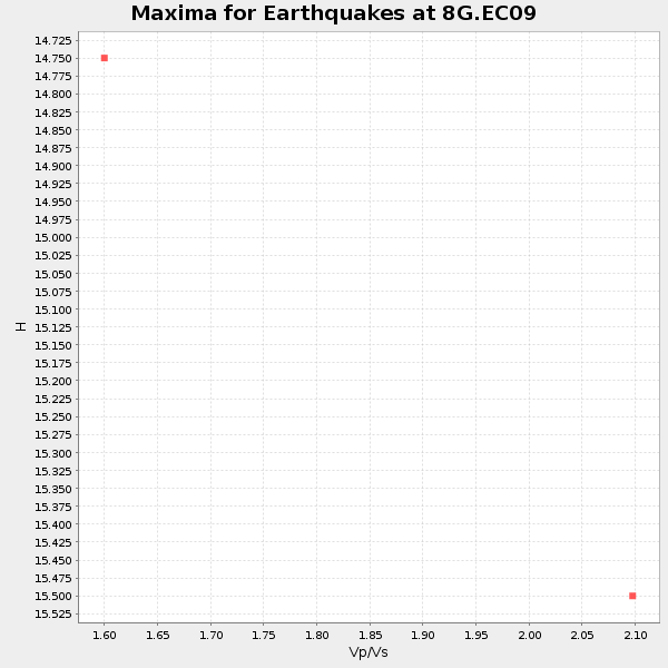
Plot maxima for each earthquake.
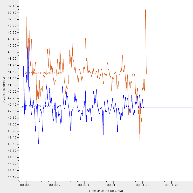
Events Used in the Stack
(2 events)| Radial Match | Distance | Baz | FERegion | Time | Lat/Lon | Depth | Magnitude |
| 88.388885 | 42.5 deg | 173.81 deg | Southern Chile | 2016/12/25 14:22:28 GMT | (-43.3, -74.5) | 15 km | 7.7 Mi |
| 81.70876 | 41.5 deg | 53.315 deg | Northern Mid-Atlantic Ridge | 2016/06/21 16:26:34 GMT | (22.7, -45.1) | 10 km | 6.1 MWB |
Losers
(15 events)| Radial Match | Distance | Baz | FERegion | Time | Lat/Lon | Depth | Magnitude | Reason |
| 83.816895 | 66.8 deg | 152.36 deg | South Georgia Island Region | 2016/08/19 07:32:22 GMT | (-55.3, -31.9) | 10 km | 7.4 MO | |
| 80.85764 | 69.7 deg | 151.444 deg | South Sandwich Islands Region | 2016/05/28 09:46:59 GMT | (-56.2, -26.9) | 73 km | 7.2 MWW, 7.3 MI | |
| 79.24296 | 32.4 deg | 161.56 deg | San Juan Province, Argentina | 2016/11/20 20:57:43 GMT | (-31.6, -68.8) | 116 km | 6.4 MWP, 6.5 MWB | |
| 74.452805 | 66.7 deg | 152.293 deg | South Georgia Island Region | 2016/08/19 17:33:40 GMT | (-55.2, -32.1) | 4.3 km | 5.8 MWW, 5.7 MWB, 5.8 MWC | |
| 73.88487 | 31.2 deg | 309.317 deg | Off Coast Of Jalisco, Mexico | 2016/06/07 10:51:38 GMT | (18.4, -105.2) | 10 km | 6.2 MWP | |
| 69.13489 | 42.7 deg | 173.858 deg | Southern Chile | 2016/12/25 14:32:13 GMT | (-43.5, -74.5) | 17 km | 5.6 mb | |
| 65.90545 | 66.9 deg | 152.238 deg | South Georgia Island Region | 2016/08/21 03:45:23 GMT | (-55.3, -31.8) | 10 km | 6.4 MWP | |
| 60.49633 | 71.6 deg | 153.362 deg | South Sandwich Islands Region | 2016/08/02 07:32:29 GMT | (-58.7, -25.6) | 35 km | 5.5 MWW, 5.4 MWB, 5.6 MWC | |
| 59.73499 | 66.7 deg | 152.306 deg | South Georgia Island Region | 2016/08/19 20:37:16 GMT | (-55.2, -32.1) | 8.6 km | 5.6 MB | |
| 56.359196 | 66.7 deg | 97.657 deg | Ascension Island Region | 2016/06/10 09:26:53 GMT | (-7.5, -13.6) | 10 km | 5.5 MWP | |
| 55.931797 | 96.2 deg | 239.624 deg | Kermadec Islands, New Zealand | 2016/06/01 15:37:23 GMT | (-30.2, -178.0) | 44 km | 5.5 MWC, 5.5 MWC | |
| 53.71907 | 30.1 deg | 165.742 deg | Off Coast Of Central Chile | 2016/07/19 05:18:40 GMT | (-30.2, -72.0) | 14 km | 5.5 MB | |
| 52.482674 | 35.0 deg | 166.765 deg | Chile-Argentina Border Region | 2016/11/04 16:20:43 GMT | (-35.1, -71.0) | 91 km | 6.4 MWP, 6.4 MWW | |
| 42.467735 | 93.2 deg | 47.575 deg | Central Italy | 2017/01/18 10:25:25 GMT | (42.6, 13.2) | 10 km | 5.6 Mww | |
| 28.011816 | 93.0 deg | 47.244 deg | Central Italy | 2016/10/26 19:18:08 GMT | (42.9, 13.0) | 10 km | 6.1 MWW, 6.0 MWB, 6.1 MWR |

