
Station CD QIZ - Qiongzhong, Hainan Province, China
Network: CD - China Digital Seismograph Network
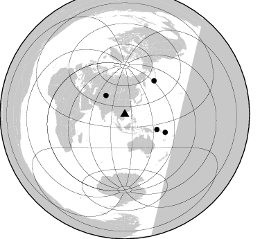
Nearby stations (2 deg radius)
| Station | Name | (Lat, Lon) | Start / End | Elevation |
| QIZ | Qiongzhong, Hainan Province, China | (19.03, 109.84) | 1992-05-18 / 2001-02-18 | 230 m |
| Crust2 Type: | M3,extended crust, 1.5 km seds. |
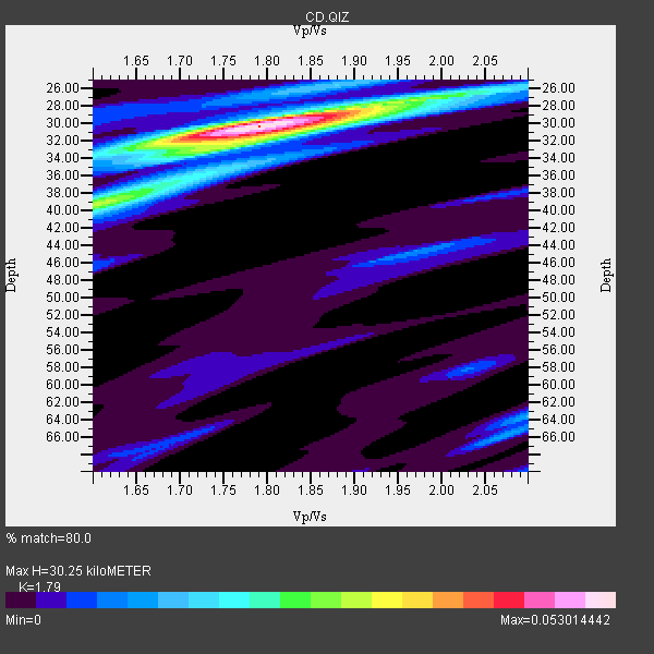
| Thickness Estimate: | 30 km |
| Thickness StdDev: | 6.6 km |
| Vp/Vs Estimate: | 1.79 |
| Vp/Vs StdDev: | 0.07 |
| Vs Estimate: | 3.454 km/s |
| Poisson's Ratio: | 0.27 |
| Peak Value: | 0.05 |
| Assumed Vp: | 6.182 km/s |
| Ps Weight: | 0.33333334 |
| PpPs Weight: | 0.33333334 |
| PsPs Weight: | 0.33333328 |
| Residual Complexity: | 0.485 |
| Nearby stations H: | 30 km +- 0.7 km |
| (2.0 deg) Vp/Vs: | 1.76 +- 0.04 |
2 with match > 90% ( 40.0 %) and 4 with match > 80% ( 80.0 %) out of 5.
Download stack as xyz text file.
Azimuth Distribution of Events:
Prior Results for this Station
| Study | Thickness | Vp/Vs | Vp | Vs | Poissons Ratio | Extra |
| EARS | 30 km | 1.79 | 6.182 km/s | 3.454 km/s | 0.27 | |
| Crust2.0 | 31 km | 1.78 | 6.182 km/s | 3.474 km/s | 0.27 | M3,extended crust, 1.5 km seds. |
| Zandt Ammon | 31 km | 1.69 | 6.0 km/s | 3.55 km/s | 0.23 | |
| Zandt Ammon | 32 km | 1.68 | 6.25 km/s | 3.72 km/s | 0.23 | |
| Zandt Ammon | 33 km | 1.68 | 6.5 km/s | 3.869 km/s | 0.23 | |
| Zandt Ammon | 35 km | 1.68 | 6.75 km/s | 4.018 km/s | 0.23 | |
| Global Maxima | 30 km | 1.79 | 6.182 km/s | 3.454 km/s | 0.27 | amp=0.053014442 |
| Local Maxima 1 | 39 km | 1.60 | 6.182 km/s | 3.864 km/s | 0.18 | amp=0.02833147 |
| Local Maxima 2 | 27 km | 1.98 | 6.182 km/s | 3.122 km/s | 0.33 | amp=0.020619694 |
| Local Maxima 3 | 32 km | 1.78 | 6.182 km/s | 3.468 km/s | 0.27 | amp=0.017722217 |
| Local Maxima 4 | 64 km | 2.10 | 6.182 km/s | 2.947 km/s | 0.35 | amp=0.013757581 |
| Predicted Arrivals for vertical incidence (zero ray parameter) | |
| Ps | 3.87 SECOND |
| PpPs | 13.65 SECOND |
| PsPs/PpSs | 17.52 SECOND |
Events Processed for this Station
Download zip of receiver functions as SAC
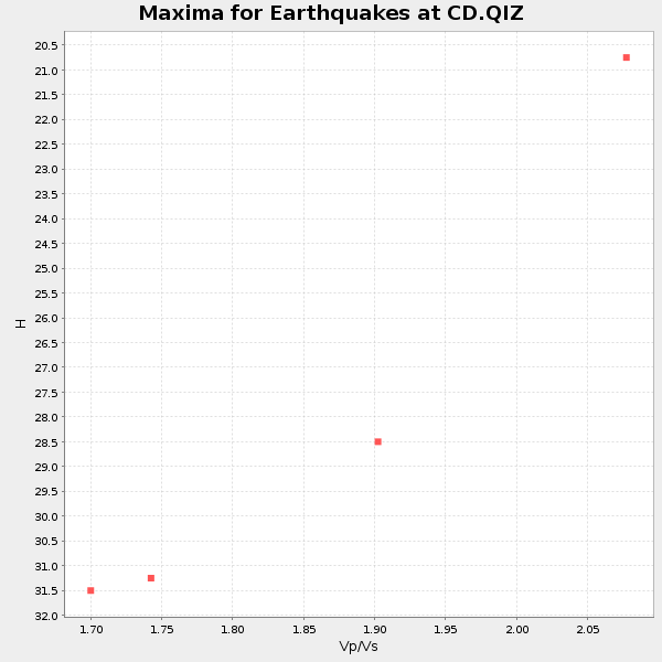
Plot maxima for each earthquake.
Events Used in the Stack
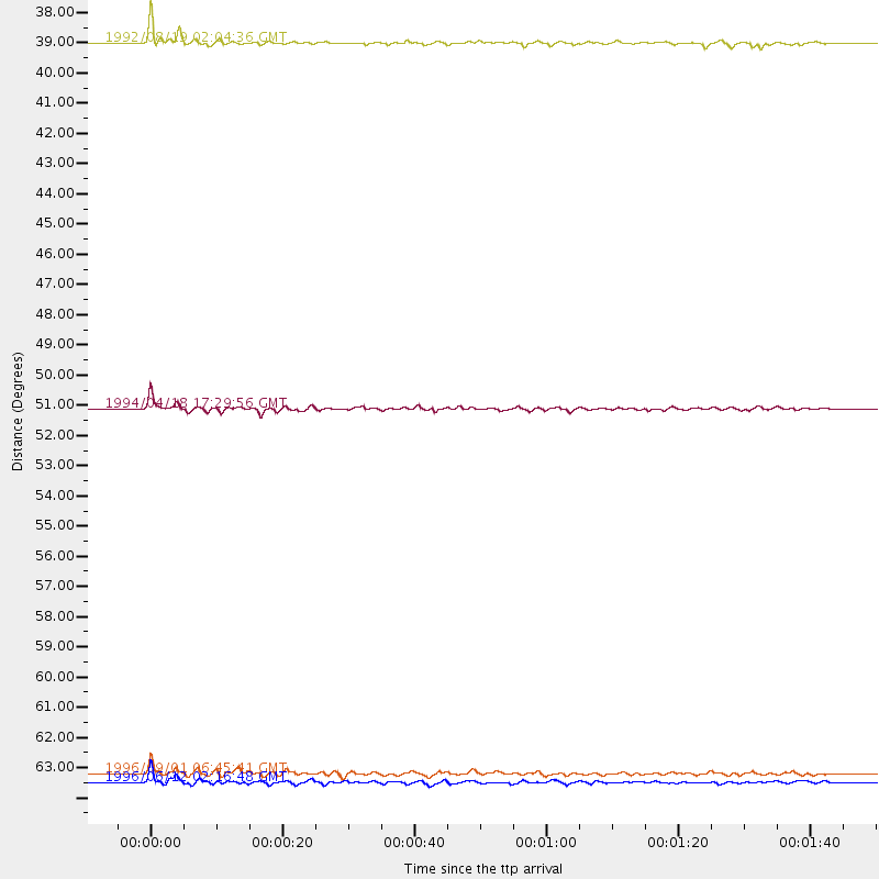
(4 events)| Radial Match | Distance | Baz | FERegion | Time | Lat/Lon | Depth | Magnitude |
| 94.64485 | 51.1 deg | 115.368 deg | Solomon Islands | 1994/04/18 17:29:56 GMT | (-6.5, 154.9) | 43 km | 6.6 MB, 6.7 MS, 6.8 UNKNOWN, 6.7 MW |
| 91.59083 | 38.4 deg | 314.783 deg | Kyrgyzstan | 1992/08/19 02:04:36 GMT | (42.1, 73.6) | 22 km | 6.8 MB, 7.4 MS |
| 89.79407 | 64.1 deg | 41.424 deg | Andreanof Islands, Aleutian Is. | 1996/06/12 02:16:48 GMT | (51.4, -178.2) | 33 km | 5.5 MB, 5.3 MS, 5.7 UNKNOWN, 5.6 ML |
| 88.690155 | 63.8 deg | 114.094 deg | Santa Cruz Islands | 1996/09/01 06:45:41 GMT | (-11.8, 166.6) | 187 km | 5.5 MB, 5.9 UNKNOWN, 5.8 MW |
Losers
(1 events)| Radial Match | Distance | Baz | FERegion | Time | Lat/Lon | Depth | Magnitude | Reason |
| 65.77031 | 85.1 deg | 126.671 deg | South Of Kermadec Islands | 1996/11/11 00:47:21 GMT | (-32.5, -179.0) | 33 km | 5.9 MB, 5.9 MS, 6.1 UNKNOWN, 6.0 MW |
