
Station GE LVC - IRIS/GEOFON/ Station
Network: GE - GEOFON
Nearby stations (2 deg radius)
| Station | Name | (Lat, Lon) | Start / End | Elevation |
| LVC | IRIS/GEOFON/ Station | (-22.62, -68.91) | 1996-12-02 / 2599-12-31 | 2915 m |
| LVC | IRIS/GEOFON/ Station Calama, Chile | (-22.62, -68.91) | 1999-12-20 / 2001-04-30 | 2.9 km |
| LVC | IRIS/GEOFON/ Station Calama, Chile | (-22.62, -68.91) | 2001-04-30 / 2499-01-01 | 2915 m |
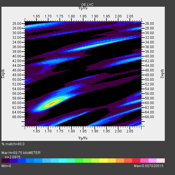
| Crust2 Type: | R3,orogen/70km Chile, 1 km seds. |
| Thickness Estimate: | 70 km |
| Thickness StdDev: | 15 km |
| Vp/Vs Estimate: | 2.10 |
| Vp/Vs StdDev: | 0.17 |
| Vs Estimate: | 3.087 km/s |
| Poisson's Ratio: | 0.35 |
| Peak Value: | 0.01 |
| Assumed Vp: | 6.475 km/s |
| Ps Weight: | 0.33333334 |
| PpPs Weight: | 0.33333334 |
| PsPs Weight: | 0.33333328 |
| Residual Complexity: | 0.985 |
| Nearby stations H: | 48 km +- 30 km |
| (2.0 deg) Vp/Vs: | 2.10 +- 0.00 |
2 with match > 90% ( 28.571428 %) and 6 with match > 80% ( 85.71429 %) out of 7.
Download stack as xyz text file.
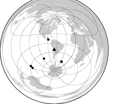
Azimuth Distribution of Events:
Prior Results for this Station
| Study | Thickness | Vp/Vs | Vp | Vs | Poissons Ratio | Extra |
| EARS | 70 km | 2.10 | 6.475 km/s | 3.087 km/s | 0.35 | |
| Crust2.0 | 70 km | 1.76 | 6.475 km/s | 3.679 km/s | 0.26 | R3,orogen/70km Chile, 1 km seds. |
| Global Maxima | 70 km | 2.10 | 6.475 km/s | 3.087 km/s | 0.35 | amp=0.007830515 |
| Local Maxima 1 | 60 km | 1.72 | 6.475 km/s | 3.77 km/s | 0.24 | amp=0.005682095 |
| Local Maxima 2 | 35 km | 1.91 | 6.475 km/s | 3.381 km/s | 0.31 | amp=0.0044371025 |
| Local Maxima 3 | 27 km | 1.60 | 6.475 km/s | 4.047 km/s | 0.18 | amp=0.0027005046 |
| Local Maxima 4 | 59 km | 2.10 | 6.475 km/s | 3.091 km/s | 0.35 | amp=0.0024299196 |
| Predicted Arrivals for vertical incidence (zero ray parameter) | |
| Ps | 11.82 SECOND |
| PpPs | 33.37 SECOND |
| PsPs/PpSs | 45.19 SECOND |
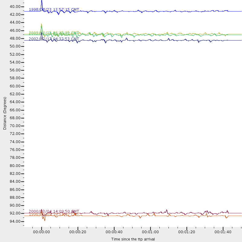
Events Processed for this Station
Download zip of receiver functions as SAC
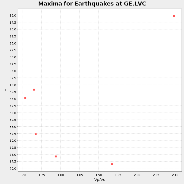
Plot maxima for each earthquake.
Events Used in the Stack
(6 events)| Radial Match | Distance | Baz | FERegion | Time | Lat/Lon | Depth | Magnitude |
| 93.144104 | 38.9 deg | 329.25 deg | Off Coast Of Central America | 1998/08/23 13:57:15 GMT | (11.7, -88.0) | 55 km | 5.7 MB, 6.3 MS, 6.8 UNKNOWN, 6.7 MW |
| 90.469826 | 46.9 deg | 148.516 deg | South Sandwich Islands Region | 2002/12/17 04:32:53 GMT | (-57.0, -24.8) | 10 km | 5.4 MB, 6.3 MS, 6.2 MW, 6.0 MW |
| 87.19879 | 45.1 deg | 229.258 deg | South Pacific Ocean | 2000/03/15 06:35:05 GMT | (-44.4, -117.4) | 10 km | 5.9 MB, 5.5 MS, 5.9 MW |
| 87.165245 | 45.4 deg | 149.052 deg | South Sandwich Islands Region | 2002/11/12 01:46:48 GMT | (-56.5, -27.5) | 120 km | 6.0 MB, 6.3 MW, 6.2 MW |
| 85.89554 | 94.9 deg | 235.207 deg | Kermadec Islands, New Zealand | 1998/09/02 18:52:42 GMT | (-29.7, -178.8) | 230 km | 5.5 UNKNOWN, 5.4 MB |
| 85.62608 | 94.1 deg | 230.319 deg | South Of Kermadec Islands | 2000/03/04 14:09:50 GMT | (-34.3, 179.1) | 33 km | 5.2 MB, 5.6 MS, 6.1 MW, 5.8 MW |
Losers
(1 events)| Radial Match | Distance | Baz | FERegion | Time | Lat/Lon | Depth | Magnitude | Reason |
| 83.88745 | 66.7 deg | 213.262 deg | Pacific-Antarctic Ridge | 1998/08/07 01:40:16 GMT | (-59.6, -150.7) | 10 km | 5.6 MS, 4.9 MB |
