
Station MN AIO - Antillo, Italy
Network: MN - MEDNET Project
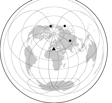
Nearby stations (2 deg radius)
| Station | Name | (Lat, Lon) | Start / End | Elevation |
| AIO | Antillo, Italy | (37.97, 15.23) | 2000-01-01 / 2499-01-01 | 751 m |
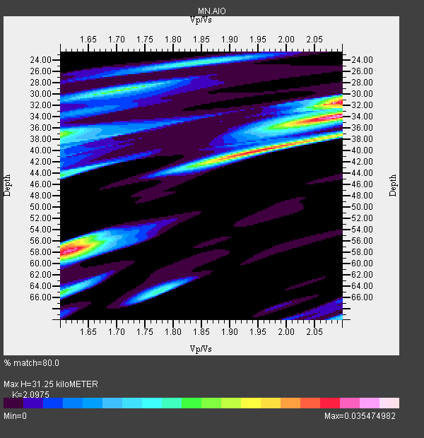
| Crust2 Type: | S4,continental slope, margin, transition 5.5 km seds. |
| Thickness Estimate: | 31 km |
| Thickness StdDev: | 11 km |
| Vp/Vs Estimate: | 2.10 |
| Vp/Vs StdDev: | 0.22 |
| Vs Estimate: | 2.736 km/s |
| Poisson's Ratio: | 0.35 |
| Peak Value: | 0.04 |
| Assumed Vp: | 5.738 km/s |
| Ps Weight: | 0.33333334 |
| PpPs Weight: | 0.33333334 |
| PsPs Weight: | 0.33333328 |
| Residual Complexity: | 0.849 |
| Nearby stations H: | +- |
| (2.0 deg) Vp/Vs: | +- |
0 with match > 90% ( 0.0 %) and 3 with match > 80% ( 100.0 %) out of 3.
Download stack as xyz text file.
Azimuth Distribution of Events:
Prior Results for this Station
| Study | Thickness | Vp/Vs | Vp | Vs | Poissons Ratio | Extra |
| EARS | 31 km | 2.10 | 5.738 km/s | 2.736 km/s | 0.35 | |
| Crust2.0 | 28 km | 1.82 | 5.738 km/s | 3.156 km/s | 0.28 | S4,continental slope, margin, transition 5.5 km seds. |
| Global Maxima | 31 km | 2.10 | 5.738 km/s | 2.736 km/s | 0.35 | amp=0.035474982 |
| Local Maxima 1 | 34 km | 2.10 | 5.738 km/s | 2.736 km/s | 0.35 | amp=0.029888717 |
| Local Maxima 2 | 58 km | 1.62 | 5.738 km/s | 3.542 km/s | 0.19 | amp=0.023225594 |
| Local Maxima 3 | 38 km | 2.05 | 5.738 km/s | 2.799 km/s | 0.34 | amp=0.022750912 |
| Local Maxima 4 | 29 km | 1.70 | 5.738 km/s | 3.37 km/s | 0.24 | amp=0.019885404 |
| Predicted Arrivals for vertical incidence (zero ray parameter) | |
| Ps | 5.98 SECOND |
| PpPs | 16.87 SECOND |
| PsPs/PpSs | 22.85 SECOND |
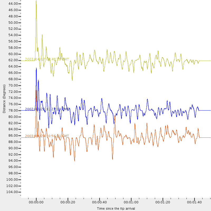
Events Processed for this Station
Download zip of receiver functions as SAC
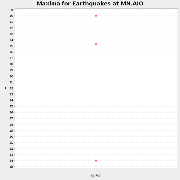
Plot maxima for each earthquake.
Events Used in the Stack
(3 events)| Radial Match | Distance | Baz | FERegion | Time | Lat/Lon | Depth | Magnitude |
| 86.29922 | 62.1 deg | 62.718 deg | Qinghai, China | 2003/04/17 00:48:38 GMT | (37.5, 96.5) | 14 km | 6.2 MB, 6.3 MS, 6.4 MW, 6.2 MW |
| 81.03528 | 86.5 deg | 25.355 deg | Kuril Islands | 2003/04/24 10:56:21 GMT | (48.8, 155.0) | 44 km | 5.6 MB, 5.7 MS, 6.1 MW, 6.0 MW |
| 80.87276 | 78.0 deg | 352.361 deg | Central Alaska | 2002/10/23 11:27:19 GMT | (63.5, -147.9) | 4.2 km | 6.0 MB, 6.7 MS, 6.7 MW, 6.7 MW |
Losers
(0 events)| Radial Match | Distance | Baz | FERegion | Time | Lat/Lon | Depth | Magnitude | Reason |
