
Station N4 Z56A - Williston, SC, USA
Network: N4 - Central and EAstern US Network
Nearby stations (2 deg radius)
| Station | Name | (Lat, Lon) | Start / End | Elevation |
| Z56A | Williston, SC, USA | (33.33, -81.37) | 2015-01-20 / 2015-03-06 | 81 m |
| Crust2 Type: | DG,thin Platform 1 km seds. |
| Thickness Estimate: | 25 km |
| Thickness StdDev: | 8.3 km |
| Vp/Vs Estimate: | 2.04 |
| Vp/Vs StdDev: | 0.20 |
| Vs Estimate: | 3.226 km/s |
| Poisson's Ratio: | 0.34 |
| Peak Value: | 0.28 |
| Assumed Vp: | 6.565 km/s |
| Ps Weight: | 0.33333334 |
| PpPs Weight: | 0.33333334 |
| PsPs Weight: | 0.33333328 |
| Residual Complexity: | 0.869 |
| Nearby stations H: | +- |
| (2.0 deg) Vp/Vs: | +- |
3 with match > 90% ( 42.857143 %) and 3 with match > 80% ( 42.857143 %) out of 7.
Download stack as xyz text file.
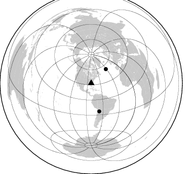
Azimuth Distribution of Events:
Prior Results for this Station
| Study | Thickness | Vp/Vs | Vp | Vs | Poissons Ratio | Extra |
| EARS | 25 km | 2.04 | 6.565 km/s | 3.226 km/s | 0.34 | |
| Crust2.0 | 31 km | 1.78 | 6.565 km/s | 3.684 km/s | 0.27 | DG,thin Platform 1 km seds. |
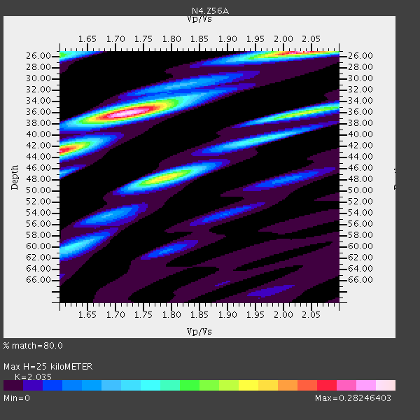
| Global Maxima | 25 km | 2.04 | 6.565 km/s | 3.226 km/s | 0.34 | amp=0.28246403 |
| Local Maxima 1 | 36 km | 1.72 | 6.565 km/s | 3.817 km/s | 0.24 | amp=0.26758698 |
| Local Maxima 2 | 48 km | 1.79 | 6.565 km/s | 3.672 km/s | 0.27 | amp=0.18905334 |
| Local Maxima 3 | 36 km | 2.03 | 6.565 km/s | 3.23 km/s | 0.34 | amp=0.16599983 |
| Local Maxima 4 | 26 km | 1.60 | 6.565 km/s | 4.103 km/s | 0.18 | amp=0.14351806 |
| Predicted Arrivals for vertical incidence (zero ray parameter) | |
| Ps | 3.94 SECOND |
| PpPs | 11.56 SECOND |
| PsPs/PpSs | 15.50 SECOND |
Events Processed for this Station
Download zip of receiver functions as SAC
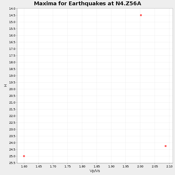
Plot maxima for each earthquake.
Events Used in the Stack
(3 events)| Radial Match | Distance | Baz | FERegion | Time | Lat/Lon | Depth | Magnitude |
| 97.76884 | 40.2 deg | 46.197 deg | Northern Mid-Atlantic Ridge | 2015/02/13 18:58:05 GMT | (52.5, -31.7) | 12 km | 4.9 mb |
| 96.0427 | 57.8 deg | 164.003 deg | Jujuy Province, Argentina | 2015/02/11 18:57:22 GMT | (-23.1, -66.7) | 223 km | 6.7 MWW, 6.7 MWC, 6.7 MWB, 6.9 MI |
| 95.035934 | 40.1 deg | 46.01 deg | Northern Mid-Atlantic Ridge | 2015/02/13 18:59:12 GMT | (52.6, -31.9) | 16 km | 7.1 MWW, 6.8 MI, 7.0 MWB, 7.0 MWC, 7.1 MWC |
Losers
(4 events)| Radial Match | Distance | Baz | FERegion | Time | Lat/Lon | Depth | Magnitude | Reason |
| 66.75544 | 67.1 deg | 166.925 deg | Mendoza Province, Argentina | 2015/02/02 10:49:48 GMT | (-32.7, -67.1) | 172 km | 6.3 MO | |
| 64.954056 | 30.8 deg | 170.468 deg | Colombia | 2015/02/22 12:56:24 GMT | (2.7, -76.5) | 151 km | 5.6 MB | |
| 55.292 | 56.2 deg | 168.282 deg | Near Coast Of Northern Chile | 2015/02/02 15:22:08 GMT | (-22.3, -70.9) | 14 km | 5.3 MW | |
| 45.17282 | 40.1 deg | 45.882 deg | Northern Mid-Atlantic Ridge | 2015/02/13 19:47:42 GMT | (52.7, -31.9) | 13 km | 4.8 mb |

