
Station PO DRCO - St. Marys Cement, ON
Network: PO - Portable Observatories for Lithospheric Analysis and Research Investigating Seis
Nearby stations (2 deg radius)
| Station | Name | (Lat, Lon) | Start / End | Elevation |
| DRCO | St. Marys Cement, ON | (43.88, -78.70) | 2011-10-26 / 2599-12-31 | 84 m |
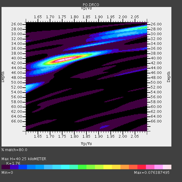
| Crust2 Type: | Q2,orogen/39km no ice, Appalachians, North Andes, 0.5 km seds. |
| Thickness Estimate: | 40 km |
| Thickness StdDev: | 0.1 km |
| Vp/Vs Estimate: | 1.76 |
| Vp/Vs StdDev: | 0.01 |
| Vs Estimate: | 3.647 km/s |
| Poisson's Ratio: | 0.26 |
| Peak Value: | 0.08 |
| Assumed Vp: | 6.419 km/s |
| Ps Weight: | 0.33333334 |
| PpPs Weight: | 0.33333334 |
| PsPs Weight: | 0.33333328 |
| Residual Complexity: | 0.399 |
| Nearby stations H: | +- |
| (2.0 deg) Vp/Vs: | +- |
4 with match > 90% ( 66.666664 %) and 4 with match > 80% ( 66.666664 %) out of 6.
Download stack as xyz text file.
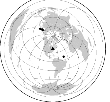
Azimuth Distribution of Events:
Prior Results for this Station
| Study | Thickness | Vp/Vs | Vp | Vs | Poissons Ratio | Extra |
| EARS | 40 km | 1.76 | 6.419 km/s | 3.647 km/s | 0.26 | |
| Crust2.0 | 39 km | 1.75 | 6.419 km/s | 3.659 km/s | 0.26 | Q2,orogen/39km no ice, Appalachians, North Andes, 0.5 km seds. |
| Global Maxima | 40 km | 1.76 | 6.419 km/s | 3.647 km/s | 0.26 | amp=0.076387495 |
| Local Maxima 1 | 27 km | 2.08 | 6.419 km/s | 3.086 km/s | 0.35 | amp=0.033748943 |
| Local Maxima 2 | 52 km | 1.60 | 6.419 km/s | 4.012 km/s | 0.18 | amp=0.024648326 |
| Local Maxima 3 | 42 km | 1.72 | 6.419 km/s | 3.727 km/s | 0.25 | amp=0.013740725 |
| Local Maxima 4 | 39 km | 1.75 | 6.419 km/s | 3.668 km/s | 0.26 | amp=0.011410452 |
| Predicted Arrivals for vertical incidence (zero ray parameter) | |
| Ps | 4.77 SECOND |
| PpPs | 17.31 SECOND |
| PsPs/PpSs | 22.07 SECOND |
Events Processed for this Station
Download zip of receiver functions as SAC
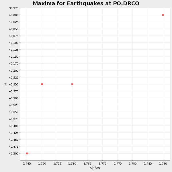
Plot maxima for each earthquake.
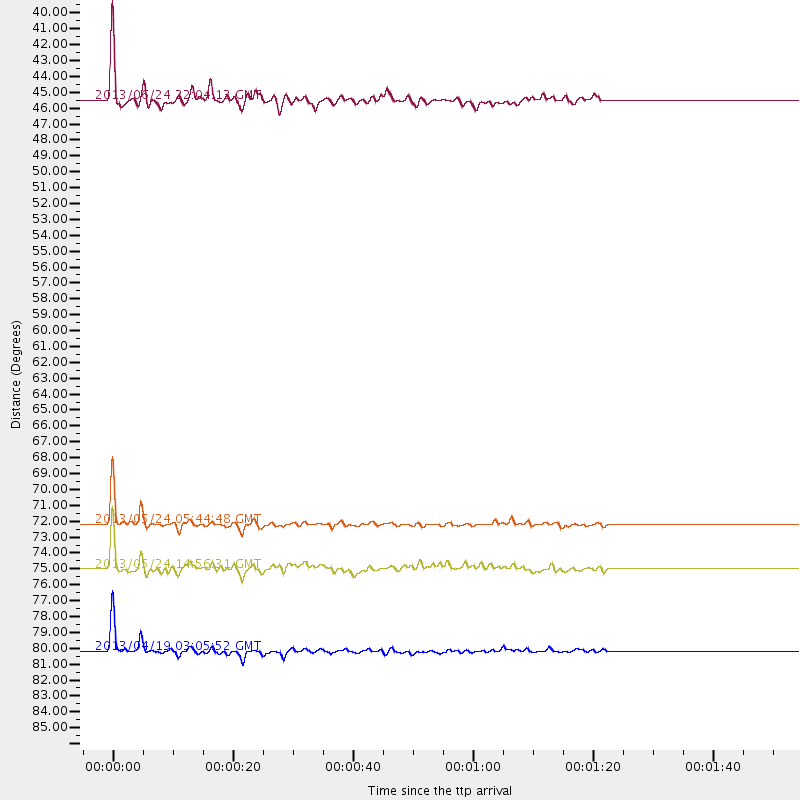
Events Used in the Stack
(4 events)| Radial Match | Distance | Baz | FERegion | Time | Lat/Lon | Depth | Magnitude |
| 98.10516 | 72.2 deg | 331.465 deg | Sea Of Okhotsk | 2013/05/24 05:44:48 GMT | (54.9, 153.2) | 598 km | 8.4 MW, 7.5 MB, 8.3 MW |
| 96.888084 | 80.2 deg | 327.605 deg | Kuril Islands | 2013/04/19 03:05:52 GMT | (46.2, 150.8) | 110 km | 7.2 MW, 7.1 MB, 7.2 MW |
| 93.16032 | 75.0 deg | 330.733 deg | Sea Of Okhotsk | 2013/05/24 14:56:31 GMT | (52.2, 151.4) | 624 km | 6.7 MW, 6.7 MB, 6.7 MW |
| 92.3206 | 45.4 deg | 125.623 deg | Northern Mid-Atlantic Ridge | 2013/06/24 22:04:13 GMT | (10.7, -42.6) | 10 km | 6.5 MW, 6.1 MB, 6.3 MS, 6.6 MW |
Losers
(2 events)| Radial Match | Distance | Baz | FERegion | Time | Lat/Lon | Depth | Magnitude | Reason |
| 68.376045 | 71.5 deg | 326.508 deg | Off East Coast Of Kamchatka | 2013/05/21 03:08:17 GMT | (52.5, 160.1) | 7.6 km | 5.8 MW, 5.6 MB, 5.7 MW, 5.8 MS | |
| 53.25235 | 71.5 deg | 326.364 deg | Off East Coast Of Kamchatka | 2013/05/21 03:05:50 GMT | (52.4, 160.3) | 11 km | 5.9 MW, 5.5 MB, 5.8 MS, 5.8 MW |
