
Station RV GODA - Gordondale, AB
Network: RV - Regional Alberta Seismic Observatory for Earthquake Studies Network
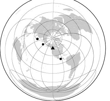
Nearby stations (2 deg radius)

| Station | Name | (Lat, Lon) | Start / End | Elevation |
| GODA | Gordondale, AB | (55.84, -119.57) | 2017-07-24 / 2599-12-31 | 718 m |
| Crust2 Type: | Q0,orogen/46km no ice, Rockies, Tarim Basin, 4 km seds. |
| Thickness Estimate: | 34 km |
| Thickness StdDev: | 9.2 km |
| Vp/Vs Estimate: | 1.68 |
| Vp/Vs StdDev: | 0.18 |
| Vs Estimate: | 3.678 km/s |
| Poisson's Ratio: | 0.22 |
| Peak Value: | 0.72 |
| Assumed Vp: | 6.161 km/s |
| Ps Weight: | 0.33333334 |
| PpPs Weight: | 0.33333334 |
| PsPs Weight: | 0.33333328 |
| Residual Complexity: | 0.852 |
| Nearby stations H: | +- |
| (2.0 deg) Vp/Vs: | +- |
1 with match > 90% ( 5.263158 %) and 4 with match > 80% ( 21.052631 %) out of 19.
Download stack as xyz text file.
Azimuth Distribution of Events:
Prior Results for this Station
| Study | Thickness | Vp/Vs | Vp | Vs | Poissons Ratio | Extra |
| EARS | 34 km | 1.68 | 6.161 km/s | 3.678 km/s | 0.22 | |
| Crust2.0 | 46 km | 1.75 | 6.161 km/s | 3.511 km/s | 0.26 | Q0,orogen/46km no ice, Rockies, Tarim Basin, 4 km seds. |
| Global Maxima | 34 km | 1.68 | 6.161 km/s | 3.678 km/s | 0.22 | amp=0.7204076 |
| Local Maxima 1 | 35 km | 1.94 | 6.161 km/s | 3.172 km/s | 0.32 | amp=0.53720075 |
| Local Maxima 2 | 43 km | 1.85 | 6.161 km/s | 3.335 km/s | 0.29 | amp=0.43305713 |
| Local Maxima 3 | 30 km | 1.79 | 6.161 km/s | 3.442 km/s | 0.27 | amp=0.36844522 |
| Local Maxima 4 | 59 km | 1.62 | 6.161 km/s | 3.797 km/s | 0.19 | amp=0.367239 |
| Predicted Arrivals for vertical incidence (zero ray parameter) | |
| Ps | 3.78 SECOND |
| PpPs | 14.98 SECOND |
| PsPs/PpSs | 18.76 SECOND |
Events Processed for this Station
Download zip of receiver functions as SAC
Plot maxima for each earthquake.
Events Used in the Stack
(4 events)| Radial Match | Distance | Baz | FERegion | Time | Lat/Lon | Depth | Magnitude |
| 92.42705 | 45.3 deg | 143.628 deg | Near Coast Of Chiapas, Mexico | 2017/09/08 04:49:21 GMT | (15.1, -93.7) | 70 km | 8.1 Mww |
| 88.34108 | 36.3 deg | 292.003 deg | Rat Islands, Aleutian Islands | 2017/10/08 22:34:33 GMT | (52.4, 176.8) | 112 km | 6.6 mww |
| 85.36105 | 61.3 deg | 301.472 deg | Hokkaido, Japan Region | 2018/01/24 10:51:20 GMT | (41.1, 142.3) | 40 km | 6.2 Mww |
| 80.353096 | 61.8 deg | 300.82 deg | Near East Coast Of Honshu, Japan | 2017/09/26 20:22:11 GMT | (40.3, 142.4) | 36 km | 5.8 Mww |
Losers
(15 events)| Radial Match | Distance | Baz | FERegion | Time | Lat/Lon | Depth | Magnitude | Reason |
| 94.89022 | 47.0 deg | 129.874 deg | North Of Honduras | 2018/01/10 02:51:31 GMT | (17.5, -83.6) | 33 km | 7.8 Mi | |
| 84.2296 | 97.0 deg | 137.971 deg | San Juan Province, Argentina | 2018/01/28 23:53:14 GMT | (-31.3, -68.7) | 88 km | 5.4 Mww | |
| 79.473526 | 93.9 deg | 266.085 deg | New Britain Region, P.N.G. | 2018/03/29 21:25:32 GMT | (-5.5, 151.4) | 10 km | 6.9 mww | |
| 77.2841 | 98.0 deg | 242.75 deg | Southeast Of Loyalty Islands | 2017/11/02 16:51:29 GMT | (-21.9, 169.0) | 5.2 km | 5.4 Mww | |
| 73.92317 | 80.7 deg | 136.538 deg | Near Coast Of Peru | 2018/01/14 09:18:45 GMT | (-15.8, -74.7) | 36 km | 7.1 mww | |
| 70.661736 | 92.3 deg | 266.637 deg | New Ireland Region, P.N.G. | 2018/02/10 22:50:48 GMT | (-3.8, 151.9) | 268 km | 5.8 Mww | |
| 70.37068 | 87.7 deg | 346.108 deg | Eastern Kashmir | 2017/12/06 23:29:02 GMT | (35.7, 77.6) | 59 km | 5.1 Mww | |
| 66.85152 | 93.9 deg | 266.053 deg | New Britain Region, P.N.G. | 2018/03/24 11:23:32 GMT | (-5.5, 151.5) | 36 km | 6.3 mww | |
| 66.6182 | 90.2 deg | 229.408 deg | Tonga Islands | 2017/12/15 12:12:07 GMT | (-21.9, -174.4) | 10 km | 5.3 Mww | |
| 60.307854 | 84.9 deg | 306.486 deg | Taiwan | 2018/02/06 15:50:41 GMT | (24.2, 121.7) | 9.5 km | 6.4 Mww | |
| 59.97621 | 71.2 deg | 295.071 deg | Southeast Of Honshu, Japan | 2018/01/03 21:30:21 GMT | (29.6, 140.5) | 9.5 km | 5.5 Mww | |
| 55.996006 | 48.9 deg | 138.398 deg | El Salvador | 2018/04/02 23:23:17 GMT | (13.1, -88.7) | 50 km | 5.9 Mww | |
| 55.952644 | 42.7 deg | 148.489 deg | Oaxaca, Mexico | 2018/02/16 23:39:44 GMT | (16.4, -97.9) | 43 km | 7.5 Mi | |
| 55.696777 | 87.5 deg | 284.056 deg | W. Caroline Islands, Micronesia | 2017/12/08 05:37:54 GMT | (10.0, 140.1) | 10 km | 5.5 mb | |
| 44.90389 | 85.7 deg | 133.893 deg | Near Coast Of Northern Chile | 2017/09/04 21:55:20 GMT | (-19.3, -70.0) | 63 km | 5.1 Mwr |

