
Station S AUGRF - Marian Catholic College, Griffith NSW
Network: S - Seismographs in Schools Projects
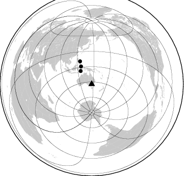
Nearby stations (2 deg radius)

| Station | Name | (Lat, Lon) | Start / End | Elevation |
| AUGRF | Marian Catholic College, Griffith NSW | (-34.29, 146.06) | 2019-02-18 / 2599-12-31 | 132 m |
| Crust2 Type: | Z6,thick Phanerozoic, 1 km seds. |
| Thickness Estimate: | 34 km |
| Thickness StdDev: | 12 km |
| Vp/Vs Estimate: | 1.77 |
| Vp/Vs StdDev: | 0.07 |
| Vs Estimate: | 3.694 km/s |
| Poisson's Ratio: | 0.27 |
| Peak Value: | 0.05 |
| Assumed Vp: | 6.548 km/s |
| Ps Weight: | 0.33333334 |
| PpPs Weight: | 0.33333334 |
| PsPs Weight: | 0.33333328 |
| Residual Complexity: | 0.781 |
| Nearby stations H: | +- |
| (2.0 deg) Vp/Vs: | +- |
1 with match > 90% ( 6.25 %) and 3 with match > 80% ( 18.75 %) out of 16.
Download stack as xyz text file.
Azimuth Distribution of Events:
Prior Results for this Station
| Study | Thickness | Vp/Vs | Vp | Vs | Poissons Ratio | Extra |
| EARS | 34 km | 1.77 | 6.548 km/s | 3.694 km/s | 0.27 | |
| Crust2.0 | 42 km | 1.78 | 6.548 km/s | 3.679 km/s | 0.27 | Z6,thick Phanerozoic, 1 km seds. |
| Global Maxima | 34 km | 1.77 | 6.548 km/s | 3.694 km/s | 0.27 | amp=0.05006595 |
| Local Maxima 1 | 57 km | 1.87 | 6.548 km/s | 3.497 km/s | 0.30 | amp=0.041619655 |
| Local Maxima 2 | 70 km | 1.62 | 6.548 km/s | 4.029 km/s | 0.20 | amp=0.038013645 |
| Local Maxima 3 | 33 km | 1.73 | 6.548 km/s | 3.785 km/s | 0.25 | amp=0.034504935 |
| Local Maxima 4 | 66 km | 1.74 | 6.548 km/s | 3.758 km/s | 0.25 | amp=0.027957456 |
| Predicted Arrivals for vertical incidence (zero ray parameter) | |
| Ps | 4.04 SECOND |
| PpPs | 14.50 SECOND |
| PsPs/PpSs | 18.54 SECOND |
Events Processed for this Station
Download zip of receiver functions as SAC
Plot maxima for each earthquake.
Events Used in the Stack
(3 events)| Radial Match | Distance | Baz | FERegion | Time | Lat/Lon | Depth | Magnitude |
| 90.82604 | 50.0 deg | 332.907 deg | Samar, Philippines | 2019/04/23 05:37:52 GMT | (11.8, 125.2) | 54 km | 6.4 Mww |
| 82.3444 | 40.3 deg | 328.699 deg | Northern Molucca Sea | 2019/03/24 04:37:34 GMT | (1.7, 126.4) | 37 km | 6.1 Mww |
| 80.31963 | 33.5 deg | 319.774 deg | Banda Sea | 2019/04/06 21:55:01 GMT | (-6.8, 125.0) | 539 km | 6.3 Mww |
Losers
(13 events)| Radial Match | Distance | Baz | FERegion | Time | Lat/Lon | Depth | Magnitude | Reason |
| 85.63062 | 30.7 deg | 97.348 deg | South Of Kermadec Islands | 2019/03/07 15:27:24 GMT | (-32.6, -177.1) | 10 km | 5.5 Mww | |
| 83.40524 | 58.0 deg | 331.059 deg | Luzon, Philippines | 2019/03/02 19:46:20 GMT | (18.6, 120.4) | 15 km | 5.6 Mww | |
| 79.542366 | 30.2 deg | 95.932 deg | South Of Kermadec Islands | 2019/03/06 15:46:14 GMT | (-32.0, -177.9) | 29 km | 6.4 Mww | |
| 75.47268 | 87.2 deg | 184.528 deg | South Sandwich Islands Region | 2019/04/09 17:53:59 GMT | (-58.6, -25.3) | 46 km | 6.5 Mww | |
| 71.986725 | 57.8 deg | 298.261 deg | Northern Sumatra, Indonesia | 2019/03/11 13:26:24 GMT | (1.9, 97.8) | 41 km | 5.2 Mww | |
| 68.779366 | 48.3 deg | 333.246 deg | Philippine Islands Region | 2019/03/08 15:06:16 GMT | (10.4, 126.1) | 54 km | 6.0 Mww | |
| 68.35253 | 72.5 deg | 259.702 deg | Mauritius - Reunion Region | 2019/04/01 18:39:06 GMT | (-18.2, 65.4) | 10 km | 6.0 Mww | |
| 68.15224 | 35.5 deg | 71.504 deg | Fiji Islands Region | 2019/03/10 08:12:25 GMT | (-17.8, -178.7) | 567 km | 6.2 Mww | |
| 66.812675 | 62.4 deg | 334.801 deg | Taiwan | 2019/04/18 05:01:06 GMT | (24.0, 121.7) | 20 km | 6.1 Mww | |
| 63.697567 | 64.2 deg | 300.204 deg | Nicobar Islands, India Region | 2019/04/01 08:11:32 GMT | (7.6, 94.4) | 10 km | 5.5 Mww | |
| 61.79534 | 30.2 deg | 353.752 deg | New Guinea, Papua New Guinea | 2019/03/06 18:47:25 GMT | (-4.1, 142.9) | 129 km | 5.6 Mww | |
| 53.151337 | 85.3 deg | 8.857 deg | East Of Kuril Islands | 2019/03/28 22:06:49 GMT | (50.5, 160.0) | 9.0 km | 6.2 Mww | |
| 38.102016 | 37.4 deg | 306.599 deg | Sumbawa Region, Indonesia | 2019/03/17 07:07:27 GMT | (-8.4, 116.5) | 24 km | 5.5 Mww |

