
Station SN RVFF - Rock Valley Frenchman Flat
Network: SN - Southern Great Basin Network
Nearby stations (2 deg radius)

| Station | Name | (Lat, Lon) | Start / End | Elevation |
| RVFF | Rock Valley Frenchman Flat | (36.73, -115.99) | 2013-04-01 / 2599-12-31 | 1079 m |
| Crust2 Type: | M5,extended crust, 0.5 km seds. |
| Thickness Estimate: | 38 km |
| Thickness StdDev: | 3.7 km |
| Vp/Vs Estimate: | 1.81 |
| Vp/Vs StdDev: | 0.12 |
| Vs Estimate: | 3.477 km/s |
| Poisson's Ratio: | 0.28 |
| Peak Value: | 0.07 |
| Assumed Vp: | 6.276 km/s |
| Ps Weight: | 0.33333334 |
| PpPs Weight: | 0.33333334 |
| PsPs Weight: | 0.33333328 |
| Residual Complexity: | 0.576 |
| Nearby stations H: | +- |
| (2.0 deg) Vp/Vs: | +- |
3 with match > 90% ( 15.789474 %) and 3 with match > 80% ( 15.789474 %) out of 19.
Download stack as xyz text file.
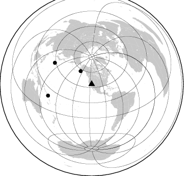
Azimuth Distribution of Events:
Prior Results for this Station
| Study | Thickness | Vp/Vs | Vp | Vs | Poissons Ratio | Extra |
| EARS | 38 km | 1.81 | 6.276 km/s | 3.477 km/s | 0.28 | |
| Crust2.0 | 31 km | 1.78 | 6.276 km/s | 3.529 km/s | 0.27 | M5,extended crust, 0.5 km seds. |
| Global Maxima | 38 km | 1.81 | 6.276 km/s | 3.477 km/s | 0.28 | amp=0.06807453 |
| Local Maxima 1 | 36 km | 1.83 | 6.276 km/s | 3.439 km/s | 0.29 | amp=0.041578636 |
| Local Maxima 2 | 30 km | 2.02 | 6.276 km/s | 3.107 km/s | 0.34 | amp=0.029595438 |
| Local Maxima 3 | 38 km | 2.09 | 6.276 km/s | 2.999 km/s | 0.35 | amp=0.024507483 |
| Local Maxima 4 | 49 km | 1.67 | 6.276 km/s | 3.758 km/s | 0.22 | amp=0.022422452 |
| Predicted Arrivals for vertical incidence (zero ray parameter) | |
| Ps | 4.84 SECOND |
| PpPs | 16.87 SECOND |
| PsPs/PpSs | 21.71 SECOND |
Events Processed for this Station
Download zip of receiver functions as SAC
Plot maxima for each earthquake.
Events Used in the Stack
(3 events)| Radial Match | Distance | Baz | FERegion | Time | Lat/Lon | Depth | Magnitude |
| 93.53376 | 83.7 deg | 299.964 deg | Bonin Islands, Japan Region | 2015/05/30 11:23:02 GMT | (27.8, 140.5) | 678 km | 7.8 MWP, 8.5 MI |
| 92.11652 | 33.5 deg | 319.538 deg | Alaska Peninsula | 2015/05/29 07:00:08 GMT | (56.7, -156.5) | 62 km | 6.8 MWP, 6.8 MI |
| 91.74251 | 88.4 deg | 255.293 deg | Santa Cruz Islands Region | 2015/05/20 22:48:53 GMT | (-10.9, 164.2) | 12 km | 6.8 MWW, 6.7 MWB, 6.8 MWC, 6.9 MI |
Losers
(16 events)| Radial Match | Distance | Baz | FERegion | Time | Lat/Lon | Depth | Magnitude | Reason |
| 92.100334 | 88.9 deg | 255.421 deg | Solomon Islands | 2015/05/22 21:45:18 GMT | (-11.1, 163.7) | 7.9 km | 6.8 MO | |
| 90.716095 | 75.1 deg | 237.023 deg | Tonga Islands | 2015/05/30 17:18:39 GMT | (-15.7, -173.3) | 51 km | 5.8 MB | |
| 90.63074 | 92.6 deg | 262.738 deg | Solomon Islands | 2015/05/30 17:40:06 GMT | (-7.5, 156.2) | 44 km | 4.7 mb, 4.7 mb | |
| 79.700775 | 73.7 deg | 134.513 deg | Northern Chile | 2015/05/26 10:32:01 GMT | (-22.1, -68.4) | 115 km | 5.7 MB | |
| 79.13051 | 80.1 deg | 300.95 deg | Southeast Of Honshu, Japan | 2015/05/30 18:49:07 GMT | (30.8, 143.0) | 13 km | 6.4 MO | |
| 72.527596 | 79.1 deg | 235.959 deg | Tonga Islands | 2015/05/20 00:30:51 GMT | (-19.3, -175.5) | 180 km | 6.0 MWP | |
| 64.393745 | 90.8 deg | 258.457 deg | Solomon Islands | 2015/05/21 19:32:57 GMT | (-9.8, 160.3) | 10 km | 6.0 MWB | |
| 63.507835 | 79.4 deg | 236.27 deg | Tonga Islands | 2015/05/24 14:39:02 GMT | (-19.3, -175.9) | 35 km | 5.7 MB | |
| 59.638546 | 93.9 deg | 266.934 deg | New Britain Region, P.N.G. | 2015/05/23 19:28:18 GMT | (-4.8, 152.7) | 51 km | 5.7 MB | |
| 57.881977 | 65.8 deg | 310.022 deg | East Of Kuril Islands | 2015/05/26 17:56:06 GMT | (45.9, 152.4) | 41 km | 4.3 mb, 4.0 mb | |
| 54.300724 | 93.0 deg | 264.293 deg | Solomon Islands | 2015/05/25 04:48:23 GMT | (-6.4, 155.0) | 71 km | 5.5 MB | |
| 53.777893 | 83.6 deg | 299.93 deg | Bonin Islands, Japan Region | 2015/06/02 21:04:28 GMT | (27.9, 140.6) | 687 km | 4.9 mb | |
| 50.160748 | 89.9 deg | 246.629 deg | Vanuatu Islands | 2015/05/19 13:54:55 GMT | (-18.6, 168.6) | 50 km | 5.8 MWB, 5.9 MWC | |
| 43.311783 | 91.8 deg | 189.387 deg | Pacific-Antarctic Ridge | 2015/05/19 15:25:21 GMT | (-54.4, -132.2) | 10 km | 6.7 MWW, 6.5 MWB, 6.6 MWC | |
| 41.796394 | 47.9 deg | 309.334 deg | Rat Islands, Aleutian Islands | 2015/05/31 18:07:49 GMT | (51.2, 178.3) | 36 km | 5.0 MW, 5.1 mb, 4.0 MS | |
| 37.49438 | 70.9 deg | 135.054 deg | Near Coast Of Northern Chile | 2015/05/22 19:39:34 GMT | (-20.2, -70.7) | 20 km | 5.3 MW, 5.3 mb, 5.0 MS |

