
Station SP BTRCK - Battery Creek High School, Beaufort County, SC USA
Network: SP - South Carolina Earth Physics Project
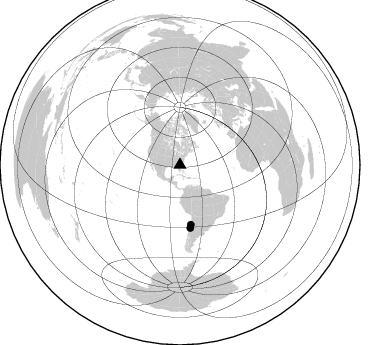
Nearby stations (2 deg radius)
| Station | Name | (Lat, Lon) | Start / End | Elevation |
| BTRCK | Battery Creek High School, Beaufort County, SC USA | (32.43, -80.75) | 2001-09-11 / 2499-01-01 | 3.0 m |
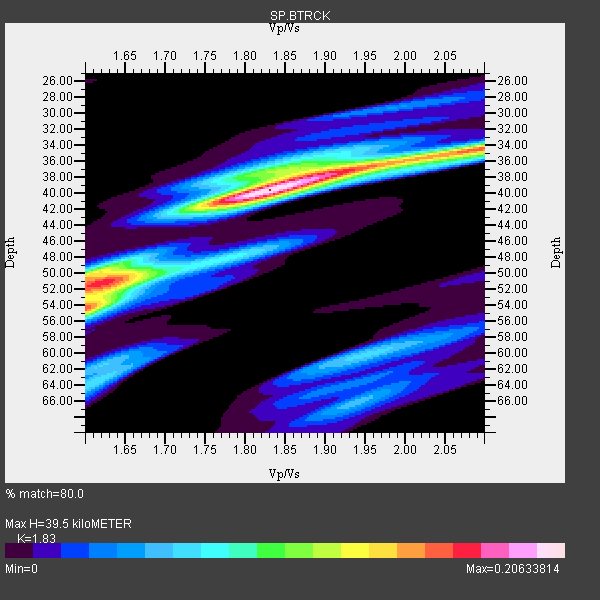
| Crust2 Type: | DG,thin Platform 1 km seds. |
| Thickness Estimate: | 40 km |
| Thickness StdDev: | 6.4 km |
| Vp/Vs Estimate: | 1.83 |
| Vp/Vs StdDev: | 0.11 |
| Vs Estimate: | 3.587 km/s |
| Poisson's Ratio: | 0.29 |
| Peak Value: | 0.21 |
| Assumed Vp: | 6.565 km/s |
| Ps Weight: | 0.33333334 |
| PpPs Weight: | 0.33333334 |
| PsPs Weight: | 0.33333328 |
| Residual Complexity: | 0.703 |
| Nearby stations H: | +- |
| (2.0 deg) Vp/Vs: | +- |
2 with match > 90% ( 66.666664 %) and 2 with match > 80% ( 66.666664 %) out of 3.
Download stack as xyz text file.
Azimuth Distribution of Events:
Prior Results for this Station
| Study | Thickness | Vp/Vs | Vp | Vs | Poissons Ratio | Extra |
| EARS | 40 km | 1.83 | 6.565 km/s | 3.587 km/s | 0.29 | |
| Crust2.0 | 31 km | 1.78 | 6.565 km/s | 3.684 km/s | 0.27 | DG,thin Platform 1 km seds. |
| Global Maxima | 40 km | 1.83 | 6.565 km/s | 3.587 km/s | 0.29 | amp=0.20633814 |
| Local Maxima 1 | 54 km | 1.60 | 6.565 km/s | 4.103 km/s | 0.18 | amp=0.15512374 |
| Local Maxima 2 | 34 km | 2.10 | 6.565 km/s | 3.13 km/s | 0.35 | amp=0.14930254 |
| Local Maxima 3 | 51 km | 1.63 | 6.565 km/s | 4.021 km/s | 0.20 | amp=0.13671014 |
| Local Maxima 4 | 50 km | 1.60 | 6.565 km/s | 4.103 km/s | 0.18 | amp=0.10596332 |
| Predicted Arrivals for vertical incidence (zero ray parameter) | |
| Ps | 4.99 SECOND |
| PpPs | 17.03 SECOND |
| PsPs/PpSs | 22.02 SECOND |
Events Processed for this Station
Download zip of receiver functions as SAC
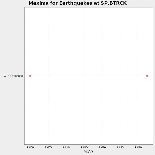
Plot maxima for each earthquake.
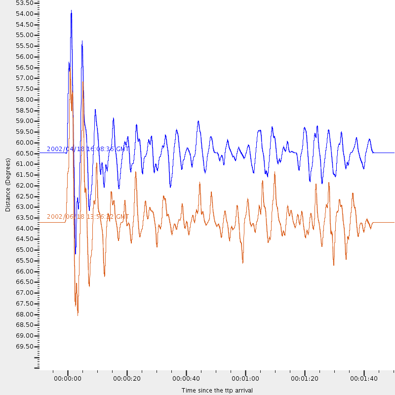
Events Used in the Stack
(2 events)| Radial Match | Distance | Baz | FERegion | Time | Lat/Lon | Depth | Magnitude |
| 94.91558 | 63.6 deg | 170.755 deg | Near Coast Of Central Chile | 2002/06/18 13:56:22 GMT | (-30.8, -71.1) | 54 km | 6.0 MB, 6.6 MW, 6.4 MW |
| 90.409645 | 60.4 deg | 169.621 deg | Near Coast Of Northern Chile | 2002/04/18 16:08:36 GMT | (-27.5, -70.6) | 62 km | 6.2 MB, 6.7 MW, 6.6 MW |
Losers
(1 events)| Radial Match | Distance | Baz | FERegion | Time | Lat/Lon | Depth | Magnitude | Reason |
| 97.403946 | 55.1 deg | 165.88 deg | Chile-Bolivia Border Region | 2002/03/28 04:56:22 GMT | (-21.7, -68.3) | 125 km | 6.1 MB, 6.5 MW, 6.5 MW |
