
Station TA 738A - Farr-Stevens Ranch, Sargent, TX, USA
Network: TA - USArray Transportable Network (new EarthScope stations)
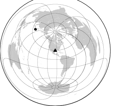
Nearby stations (2 deg radius)

| Station | Name | (Lat, Lon) | Start / End | Elevation |
| 738A | Farr-Stevens Ranch, Sargent, TX, USA | (28.84, -95.65) | 2010-02-16 / 2599-12-31 | 13 m |
| Crust2 Type: | SC,continental slope, margin, transition 11.5 km seds. |
| Thickness Estimate: | 52 km |
| Thickness StdDev: | 6.4 km |
| Vp/Vs Estimate: | 1.60 |
| Vp/Vs StdDev: | 0.00 |
| Vs Estimate: | 3.488 km/s |
| Poisson's Ratio: | 0.18 |
| Peak Value: | 0.08 |
| Assumed Vp: | 5.581 km/s |
| Ps Weight: | 0.33333334 |
| PpPs Weight: | 0.33333334 |
| PsPs Weight: | 0.33333328 |
| Residual Complexity: | 0.771 |
| Nearby stations H: | +- |
| (2.0 deg) Vp/Vs: | +- |
0 with match > 90% ( 0.0 %) and 2 with match > 80% ( 14.285714 %) out of 14.
Download stack as xyz text file.
Azimuth Distribution of Events:
Prior Results for this Station
| Study | Thickness | Vp/Vs | Vp | Vs | Poissons Ratio | Extra |
| EARS | 52 km | 1.60 | 5.581 km/s | 3.488 km/s | 0.18 | |
| Crust2.0 | 27 km | 1.82 | 5.581 km/s | 3.07 km/s | 0.28 | SC,continental slope, margin, transition 11.5 km seds. |
| Global Maxima | 52 km | 1.60 | 5.581 km/s | 3.488 km/s | 0.18 | amp=0.07555314 |
| Local Maxima 1 | 68 km | 1.61 | 5.581 km/s | 3.461 km/s | 0.19 | amp=0.06877033 |
| Local Maxima 2 | 32 km | 1.97 | 5.581 km/s | 2.833 km/s | 0.33 | amp=0.05097332 |
| Local Maxima 3 | 53 km | 1.60 | 5.581 km/s | 3.488 km/s | 0.18 | amp=0.0398293 |
| Local Maxima 4 | 35 km | 1.83 | 5.581 km/s | 3.05 km/s | 0.29 | amp=0.030466888 |
| Predicted Arrivals for vertical incidence (zero ray parameter) | |
| Ps | 5.54 SECOND |
| PpPs | 23.99 SECOND |
| PsPs/PpSs | 29.53 SECOND |
Events Processed for this Station
Download zip of receiver functions as SAC
Plot maxima for each earthquake.
Events Used in the Stack
(2 events)| Radial Match | Distance | Baz | FERegion | Time | Lat/Lon | Depth | Magnitude |
| 82.54968 | 95.5 deg | 316.851 deg | Near East Coast Of Honshu, Japan | 2011/03/11 07:42:55 GMT | (36.4, 141.9) | 35 km | 5.7 MB |
| 82.34782 | 94.2 deg | 317.203 deg | Off East Coast Of Honshu, Japan | 2011/03/11 06:55:33 GMT | (37.6, 142.9) | 40 km | 5.9 MB |
Losers
(12 events)| Radial Match | Distance | Baz | FERegion | Time | Lat/Lon | Depth | Magnitude | Reason |
| 87.266754 | 93.1 deg | 318.467 deg | Near East Coast Of Honshu, Japan | 2011/03/11 07:38:27 GMT | (39.2, 142.8) | 38 km | 5.8 MB | |
| 82.91921 | 68.3 deg | 160.596 deg | Near Coast Of Central Chile | 2011/02/11 20:05:30 GMT | (-36.5, -73.1) | 28 km | 6.0 MB, 6.8 MW, 6.8 MW | |
| 78.44953 | 58.2 deg | 316.687 deg | Fox Islands, Aleutian Islands | 2010/07/18 05:56:44 GMT | (52.9, -169.8) | 14 km | 6.3 MB, 6.7 MS, 6.6 MW, 6.6 MW | |
| 75.17481 | 38.0 deg | 149.769 deg | Northern Peru | 2010/05/19 04:15:44 GMT | (-5.1, -77.5) | 140 km | 6.0 MB, 6.0 MW, 6.0 MW | |
| 67.94619 | 49.4 deg | 147.594 deg | Central Peru | 2010/09/13 07:15:49 GMT | (-14.6, -70.8) | 180 km | 5.6 MB, 5.9 MW, 5.8 MW | |
| 67.03412 | 57.2 deg | 149.452 deg | Northern Chile | 2010/07/12 00:11:21 GMT | (-22.1, -68.2) | 115 km | 6.1 MB, 6.3 MW, 6.2 MW | |
| 65.518974 | 66.7 deg | 158.703 deg | Near Coast Of Central Chile | 2010/03/11 14:39:43 GMT | (-34.3, -71.9) | 11 km | 6.7 MB, 7.0 MS, 6.9 MW, 6.9 MW | |
| 60.100304 | 69.2 deg | 161.094 deg | Near Coast Of Central Chile | 2010/08/05 06:01:47 GMT | (-37.4, -73.3) | 18 km | 5.5 MS, 5.4 MB, 5.9 MW, 5.8 MW | |
| 51.54696 | 92.8 deg | 323.734 deg | Eastern Sea Of Japan | 2010/03/30 01:02:53 GMT | (43.3, 138.4) | 21 km | 6.1 MB, 5.3 MS, 5.7 MW, 5.6 MW | |
| 48.610603 | 91.6 deg | 247.118 deg | Tonga Islands | 2011/02/12 17:57:56 GMT | (-20.9, -175.7) | 90 km | 6.0 MB, 6.1 MW, 6.1 MW | |
| 46.27772 | 62.7 deg | 21.695 deg | Jan Mayen Island Region | 2011/01/29 06:55:26 GMT | (70.9, -6.7) | 6.0 km | 6.1 MB, 6.1 MS, 6.2 MW, 6.2 MW | |
| 43.992176 | 89.0 deg | 199.732 deg | Pacific-Antarctic Ridge | 2010/11/21 04:36:31 GMT | (-55.0, -131.5) | 10 km | 5.7 MB, 5.8 MS, 6.0 MW, 5.9 MW |
