
Station TW WFSB - WU-FENG-SHAN
Network: TW - Broadband Array in Taiwan for Seismology
Nearby stations (2 deg radius)

| Station | Name | (Lat, Lon) | Start / End | Elevation |
| WFSB | WU-FENG-SHAN | (25.07, 121.78) | 1997-10-24 / 2499-01-01 | 100 m |
| Crust2 Type: | K1,forearc, New Zealand, 2 km seds. |
| Thickness Estimate: | 25 km |
| Thickness StdDev: | 0.6 km |
| Vp/Vs Estimate: | 1.81 |
| Vp/Vs StdDev: | 0.03 |
| Vs Estimate: | 3.484 km/s |
| Poisson's Ratio: | 0.28 |
| Peak Value: | 0.04 |
| Assumed Vp: | 6.289 km/s |
| Ps Weight: | 0.33333334 |
| PpPs Weight: | 0.33333334 |
| PsPs Weight: | 0.33333328 |
| Residual Complexity: | 0.649 |
| Nearby stations H: | +- |
| (2.0 deg) Vp/Vs: | +- |
6 with match > 90% ( 25.0 %) and 21 with match > 80% ( 87.5 %) out of 24.
Download stack as xyz text file.
Azimuth Distribution of Events:

Prior Results for this Station
| Study | Thickness | Vp/Vs | Vp | Vs | Poissons Ratio | Extra |
| EARS | 25 km | 1.81 | 6.289 km/s | 3.484 km/s | 0.28 | |
| Crust2.0 | 35 km | 1.76 | 6.289 km/s | 3.569 km/s | 0.26 | K1,forearc, New Zealand, 2 km seds. |
| Global Maxima | 25 km | 1.81 | 6.289 km/s | 3.484 km/s | 0.28 | amp=0.037487745 |
| Local Maxima 1 | 26 km | 1.89 | 6.289 km/s | 3.323 km/s | 0.31 | amp=0.0193714 |
| Local Maxima 2 | 56 km | 2.08 | 6.289 km/s | 3.02 km/s | 0.35 | amp=0.014176398 |
| Local Maxima 3 | 30 km | 1.72 | 6.289 km/s | 3.667 km/s | 0.24 | amp=0.011313867 |
| Local Maxima 4 | 56 km | 2.01 | 6.289 km/s | 3.125 km/s | 0.34 | amp=0.0084069725 |
| Predicted Arrivals for vertical incidence (zero ray parameter) | |
| Ps | 3.20 SECOND |
| PpPs | 11.15 SECOND |
| PsPs/PpSs | 14.35 SECOND |
Events Processed for this Station
Download zip of receiver functions as SAC
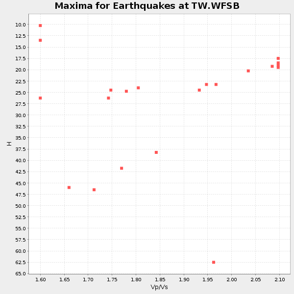
Plot maxima for each earthquake.
Events Used in the Stack
(21 events)| Radial Match | Distance | Baz | FERegion | Time | Lat/Lon | Depth | Magnitude |
| 95.024124 | 78.9 deg | 130.109 deg | Kermadec Islands, New Zealand | 2001/06/03 02:41:57 GMT | (-29.7, -178.6) | 178 km | 6.8 MB, 7.2 MW, 7.1 MW |
| 94.45317 | 45.3 deg | 214.24 deg | South Indian Ocean | 2000/06/18 14:44:13 GMT | (-13.8, 97.5) | 10 km | 6.8 MB, 7.8 MS, 7.8 MW, 7.6 MW |
| 94.424934 | 46.8 deg | 279.291 deg | Southern India | 2001/01/26 03:16:40 GMT | (23.4, 70.2) | 16 km | 6.9 MB, 8.0 MS, 7.7 MW, 7.7 ME |
| 92.9323 | 35.3 deg | 215.575 deg | Southern Sumatra, Indonesia | 2000/06/04 16:28:26 GMT | (-4.7, 102.1) | 33 km | 6.8 MB, 8.0 MS, 7.9 MW, 7.7 MW |
| 92.53494 | 42.8 deg | 130.406 deg | New Ireland Region, P.N.G. | 2000/11/16 07:42:16 GMT | (-5.2, 153.1) | 30 km | 6.2 MB, 7.8 MS, 7.6 MW, 7.3 ME |
| 92.50978 | 61.7 deg | 128.751 deg | Vanuatu Islands | 2002/01/02 17:22:48 GMT | (-17.6, 167.9) | 21 km | 6.3 MB, 7.5 MS, 7.3 MW, 7.1 MW |
| 88.926506 | 32.9 deg | 191.205 deg | Bali Sea | 2002/10/03 19:05:10 GMT | (-7.5, 115.7) | 316 km | 6.0 MB, 6.0 MW, 6.0 MW |
| 87.050575 | 34.5 deg | 141.602 deg | Near N Coast Of New Guinea, P.N.G. | 2002/01/10 11:14:56 GMT | (-3.2, 142.4) | 11 km | 6.0 MB, 6.6 MS, 6.7 MW, 6.6 MW |
| 86.89076 | 45.1 deg | 297.318 deg | Hindu Kush Region, Afghanistan | 2002/03/03 12:08:19 GMT | (36.5, 70.5) | 226 km | 6.6 MB, 7.4 MW, 7.3 MW |
| 86.531166 | 43.5 deg | 32.874 deg | Near East Coast Of Kamchatka | 2001/08/02 23:41:06 GMT | (56.3, 163.8) | 14 km | 5.9 MB, 6.2 MS, 6.3 MW, 6.2 ME |
| 86.48197 | 38.3 deg | 143.036 deg | New Guinea, Papua New Guinea | 2000/03/03 22:22:40 GMT | (-6.8, 143.8) | 10 km | 6.3 MB, 6.7 MS, 6.6 MW, 6.5 MW |
| 86.40272 | 59.6 deg | 127.601 deg | Vanuatu Islands | 2000/10/04 16:58:44 GMT | (-15.4, 166.9) | 23 km | 6.1 MB, 6.9 MS, 6.8 MW, 6.5 ME |
| 85.32102 | 35.0 deg | 214.912 deg | Southern Sumatra, Indonesia | 2001/02/13 19:28:30 GMT | (-4.7, 102.6) | 36 km | 6.2 MB, 7.2 MS, 7.4 MW, 7.0 ME |
| 85.31119 | 34.8 deg | 216.784 deg | Southern Sumatra, Indonesia | 2001/01/16 13:25:01 GMT | (-4.0, 101.7) | 33 km | 6.0 MB |
| 82.99131 | 33.2 deg | 229.709 deg | Northern Sumatra, Indonesia | 2005/07/05 01:52:02 GMT | (1.8, 97.1) | 21 km | 6.2 MB, 6.8 MS, 6.7 MW, 6.6 MW |
| 82.86898 | 73.5 deg | 119.505 deg | Fiji Islands Region | 2001/04/28 04:49:53 GMT | (-18.1, -176.9) | 352 km | 6.2 MB, 6.8 MW, 6.8 MW |
| 82.85201 | 57.2 deg | 302.197 deg | Turkmenistan | 2000/12/06 17:11:06 GMT | (39.6, 54.8) | 30 km | 6.7 MB, 7.5 MS, 7.0 MW, 6.9 ME |
| 82.62375 | 33.7 deg | 227.058 deg | Northern Sumatra, Indonesia | 2001/05/18 02:05:33 GMT | (0.4, 97.8) | 33 km | 5.4 MB, 5.8 MS, 5.9 MW, 5.9 MW |
| 82.081 | 37.0 deg | 136.432 deg | Bismarck Sea | 2001/08/23 21:45:03 GMT | (-3.4, 146.3) | 10 km | 5.8 MB, 6.2 MS, 6.2 MW, 6.0 MW |
| 81.41628 | 31.7 deg | 159.705 deg | Aru Islands Region, Indonesia | 2001/07/22 18:15:09 GMT | (-5.1, 132.3) | 33 km | 5.7 MB, 5.4 MS, 6.0 MW, 6.0 MW |
| 80.25254 | 72.7 deg | 116.349 deg | Tonga Islands | 2002/06/21 14:21:44 GMT | (-15.1, -175.9) | 319 km | 5.7 MB, 5.7 MW, 5.7 MW |
Losers
(3 events)| Radial Match | Distance | Baz | FERegion | Time | Lat/Lon | Depth | Magnitude | Reason |
| 69.61005 | 75.9 deg | 122.241 deg | Fiji Islands Region | 1998/12/27 00:38:26 GMT | (-21.6, -176.4) | 144 km | 6.1 MB, 6.9 UNKNOWN, 6.6 ME | |
| 66.80099 | 58.3 deg | 126.083 deg | Vanuatu Islands | 1998/09/21 12:09:39 GMT | (-13.6, 166.8) | 33 km | 6.0 MB, 6.3 MS, 6.4 UNKNOWN, 6.3 MW | |
| 52.40222 | 73.5 deg | 123.261 deg | Fiji Islands Region | 1998/10/11 12:04:54 GMT | (-21.0, -179.1) | 624 km | 5.9 UNKNOWN, 5.4 MB, 5.9 MW |
