
Station US DWPF - Disney Wilderness Preserve, Florida, USA
Network: US - United States National Seismic Network
Nearby stations (2 deg radius)
| Station | Name | (Lat, Lon) | Start / End | Elevation |
| DWPF | Disney Wilderness Preserve, Florida, USA | (28.11, -81.43) | 1999-03-01 / 2499-01-01 | -142.0 m |
| Crust2 Type: | C3,continental shelf, 2 km seds. |
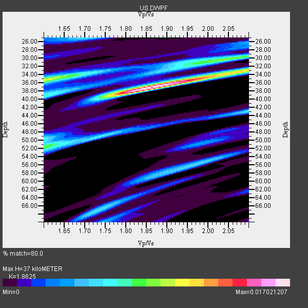
| Thickness Estimate: | 37 km |
| Thickness StdDev: | 7.2 km |
| Vp/Vs Estimate: | 1.86 |
| Vp/Vs StdDev: | 0.14 |
| Vs Estimate: | 3.293 km/s |
| Poisson's Ratio: | 0.30 |
| Peak Value: | 0.02 |
| Assumed Vp: | 6.134 km/s |
| Ps Weight: | 0.33333334 |
| PpPs Weight: | 0.33333334 |
| PsPs Weight: | 0.33333328 |
| Residual Complexity: | 0.679 |
| Nearby stations H: | +- |
| (2.0 deg) Vp/Vs: | +- |
3 with match > 90% ( 60.0 %) and 5 with match > 80% ( 100.0 %) out of 5.
Download stack as xyz text file.
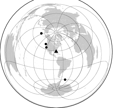
Azimuth Distribution of Events:
Prior Results for this Station
| Study | Thickness | Vp/Vs | Vp | Vs | Poissons Ratio | Extra |
| EARS | 37 km | 1.86 | 6.134 km/s | 3.293 km/s | 0.30 | |
| Crust2.0 | 31 km | 1.80 | 6.134 km/s | 3.406 km/s | 0.28 | C3,continental shelf, 2 km seds. |
| Global Maxima | 37 km | 1.86 | 6.134 km/s | 3.293 km/s | 0.30 | amp=0.017021207 |
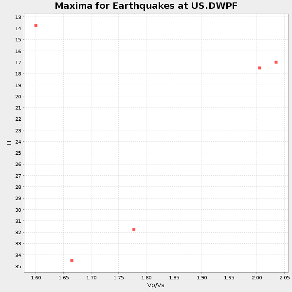
| Local Maxima 1 | 35 km | 1.61 | 6.134 km/s | 3.816 km/s | 0.18 | amp=0.011190192 |
| Local Maxima 2 | 33 km | 2.10 | 6.134 km/s | 2.924 km/s | 0.35 | amp=0.010412389 |
| Local Maxima 3 | 52 km | 1.60 | 6.134 km/s | 3.834 km/s | 0.18 | amp=0.008293788 |
| Local Maxima 4 | 67 km | 1.73 | 6.134 km/s | 3.546 km/s | 0.25 | amp=0.005709709 |
| Predicted Arrivals for vertical incidence (zero ray parameter) | |
| Ps | 5.20 SECOND |
| PpPs | 17.27 SECOND |
| PsPs/PpSs | 22.47 SECOND |
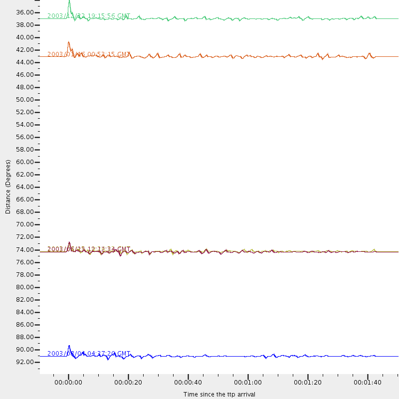
Events Processed for this Station
Download zip of receiver functions as SAC
Plot maxima for each earthquake.
Events Used in the Stack
(5 events)| Radial Match | Distance | Baz | FERegion | Time | Lat/Lon | Depth | Magnitude |
| 96.44492 | 93.6 deg | 162.232 deg | Scotia Sea | 2003/08/04 04:37:20 GMT | (-60.5, -43.4) | 10 km | 6.2 MB, 7.5 MS, 7.5 MW, 7.1 MW |
| 92.97702 | 75.4 deg | 320.709 deg | Rat Islands, Aleutian Islands | 2003/06/23 12:12:34 GMT | (51.4, 176.8) | 20 km | 6.3 MB, 7.0 MS, 6.9 MW, 6.8 MW |
| 92.703445 | 34.3 deg | 292.916 deg | Central California | 2003/12/22 19:15:56 GMT | (35.7, -121.1) | 7.6 km | 6.1 MB, 6.4 MS, 6.5 MW, 6.4 MW |
| 83.010376 | 75.2 deg | 320.773 deg | Rat Islands, Aleutian Islands | 2003/06/15 19:24:33 GMT | (51.6, 176.9) | 20 km | 6.0 MB, 6.4 MS, 6.5 MW, 6.5 MW |
| 80.20135 | 41.1 deg | 306.164 deg | Off Coast Of Oregon | 2003/01/16 00:53:15 GMT | (44.3, -129.0) | 10 km | 5.4 MB, 6.0 MS, 6.2 MW, 6.2 MW |
Losers
(0 events)| Radial Match | Distance | Baz | FERegion | Time | Lat/Lon | Depth | Magnitude | Reason |
