
Station UU HLJ - Hailstone Junction, Jordanelle, UT, USA
Network: UU - University of Utah Regional Network
Nearby stations (2 deg radius)

| Station | Name | (Lat, Lon) | Start / End | Elevation |
| HLJ | Hailstone Junction, Jordanelle, UT, USA | (40.61, -111.40) | 1992-10-22 / 2499-01-01 | 1945 m |
| Crust2 Type: | M2,extended crust, 2 km seds. |
| Thickness Estimate: | 33 km |
| Thickness StdDev: | 9.4 km |
| Vp/Vs Estimate: | 1.92 |
| Vp/Vs StdDev: | 0.16 |
| Vs Estimate: | 3.206 km/s |
| Poisson's Ratio: | 0.31 |
| Peak Value: | 0.02 |
| Assumed Vp: | 6.155 km/s |
| Ps Weight: | 0.33333334 |
| PpPs Weight: | 0.33333334 |
| PsPs Weight: | 0.33333328 |
| Residual Complexity: | 0.761 |
| Nearby stations H: | +- |
| (2.0 deg) Vp/Vs: | +- |
2 with match > 90% ( 5.263158 %) and 7 with match > 80% ( 18.421053 %) out of 38.
Download stack as xyz text file.
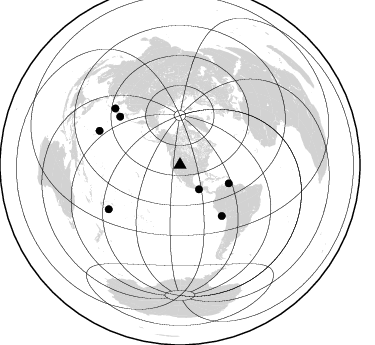
Azimuth Distribution of Events:
Prior Results for this Station
| Study | Thickness | Vp/Vs | Vp | Vs | Poissons Ratio | Extra |
| EARS | 33 km | 1.92 | 6.155 km/s | 3.206 km/s | 0.31 | |
| Crust2.0 | 31 km | 1.78 | 6.155 km/s | 3.458 km/s | 0.27 | M2,extended crust, 2 km seds. |
| Global Maxima | 33 km | 1.92 | 6.155 km/s | 3.206 km/s | 0.31 | amp=0.016228283 |
| Local Maxima 1 | 40 km | 1.65 | 6.155 km/s | 3.73 km/s | 0.21 | amp=0.016127685 |
| Local Maxima 2 | 26 km | 1.93 | 6.155 km/s | 3.193 km/s | 0.32 | amp=0.012081782 |
| Local Maxima 3 | 50 km | 1.89 | 6.155 km/s | 3.248 km/s | 0.31 | amp=0.009525097 |
| Local Maxima 4 | 36 km | 1.61 | 6.155 km/s | 3.823 km/s | 0.19 | amp=0.0075990763 |
| Predicted Arrivals for vertical incidence (zero ray parameter) | |
| Ps | 4.97 SECOND |
| PpPs | 15.77 SECOND |
| PsPs/PpSs | 20.74 SECOND |
Events Processed for this Station
Download zip of receiver functions as SAC
Plot maxima for each earthquake.
Events Used in the Stack
(7 events)| Radial Match | Distance | Baz | FERegion | Time | Lat/Lon | Depth | Magnitude |
| 94.10925 | 65.8 deg | 140.613 deg | Near Coast Of Peru | 2024/06/28 05:36:37 UTC | (-15.8, -74.4) | 28 km | 7.2 mww |
| 92.8363 | 83.8 deg | 238.16 deg | Tonga Islands | 2024/05/26 20:47:09 UTC | (-19.4, -174.9) | 112 km | 6.6 mww |
| 87.36493 | 30.9 deg | 142.035 deg | Near Coast Of Chiapas, Mexico | 2024/05/12 11:39:14 UTC | (14.5, -92.4) | 75 km | 6.4 mww |
| 87.1396 | 85.9 deg | 311.023 deg | Shikoku, Japan | 2024/04/17 14:14:45 UTC | (33.2, 132.4) | 26 km | 6.3 mww |
| 86.41689 | 87.3 deg | 292.844 deg | Mariana Islands | 2024/04/05 11:03:16 UTC | (19.1, 145.4) | 222 km | 6.8 mww |
| 83.52236 | 77.2 deg | 308.826 deg | Near East Coast Of Honshu, Japan | 2024/04/04 03:16:31 UTC | (37.7, 141.9) | 40 km | 6.1 Mww |
| 83.30868 | 52.2 deg | 110.669 deg | Near Coast Of Venezuela | 2024/06/23 03:58:00 UTC | (10.8, -62.6) | 87 km | 6.0 mww |
Losers
(31 events)| Radial Match | Distance | Baz | FERegion | Time | Lat/Lon | Depth | Magnitude | Reason |
| 78.301125 | 65.8 deg | 140.759 deg | Near Coast Of Peru | 2024/06/16 14:47:31 UTC | (-15.9, -74.5) | 20 km | 6.0 mww | |
| 76.44886 | 41.5 deg | 306.786 deg | Fox Islands, Aleutian Islands | 2024/05/19 09:35:24 UTC | (52.2, -170.9) | 28 km | 6.0 mww | |
| 76.08831 | 87.0 deg | 239.734 deg | Fiji Islands Region | 2024/03/02 00:26:40 UTC | (-20.6, -178.4) | 537 km | 5.8 mww | |
| 75.43478 | 80.1 deg | 311.208 deg | Near West Coast Of Honshu, Japan | 2024/06/02 21:31:38 UTC | (37.5, 137.2) | 4.8 km | 5.8 mww | |
| 75.00506 | 75.7 deg | 310.805 deg | Near East Coast Of Honshu, Japan | 2024/04/01 19:24:36 UTC | (40.1, 141.7) | 73 km | 5.9 mww | |
| 74.77464 | 92.8 deg | 252.531 deg | Vanuatu Islands | 2024/05/08 08:17:15 UTC | (-15.1, 168.0) | 12 km | 6.1 mww | |
| 74.73142 | 81.1 deg | 239.383 deg | Tonga Islands | 2024/06/18 06:40:36 UTC | (-16.5, -173.8) | 35 km | 5.9 mww | |
| 73.68976 | 85.3 deg | 302.856 deg | Bonin Islands, Japan Region | 2024/04/27 08:35:34 UTC | (27.8, 139.6) | 503 km | 6.5 mww | |
| 70.79262 | 89.0 deg | 308.92 deg | Southeast Of Ryukyu Islands | 2024/04/15 22:38:57 UTC | (29.5, 131.7) | 8.0 km | 5.9 mww | |
| 70.76472 | 75.4 deg | 179.479 deg | Southern East Pacific Rise | 2024/02/23 01:51:12 UTC | (-35.1, -110.8) | 2.0 km | 6.3 Mww | |
| 68.33214 | 55.9 deg | 78.263 deg | Northern Mid-Atlantic Ridge | 2024/06/03 06:41:51 UTC | (29.6, -42.8) | 10 km | 5.9 mww | |
| 68.03308 | 35.0 deg | 136.781 deg | Near Coast Of Nicaragua | 2024/03/17 00:44:03 UTC | (12.4, -87.7) | 53 km | 5.6 mww | |
| 67.5476 | 90.7 deg | 309.252 deg | Ryukyu Islands, Japan | 2024/03/15 10:32:48 UTC | (28.4, 130.1) | 10 km | 5.6 mb | |
| 66.945885 | 85.2 deg | 241.583 deg | Fiji Islands Region | 2024/06/04 10:00:02 UTC | (-18.0, -178.4) | 586 km | 5.6 Mww | |
| 64.259514 | 55.9 deg | 77.975 deg | Northern Mid-Atlantic Ridge | 2024/03/14 21:10:25 UTC | (29.8, -42.7) | 10 km | 6.0 mww | |
| 61.458298 | 66.2 deg | 316.338 deg | Sea Of Okhotsk | 2024/06/06 11:07:53 UTC | (50.1, 147.6) | 622 km | 5.9 mww | |
| 61.451084 | 91.2 deg | 35.859 deg | Southern Greece | 2024/03/29 07:12:47 UTC | (37.3, 21.3) | 25 km | 5.8 Mww | |
| 56.06029 | 91.3 deg | 255.276 deg | Santa Cruz Islands | 2024/05/21 09:50:43 UTC | (-12.1, 167.3) | 248 km | 5.4 Mww | |
| 55.848564 | 37.3 deg | 134.58 deg | Nicaragua | 2024/04/17 21:21:54 UTC | (11.1, -85.3) | 154 km | 5.5 mww | |
| 53.334988 | 93.2 deg | 233.824 deg | Kermadec Islands, New Zealand | 2024/05/17 20:58:27 UTC | (-29.1, -178.5) | 196 km | 5.8 Mww | |
| 51.308743 | 88.5 deg | 289.466 deg | Mariana Islands | 2024/04/02 09:54:09 UTC | (15.8, 146.9) | 10 km | 6.2 mww | |
| 51.193638 | 47.3 deg | 308.161 deg | Rat Islands, Aleutian Islands | 2024/02/28 15:50:21 UTC | (51.9, 179.6) | 119 km | 5.5 mww | |
| 51.073013 | 94.1 deg | 251.126 deg | Vanuatu Islands | 2024/05/25 22:23:16 UTC | (-17.1, 167.9) | 29 km | 6.3 mww | |
| 50.48938 | 54.5 deg | 135.714 deg | Northern Peru | 2024/06/18 02:22:09 UTC | (-3.9, -76.7) | 100 km | 5.5 Mww | |
| 46.72143 | 43.1 deg | 106.237 deg | Mona Passage | 2024/05/15 00:30:11 UTC | (19.3, -67.4) | 7.0 km | 4.8 Mww | |
| 46.058872 | 83.5 deg | 307.301 deg | Southeast Of Honshu, Japan | 2024/05/29 17:14:58 UTC | (32.3, 137.6) | 392 km | 5.5 Mww | |
| 42.550068 | 96.9 deg | 268.79 deg | Solomon Islands | 2024/06/09 16:28:38 UTC | (-5.4, 154.1) | 125 km | 5.7 Mww | |
| 37.311867 | 70.7 deg | 137.622 deg | Northern Chile | 2024/03/13 09:30:05 UTC | (-18.6, -69.3) | 110 km | 5.3 Mww | |
| 24.935942 | 94.8 deg | 232.127 deg | Kermadec Islands Region | 2024/05/12 18:43:20 UTC | (-31.5, -178.5) | 23 km | 5.8 Mww | |
| 23.587496 | 96.6 deg | 231.255 deg | South Of Kermadec Islands | 2024/06/27 16:37:51 UTC | (-33.4, -179.2) | 32 km | 5.9 Mww | |
| 22.16334 | 82.2 deg | 236.958 deg | Tonga Islands Region | 2024/06/17 14:05:11 UTC | (-19.0, -172.8) | 10 km | 5.6 Mww |

