
Station XA SA04 - XA.SA04
Network: XA97 - Anatomy of an Archean Craton, South Africa
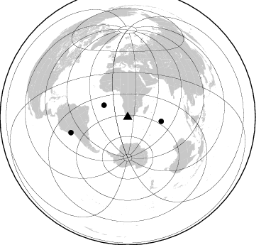
Nearby stations (2 deg radius)
| Station | Name | (Lat, Lon) | Start / End | Elevation |
| SA04 | XA.SA04 | (-32.85, 19.62) | 1998-04-11 / 1999-12-31 | 1200 m |
| Crust2 Type: | I1,late Proter., no seds. |
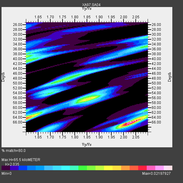
| Thickness Estimate: | 66 km |
| Thickness StdDev: | 11 km |
| Vp/Vs Estimate: | 2.04 |
| Vp/Vs StdDev: | 0.19 |
| Vs Estimate: | 3.264 km/s |
| Poisson's Ratio: | 0.34 |
| Peak Value: | 0.02 |
| Assumed Vp: | 6.642 km/s |
| Ps Weight: | 0.33333334 |
| PpPs Weight: | 0.33333334 |
| PsPs Weight: | 0.33333328 |
| Residual Complexity: | 0.872 |
| Nearby stations H: | +- |
| (2.0 deg) Vp/Vs: | +- |
0 with match > 90% ( 0.0 %) and 3 with match > 80% ( 37.5 %) out of 8.
Download stack as xyz text file.
Azimuth Distribution of Events:
Prior Results for this Station
| Study | Thickness | Vp/Vs | Vp | Vs | Poissons Ratio | Extra |
| EARS | 66 km | 2.04 | 6.642 km/s | 3.264 km/s | 0.34 | |
| Crust2.0 | 43 km | 1.77 | 6.642 km/s | 3.756 km/s | 0.26 | I1,late Proter., no seds. |
| Global Maxima | 66 km | 2.04 | 6.642 km/s | 3.264 km/s | 0.34 | amp=0.02197927 |
| Local Maxima 1 | 64 km | 1.60 | 6.642 km/s | 4.151 km/s | 0.18 | amp=0.017317286 |
| Local Maxima 2 | 56 km | 1.86 | 6.642 km/s | 3.571 km/s | 0.30 | amp=0.014803333 |
| Local Maxima 3 | 39 km | 1.60 | 6.642 km/s | 4.151 km/s | 0.18 | amp=0.012913771 |
| Local Maxima 4 | 49 km | 1.74 | 6.642 km/s | 3.812 km/s | 0.25 | amp=0.011330969 |
| Predicted Arrivals for vertical incidence (zero ray parameter) | |
| Ps | 10.21 SECOND |
| PpPs | 29.93 SECOND |
| PsPs/PpSs | 40.14 SECOND |
Events Processed for this Station
Download zip of receiver functions as SAC
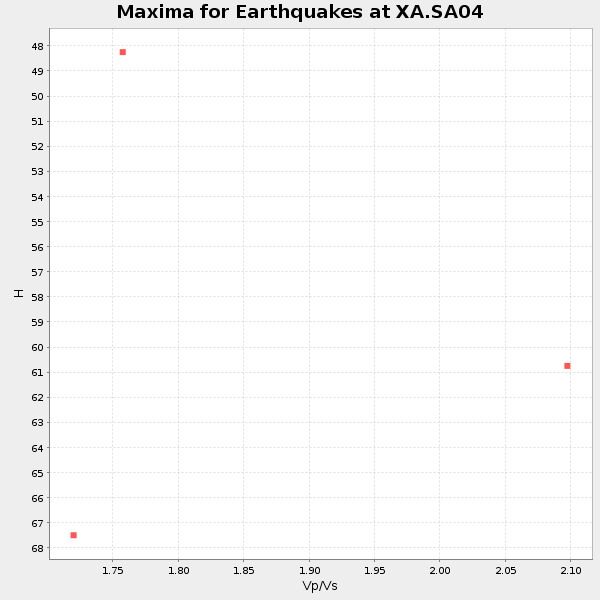
Plot maxima for each earthquake.
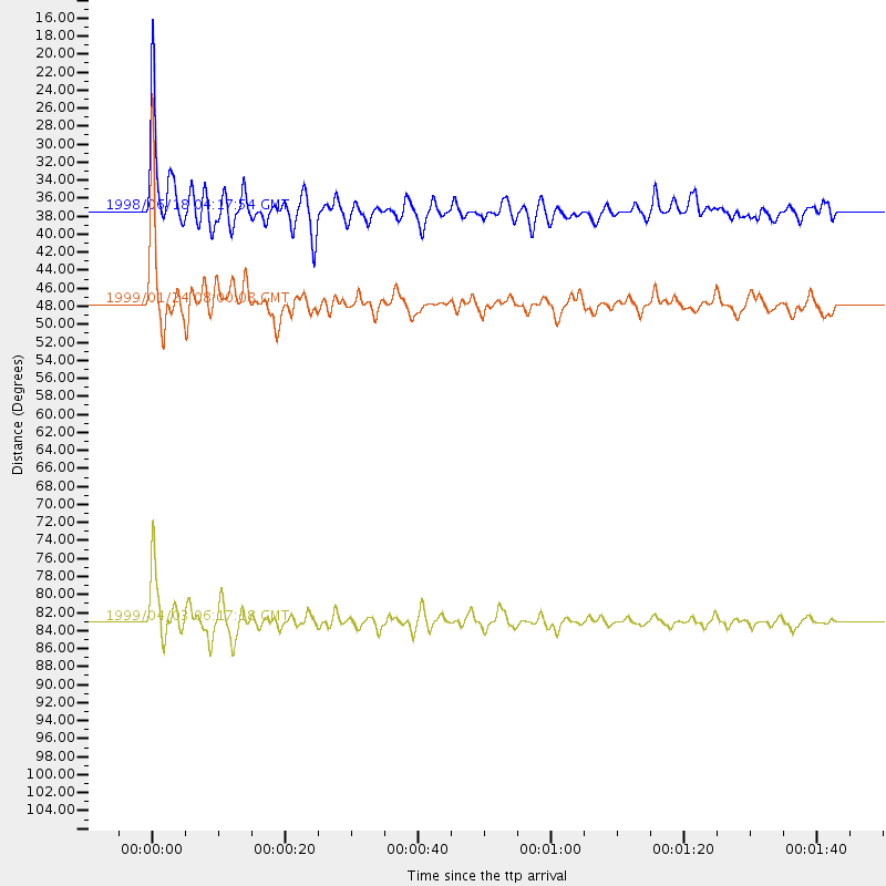
Events Used in the Stack
(3 events)| Radial Match | Distance | Baz | FERegion | Time | Lat/Lon | Depth | Magnitude |
| 88.24006 | 47.7 deg | 97.346 deg | Mid-Indian Ridge | 1999/01/24 08:00:08 GMT | (-26.5, 74.5) | 10 km | 6.0 MB, 6.3 MS, 6.3 MW, 6.3 ME |
| 85.021255 | 37.3 deg | 296.801 deg | Ascension Island Region | 1998/06/18 04:17:54 GMT | (-11.6, -13.9) | 10 km | 6.1 MS, 5.4 MB, 6.2 UNKNOWN |
| 84.6484 | 83.0 deg | 254.788 deg | Near Coast Of Peru | 1999/04/03 06:17:18 GMT | (-16.7, -72.7) | 87 km | 6.1 MB, 6.2 MS, 6.8 MW, 6.8 MW |
Losers
(5 events)| Radial Match | Distance | Baz | FERegion | Time | Lat/Lon | Depth | Magnitude | Reason |
| 67.952965 | 74.0 deg | 241.746 deg | Near Coast Of Central Chile | 1998/07/29 07:14:24 GMT | (-32.3, -71.3) | 51 km | 6.3 MB, 6.5 UNKNOWN, 6.5 ME | |
| 67.720764 | 77.5 deg | 295.4 deg | Northern Mid-Atlantic Ridge | 1998/10/01 03:41:13 GMT | (13.7, -45.6) | 10 km | 5.4 MB, 5.5 MS, 6.1 UNKNOWN, 5.9 MW | |
| 67.05355 | 70.5 deg | 34.727 deg | Southern Iran | 1999/03/04 05:47:49 GMT | (28.3, 57.1) | 33 km | 5.6 MB | |
| 61.958813 | 71.0 deg | 236.397 deg | S. Chile-Argentina Border Region | 1998/12/14 16:25:24 GMT | (-38.2, -71.0) | 138 km | 6.0 UNKNOWN, 4.8 MS, 5.4 MB | |
| 56.530476 | 30.5 deg | 251.132 deg | Southern Mid-Atlantic Ridge | 1998/06/24 10:44:30 GMT | (-37.3, -17.4) | 10 km | 5.7 MB, 5.8 MS, 6.0 UNKNOWN, 5.9 MW |
