
Station XA SA81 - XA.SA81
Network: XA97 - Anatomy of an Archean Craton, South Africa
Nearby stations (2 deg radius)
| Station | Name | (Lat, Lon) | Start / End | Elevation |
| SA81 | XA.SA81 | (-30.93, 21.27) | 1997-05-07 / 1999-12-31 | 1270 m |
| Crust2 Type: | I7,late Proter., 1 km seds. |
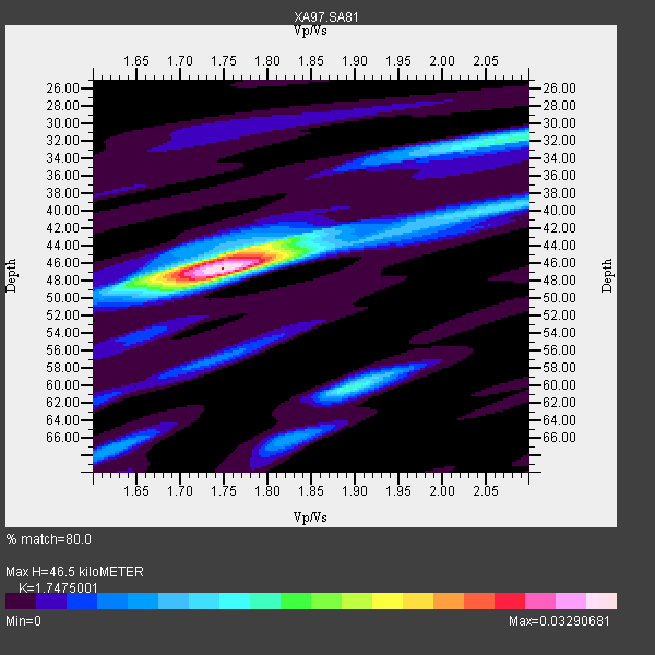
| Thickness Estimate: | 46 km |
| Thickness StdDev: | 5.3 km |
| Vp/Vs Estimate: | 1.75 |
| Vp/Vs StdDev: | 0.06 |
| Vs Estimate: | 3.784 km/s |
| Poisson's Ratio: | 0.26 |
| Peak Value: | 0.03 |
| Assumed Vp: | 6.612 km/s |
| Ps Weight: | 0.33333334 |
| PpPs Weight: | 0.33333334 |
| PsPs Weight: | 0.33333328 |
| Residual Complexity: | 0.516 |
| Nearby stations H: | +- |
| (2.0 deg) Vp/Vs: | +- |
1 with match > 90% ( 5.263158 %) and 4 with match > 80% ( 21.052631 %) out of 19.
Download stack as xyz text file.
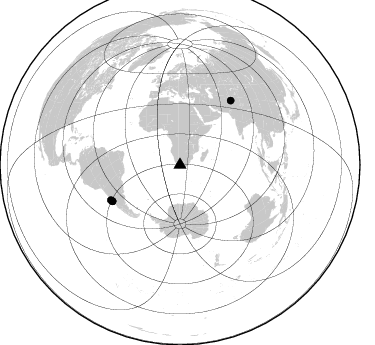
Azimuth Distribution of Events:
Prior Results for this Station
| Study | Thickness | Vp/Vs | Vp | Vs | Poissons Ratio | Extra |
| EARS | 46 km | 1.75 | 6.612 km/s | 3.784 km/s | 0.26 | |
| Crust2.0 | 42 km | 1.78 | 6.612 km/s | 3.71 km/s | 0.27 | I7,late Proter., 1 km seds. |
| Global Maxima | 46 km | 1.75 | 6.612 km/s | 3.784 km/s | 0.26 | amp=0.03290681 |
| Local Maxima 1 | 45 km | 1.76 | 6.612 km/s | 3.757 km/s | 0.26 | amp=0.01657094 |
| Local Maxima 2 | 60 km | 1.90 | 6.612 km/s | 3.485 km/s | 0.31 | amp=0.014439645 |
| Local Maxima 3 | 32 km | 2.07 | 6.612 km/s | 3.19 km/s | 0.35 | amp=0.0126899555 |
| Local Maxima 4 | 40 km | 2.06 | 6.612 km/s | 3.217 km/s | 0.34 | amp=0.009895609 |
| Predicted Arrivals for vertical incidence (zero ray parameter) | |
| Ps | 5.26 SECOND |
| PpPs | 19.32 SECOND |
| PsPs/PpSs | 24.58 SECOND |
Events Processed for this Station
Download zip of receiver functions as SAC
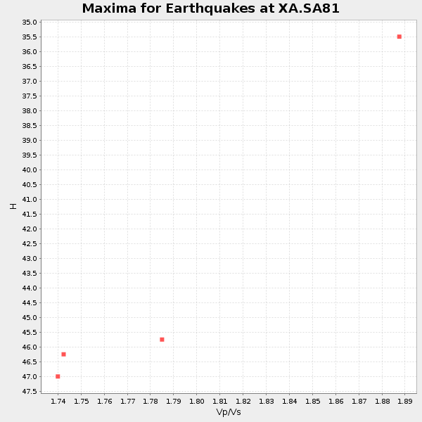
Plot maxima for each earthquake.
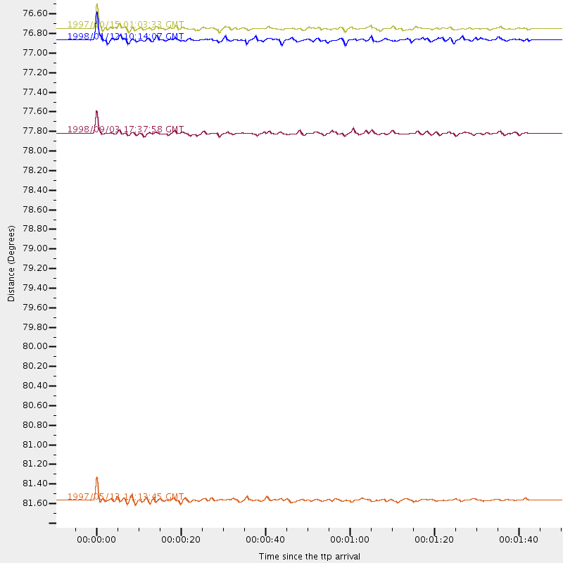
Events Used in the Stack
(4 events)| Radial Match | Distance | Baz | FERegion | Time | Lat/Lon | Depth | Magnitude |
| 96.89209 | 76.7 deg | 241.887 deg | Near Coast Of Central Chile | 1997/10/15 01:03:33 GMT | (-30.9, -71.2) | 58 km | 6.8 MB, 6.8 MS, 7.3 UNKNOWN, 7.1 MW |
| 85.61689 | 76.9 deg | 241.761 deg | Near Coast Of Central Chile | 1998/01/12 10:14:07 GMT | (-31.0, -71.4) | 35 km | 5.8 MB, 6.2 MS, 6.6 UNKNOWN, 6.2 ME |
| 84.009705 | 81.6 deg | 38.441 deg | Hindu Kush Region, Afghanistan | 1997/05/13 14:13:45 GMT | (36.4, 70.9) | 196 km | 6.1 MB, 6.5 UNKNOWN, 6.4 MW |
| 81.471596 | 77.8 deg | 243.012 deg | Near Coast Of Central Chile | 1998/09/03 17:37:58 GMT | (-29.5, -71.7) | 27 km | 6.2 MB, 6.6 MS, 6.5 UNKNOWN, 6.4 ME |
Losers
(15 events)| Radial Match | Distance | Baz | FERegion | Time | Lat/Lon | Depth | Magnitude | Reason |
| 79.63693 | 37.8 deg | 292.901 deg | Ascension Island Region | 1998/06/18 04:17:54 GMT | (-11.6, -13.9) | 10 km | 6.1 MS, 5.4 MB, 6.2 UNKNOWN | |
| 78.25959 | 32.5 deg | 248.123 deg | Southern Mid-Atlantic Ridge | 1998/06/24 10:44:30 GMT | (-37.3, -17.4) | 10 km | 5.7 MB, 5.8 MS, 6.0 UNKNOWN, 5.9 MW | |
| 77.65352 | 44.1 deg | 214.137 deg | South Sandwich Islands Region | 1997/10/05 18:04:30 GMT | (-59.7, -29.2) | 274 km | 6.0 MB, 6.3 UNKNOWN, 6.3 MW | |
| 72.8682 | 76.1 deg | 240.611 deg | Near Coast Of Central Chile | 1998/07/29 07:14:24 GMT | (-32.3, -71.3) | 51 km | 6.3 MB, 6.5 UNKNOWN, 6.5 ME | |
| 63.621048 | 77.9 deg | 243.176 deg | Near Coast Of Central Chile | 1997/07/19 12:22:57 GMT | (-29.3, -71.7) | 26 km | 5.8 MB, 5.5 MS, 5.9 UNKNOWN, 5.8 MW | |
| 63.317623 | 81.6 deg | 153.227 deg | West Of Macquarie Island | 1998/08/04 15:51:01 GMT | (-56.7, 147.4) | 10 km | 5.5 MS, 5.3 MB | |
| 63.2009 | 83.4 deg | 322.921 deg | Azores Islands, Portugal | 1998/07/09 05:19:07 GMT | (38.7, -28.6) | 10 km | 5.7 MB, 6.0 MS, 6.6 UNKNOWN, 6.2 MW | |
| 63.09713 | 83.1 deg | 258.183 deg | Peru-Bolivia Border Region | 1997/11/28 22:53:41 GMT | (-13.7, -68.8) | 586 km | 6.4 MB, 6.6 UNKNOWN, 6.6 MW | |
| 57.02702 | 92.6 deg | 156.48 deg | Auckland Islands, N.Z. Region | 1998/03/20 21:08:08 GMT | (-50.0, 163.1) | 10 km | 5.8 MB, 6.1 MS, 6.7 UNKNOWN, 6.4 MW | |
| 55.957085 | 77.5 deg | 242.139 deg | Near Coast Of Central Chile | 1997/07/21 23:19:39 GMT | (-30.3, -71.9) | 33 km | 5.2 MB, 5.5 MS, 6.1 UNKNOWN | |
| 54.25792 | 78.6 deg | 250.739 deg | Northern Chile | 1997/09/28 23:13:13 GMT | (-22.4, -68.4) | 107 km | 5.7 MB, 5.6 UNKNOWN, 5.6 MW | |
| 52.405476 | 31.5 deg | 251.597 deg | Southern Mid-Atlantic Ridge | 1998/01/03 06:10:08 GMT | (-35.5, -16.2) | 10 km | 5.9 MS, 5.4 MB, 6.3 UNKNOWN, 6.1 MW | |
| 52.286736 | 77.2 deg | 246.017 deg | Northern Chile | 1997/05/17 02:10:18 GMT | (-27.2, -69.5) | 106 km | 5.5 MB, 5.6 UNKNOWN, 5.5 MW | |
| 51.714935 | 95.3 deg | 97.576 deg | Sulawesi, Indonesia | 1997/09/28 01:38:28 GMT | (-3.8, 119.7) | 33 km | 5.6 MB, 5.5 MS, 5.9 UNKNOWN, 5.9 MW | |
| 45.592945 | 86.7 deg | 94.628 deg | Java Sea | 1997/07/11 09:55:12 GMT | (-5.7, 110.8) | 574 km | 5.6 MB |
