
Station XB C0302 - 991012
Network: XB14 - Sweetwater Array
Nearby stations (2 deg radius)

| Station | Name | (Lat, Lon) | Start / End | Elevation |
| C0302 | 991012 | (32.71, -100.52) | 2014-03-07 / 2014-05-01 | 607 m |
| Crust2 Type: | D8,thick Platform 3 km seds. |
| Thickness Estimate: | 42 km |
| Thickness StdDev: | 0.2 km |
| Vp/Vs Estimate: | 1.74 |
| Vp/Vs StdDev: | 0.01 |
| Vs Estimate: | 3.693 km/s |
| Poisson's Ratio: | 0.25 |
| Peak Value: | 0.06 |
| Assumed Vp: | 6.426 km/s |
| Ps Weight: | 0.33333334 |
| PpPs Weight: | 0.33333334 |
| PsPs Weight: | 0.33333328 |
| Residual Complexity: | 0.321 |
| Nearby stations H: | +- |
| (2.0 deg) Vp/Vs: | +- |
1 with match > 90% ( 6.25 %) and 3 with match > 80% ( 18.75 %) out of 16.
Download stack as xyz text file.
Azimuth Distribution of Events:

Prior Results for this Station
| Study | Thickness | Vp/Vs | Vp | Vs | Poissons Ratio | Extra |
| EARS | 42 km | 1.74 | 6.426 km/s | 3.693 km/s | 0.25 | |
| Crust2.0 | 46 km | 1.78 | 6.426 km/s | 3.613 km/s | 0.27 | D8,thick Platform 3 km seds. |
| Global Maxima | 42 km | 1.74 | 6.426 km/s | 3.693 km/s | 0.25 | amp=0.06093783 |
| Local Maxima 1 | 44 km | 1.73 | 6.426 km/s | 3.72 km/s | 0.25 | amp=0.019286968 |
| Local Maxima 2 | 42 km | 1.73 | 6.426 km/s | 3.72 km/s | 0.25 | amp=0.013567017 |
| Local Maxima 3 | 53 km | 1.60 | 6.426 km/s | 4.016 km/s | 0.18 | amp=0.011327085 |
| Local Maxima 4 | 28 km | 2.10 | 6.426 km/s | 3.064 km/s | 0.35 | amp=0.00997758 |
| Predicted Arrivals for vertical incidence (zero ray parameter) | |
| Ps | 4.89 SECOND |
| PpPs | 18.12 SECOND |
| PsPs/PpSs | 23.02 SECOND |
Events Processed for this Station
Download zip of receiver functions as SAC
Plot maxima for each earthquake.
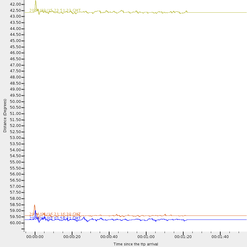
Events Used in the Stack
(3 events)| Radial Match | Distance | Baz | FERegion | Time | Lat/Lon | Depth | Magnitude |
| 93.504105 | 59.6 deg | 147.086 deg | Near Coast Of Northern Chile | 2014/03/16 21:16:30 GMT | (-19.9, -70.6) | 20 km | 6.7 MWW, 6.7 MWC, 7.0 MI |
| 89.17098 | 42.4 deg | 150.371 deg | Near Coast Of Northern Peru | 2014/03/15 23:51:33 GMT | (-5.6, -81.0) | 29 km | 6.3 MWW, 6.2 MWB, 6.3 MWC |
| 83.48828 | 60.0 deg | 147.21 deg | Near Coast Of Northern Chile | 2014/04/03 01:58:31 GMT | (-20.3, -70.6) | 23 km | 6.5 MWW, 6.5 MWB, 6.6 MWC |
Losers
(13 events)| Radial Match | Distance | Baz | FERegion | Time | Lat/Lon | Depth | Magnitude | Reason |
| 99.18119 | 59.3 deg | 147.108 deg | Near Coast Of Northern Chile | 2014/04/01 23:46:46 GMT | (-19.6, -70.8) | 20 km | 8.2 MWW, 8.0 MI, 8.1 MWC | |
| 96.55657 | 60.2 deg | 147.295 deg | Near Coast Of Northern Chile | 2014/04/03 02:43:14 GMT | (-20.5, -70.5) | 31 km | 7.7 MWW, 7.4 MI, 7.7 MWC | |
| 87.033134 | 60.5 deg | 147.346 deg | Near Coast Of Northern Chile | 2014/04/03 05:51:44 GMT | (-20.8, -70.4) | 27 km | 5.5 MB, 5.3 MWR | |
| 85.03272 | 60.2 deg | 147.58 deg | Near Coast Of Northern Chile | 2014/04/04 01:37:51 GMT | (-20.6, -70.7) | 20 km | 6.1 MWP, 6.1 MWB, 6.1 MWW, 6.3 MWC | |
| 77.01455 | 59.4 deg | 147.159 deg | Near Coast Of Northern Chile | 2014/03/23 18:20:03 GMT | (-19.7, -70.8) | 35 km | 6.0 MB, 6.2 MWB, 6.2 MWW, 6.3 MWC | |
| 76.93679 | 60.2 deg | 147.582 deg | Near Coast Of Northern Chile | 2014/04/03 03:11:14 GMT | (-20.6, -70.7) | 10 km | 5.8 MB | |
| 70.8387 | 60.2 deg | 147.549 deg | Near Coast Of Northern Chile | 2014/04/03 04:17:57 GMT | (-20.6, -70.7) | 18 km | 5.2 mb | |
| 68.95724 | 52.0 deg | 149.67 deg | Near Coast Of Peru | 2014/03/15 08:59:21 GMT | (-14.1, -76.3) | 20 km | 6.1 MWW, 6.0 MWB, 6.2 MWC | |
| 64.332245 | 60.0 deg | 145.482 deg | Northern Chile | 2014/03/31 12:53:05 GMT | (-19.5, -69.2) | 112 km | 5.6 MB, 5.5 MWB, 5.6 MWC, 5.6 MWW | |
| 61.935852 | 59.5 deg | 146.402 deg | Near Coast Of Northern Chile | 2014/04/01 23:59:57 GMT | (-19.5, -70.2) | 22 km | 5.8 MB | |
| 60.260674 | 96.1 deg | 243.024 deg | South Of Fiji Islands | 2014/03/26 03:29:36 GMT | (-26.1, 179.3) | 493 km | 6.5 MWP, 6.3 MWW, 6.3 MWC, 6.4 MWB, 6.4 MWC, 6.5 MI | |
| 52.94335 | 59.3 deg | 147.088 deg | Near Coast Of Northern Chile | 2014/03/24 15:45:31 GMT | (-19.6, -70.8) | 18 km | 5.6 MWB, 5.5 MWR, 5.7 MWC, 5.7 MWW | |
| 50.807854 | 63.8 deg | 148.025 deg | Northern Chile | 2014/03/20 18:41:32 GMT | (-24.0, -69.2) | 96 km | 5.1 MW |

