
Station XB SUVA - Suva, Fiji
Network: XB93 - Southwest Pacific Seismic Experiment
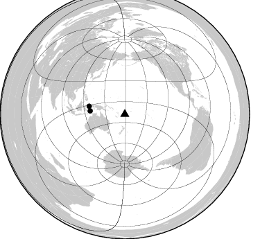
Nearby stations (2 deg radius)

| Station | Name | (Lat, Lon) | Start / End | Elevation |
| SUVA | Suva, Fiji | (-18.11, 178.45) | 1994-03-02 / 1995-12-31 | 50 m |
| Crust2 Type: | B6,thick melt affected o.c., 0.5 km seds. |
| Thickness Estimate: | 36 km |
| Thickness StdDev: | 14 km |
| Vp/Vs Estimate: | 1.60 |
| Vp/Vs StdDev: | 0.00 |
| Vs Estimate: | 3.247 km/s |
| Poisson's Ratio: | 0.18 |
| Peak Value: | 0.16 |
| Assumed Vp: | 5.195 km/s |
| Ps Weight: | 0.33333334 |
| PpPs Weight: | 0.33333334 |
| PsPs Weight: | 0.33333328 |
| Residual Complexity: | 0.851 |
| Nearby stations H: | +- |
| (2.0 deg) Vp/Vs: | +- |
0 with match > 90% ( 0.0 %) and 2 with match > 80% ( 12.5 %) out of 16.
Download stack as xyz text file.
Azimuth Distribution of Events:
Prior Results for this Station
| Study | Thickness | Vp/Vs | Vp | Vs | Poissons Ratio | Extra |
| EARS | 36 km | 1.60 | 5.195 km/s | 3.247 km/s | 0.18 | |
| Crust2.0 | 24 km | 1.98 | 5.195 km/s | 2.627 km/s | 0.33 | B6,thick melt affected o.c., 0.5 km seds. |
| Global Maxima | 36 km | 1.60 | 5.195 km/s | 3.247 km/s | 0.18 | amp=0.16297504 |
| Local Maxima 1 | 40 km | 1.62 | 5.195 km/s | 3.202 km/s | 0.19 | amp=0.11904098 |
| Local Maxima 2 | 38 km | 2.10 | 5.195 km/s | 2.477 km/s | 0.35 | amp=0.10663454 |
| Local Maxima 3 | 50 km | 1.88 | 5.195 km/s | 2.767 km/s | 0.30 | amp=0.08617996 |
| Local Maxima 4 | 27 km | 1.81 | 5.195 km/s | 2.87 km/s | 0.28 | amp=0.083890304 |
| Predicted Arrivals for vertical incidence (zero ray parameter) | |
| Ps | 4.13 SECOND |
| PpPs | 17.89 SECOND |
| PsPs/PpSs | 22.02 SECOND |
Events Processed for this Station
Download zip of receiver functions as SAC
Plot maxima for each earthquake.
Events Used in the Stack
(2 events)| Radial Match | Distance | Baz | FERegion | Time | Lat/Lon | Depth | Magnitude |
| 83.983315 | 52.7 deg | 282.526 deg | Halmahera, Indonesia | 1995/02/13 15:04:26 GMT | (-1.4, 127.5) | 33 km | 6.2 MB, 6.8 MS, 6.8 UNKNOWN, 6.7 MW |
| 81.016945 | 50.2 deg | 275.339 deg | Banda Sea | 1994/07/13 11:45:25 GMT | (-7.5, 127.9) | 185 km | 6.4 MB, 6.8 UNKNOWN, 6.5 MW |
Losers
(14 events)| Radial Match | Distance | Baz | FERegion | Time | Lat/Lon | Depth | Magnitude | Reason |
| 73.066505 | 46.6 deg | 195.358 deg | Balleny Islands Region | 1995/06/21 15:28:51 GMT | (-61.6, 154.7) | 10 km | 5.6 MB, 6.7 MS, 6.8 UNKNOWN, 6.8 MW | |
| 68.74297 | 52.9 deg | 317.04 deg | Mariana Islands Region | 1995/04/08 17:45:18 GMT | (21.8, 142.6) | 319 km | 6.3 MB | |
| 67.29906 | 44.3 deg | 282.955 deg | Irian Jaya Region, Indonesia | 1994/05/25 04:03:40 GMT | (-4.2, 135.4) | 33 km | 5.9 MB, 6.5 MS, 6.6 UNKNOWN, 6.5 MW | |
| 66.94228 | 78.6 deg | 271.628 deg | Southern Sumatra, Indonesia | 1994/05/11 08:18:16 GMT | (-2.0, 99.8) | 28 km | 6.0 MB, 6.3 MS, 6.0 UNKNOWN, 6.3 MW | |
| 63.61965 | 73.3 deg | 326.433 deg | Primor'ye, Russia | 1994/07/21 18:36:31 GMT | (42.3, 132.9) | 473 km | 6.4 MB, 7.2 UNKNOWN | |
| 61.550766 | 33.5 deg | 288.355 deg | Eastern New Guinea Reg., P.N.G. | 1995/03/12 12:09:43 GMT | (-5.3, 146.7) | 233 km | 5.6 MB, 6.2 UNKNOWN, 6.1 MW | |
| 60.198544 | 54.0 deg | 287.065 deg | Northern Molucca Sea | 1995/07/26 23:42:02 GMT | (2.6, 127.7) | 66 km | 5.9 MB, 6.4 UNKNOWN, 6.4 MW | |
| 56.739075 | 57.1 deg | 282.123 deg | Minahassa Peninsula, Sulawesi | 1995/09/01 06:30:37 GMT | (0.0, 123.2) | 163 km | 5.5 MB | |
| 55.45413 | 69.9 deg | 343.362 deg | Kuril Islands | 1995/06/29 07:45:09 GMT | (48.8, 154.5) | 62 km | 5.9 MB, 6.0 UNKNOWN, 6.0 MW | |
| 50.76696 | 69.2 deg | 324.596 deg | Sea Of Japan | 1995/03/31 14:01:40 GMT | (38.2, 135.1) | 365 km | 6.0 MB, 6.2 UNKNOWN, 6.3 MW | |
| 47.547844 | 57.1 deg | 289.868 deg | Mindanao, Philippines | 1994/07/06 09:13:11 GMT | (6.0, 125.9) | 164 km | 5.7 MB, 6.1 UNKNOWN | |
| 47.45248 | 48.9 deg | 277.197 deg | Banda Sea | 1994/04/14 03:28:26 GMT | (-6.6, 129.7) | 170 km | 5.8 MB | |
| 44.073082 | 56.5 deg | 289.206 deg | Mindanao, Philippines | 1995/02/19 00:17:48 GMT | (5.2, 126.2) | 104 km | 5.9 MB, 6.1 UNKNOWN, 6.1 MW | |
| 43.270912 | 75.4 deg | 350.126 deg | Near East Coast Of Kamchatka | 1994/05/24 21:13:18 GMT | (56.2, 161.2) | 91 km | 5.9 MB, 5.8 UNKNOWN, 5.7 MW |
