
Station XB POP2 - XB.POP2
Network: XB96 - Abitibi Experiment
Nearby stations (2 deg radius)

| Station | Name | (Lat, Lon) | Start / End | Elevation |
| POP2 | XB.POP2 | (47.59, -79.22) | 1996-05-17 / 1996-12-31 | 0.0 m |
| Crust2 Type: | H2,early/mid Proter. shield, Finland, no seds. |
| Thickness Estimate: | 39 km |
| Thickness StdDev: | 3.8 km |
| Vp/Vs Estimate: | 1.73 |
| Vp/Vs StdDev: | 0.07 |
| Vs Estimate: | 3.822 km/s |
| Poisson's Ratio: | 0.25 |
| Peak Value: | 0.02 |
| Assumed Vp: | 6.622 km/s |
| Ps Weight: | 0.33333334 |
| PpPs Weight: | 0.33333334 |
| PsPs Weight: | 0.33333328 |
| Residual Complexity: | 0.644 |
| Nearby stations H: | +- |
| (2.0 deg) Vp/Vs: | +- |
6 with match > 90% ( 28.571428 %) and 10 with match > 80% ( 47.61905 %) out of 21.
Download stack as xyz text file.
Azimuth Distribution of Events:

Prior Results for this Station
| Study | Thickness | Vp/Vs | Vp | Vs | Poissons Ratio | Extra |
| EARS | 39 km | 1.73 | 6.622 km/s | 3.822 km/s | 0.25 | |
| Crust2.0 | 45 km | 1.78 | 6.622 km/s | 3.729 km/s | 0.27 | H2,early/mid Proter. shield, Finland, no seds. |
| Global Maxima | 39 km | 1.73 | 6.622 km/s | 3.822 km/s | 0.25 | amp=0.018606896 |
| Local Maxima 1 | 44 km | 1.65 | 6.622 km/s | 4.02 km/s | 0.21 | amp=0.011513506 |
| Local Maxima 2 | 37 km | 1.74 | 6.622 km/s | 3.817 km/s | 0.25 | amp=0.009309694 |
| Local Maxima 3 | 29 km | 1.89 | 6.622 km/s | 3.495 km/s | 0.31 | amp=0.008572446 |
| Local Maxima 4 | 32 km | 1.90 | 6.622 km/s | 3.485 km/s | 0.31 | amp=0.0068837004 |
| Predicted Arrivals for vertical incidence (zero ray parameter) | |
| Ps | 4.31 SECOND |
| PpPs | 16.09 SECOND |
| PsPs/PpSs | 20.41 SECOND |
Events Processed for this Station
Download zip of receiver functions as SAC
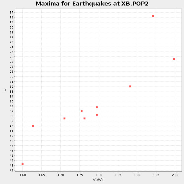
Plot maxima for each earthquake.
Events Used in the Stack
(10 events)| Radial Match | Distance | Baz | FERegion | Time | Lat/Lon | Depth | Magnitude |
| 98.585014 | 58.8 deg | 313.551 deg | Andreanof Islands, Aleutian Is. | 1996/06/10 15:24:56 GMT | (51.5, -176.8) | 26 km | 5.9 MB, 7.1 MS, 7.2 UNKNOWN, 6.9 MS |
| 97.96877 | 59.1 deg | 313.986 deg | Andreanof Islands, Aleutian Is. | 1996/06/10 04:03:35 GMT | (51.6, -177.6) | 33 km | 6.6 MB, 7.6 MS, 7.9 UNKNOWN, 7.4 MS |
| 95.46525 | 89.8 deg | 328.262 deg | Near East Coast Of Honshu, Japan | 1996/09/11 02:37:14 GMT | (35.5, 140.9) | 55 km | 6.1 MB, 5.7 MS, 6.2 UNKNOWN, 6.1 MW |
| 94.998604 | 48.1 deg | 127.41 deg | Northern Mid-Atlantic Ridge | 1996/06/02 02:52:09 GMT | (10.8, -42.3) | 10 km | 6.1 MB, 6.9 MS, 7.0 UNKNOWN, 6.8 MW |
| 94.86933 | 69.3 deg | 325.396 deg | Off East Coast Of Kamchatka | 1996/06/21 13:57:10 GMT | (51.6, 159.1) | 20 km | 6.0 MB, 6.6 MS, 7.0 UNKNOWN, 6.5 MS |
| 93.78609 | 49.4 deg | 182.343 deg | Off Coast Of Ecuador | 1996/08/05 21:39:16 GMT | (-2.0, -81.0) | 33 km | 5.7 MB, 5.9 MS, 6.2 UNKNOWN, 6.2 MW |
| 89.80336 | 34.8 deg | 218.219 deg | Guerrero, Mexico | 1996/07/15 21:23:34 GMT | (17.6, -101.0) | 18 km | 5.7 MB, 6.5 MS, 6.6 UNKNOWN, 6.2 ME |
| 82.10673 | 38.3 deg | 188.119 deg | Costa Rica | 1996/08/28 17:16:17 GMT | (9.4, -84.3) | 33 km | 5.5 MB, 5.5 MS, 5.9 UNKNOWN |
| 80.94695 | 59.5 deg | 314.22 deg | Andreanof Islands, Aleutian Is. | 1996/08/19 04:19:16 GMT | (51.5, -178.4) | 33 km | 5.7 MB, 5.6 MS, 6.0 UNKNOWN, 5.7 ML |
| 80.20054 | 58.6 deg | 313.097 deg | Andreanof Islands, Aleutian Is. | 1996/06/11 10:40:08 GMT | (51.3, -176.3) | 33 km | 5.6 MB, 5.6 MS, 6.0 UNKNOWN, 5.5 MS |
Losers
(11 events)| Radial Match | Distance | Baz | FERegion | Time | Lat/Lon | Depth | Magnitude | Reason |
| 79.69053 | 64.3 deg | 330.855 deg | Kamchatka Peninsula, Russia | 1996/07/07 10:49:59 GMT | (58.6, 157.8) | 10 km | 5.6 MB, 5.6 MS, 5.8 UNKNOWN, 5.8 MW | |
| 75.6039 | 68.9 deg | 325.138 deg | Off East Coast Of Kamchatka | 1996/06/30 11:32:35 GMT | (51.7, 159.8) | 33 km | 5.5 MB, 5.9 MS, 6.1 UNKNOWN, 6.0 MW | |
| 71.99384 | 69.2 deg | 325.177 deg | Off East Coast Of Kamchatka | 1996/07/18 22:55:03 GMT | (51.5, 159.4) | 33 km | 5.5 MB, 5.2 MS | |
| 62.430588 | 59.5 deg | 314.122 deg | Andreanof Islands, Aleutian Is. | 1996/06/12 02:16:48 GMT | (51.4, -178.2) | 33 km | 5.5 MB, 5.3 MS, 5.7 UNKNOWN, 5.6 ML | |
| 62.258453 | 36.4 deg | 190.357 deg | Nicaragua | 1996/09/18 17:34:20 GMT | (11.4, -85.5) | 193 km | 5.7 UNKNOWN, 5.3 MB, 5.5 MW | |
| 61.59205 | 69.4 deg | 325.221 deg | Off East Coast Of Kamchatka | 1996/06/22 14:50:07 GMT | (51.4, 159.2) | 33 km | 5.6 MB, 6.0 MS, 6.2 UNKNOWN, 6.2 MW | |
| 60.066463 | 38.3 deg | 188.043 deg | Costa Rica | 1996/09/04 19:06:49 GMT | (9.4, -84.3) | 33 km | 5.8 MB, 5.9 MS, 6.2 UNKNOWN, 6.1 MW | |
| 56.958183 | 86.9 deg | 330.024 deg | Eastern Honshu, Japan | 1996/08/10 18:12:17 GMT | (38.9, 140.5) | 10 km | 6.0 MB, 5.7 MS, 5.9 UNKNOWN, 5.9 MW | |
| 49.36203 | 55.5 deg | 311.701 deg | Fox Islands, Aleutian Islands | 1996/07/10 05:48:19 GMT | (52.2, -171.1) | 33 km | 5.9 ML, 5.4 MS, 5.3 MB | |
| 47.070835 | 90.5 deg | 9.03 deg | Southern Xinjiang, China | 1996/06/08 02:55:57 GMT | (41.7, 88.7) | 0.0 km | 5.9 MB, 4.3 MS | |
| 43.888336 | 69.1 deg | 325.203 deg | Off East Coast Of Kamchatka | 1996/06/23 12:45:06 GMT | (51.6, 159.5) | 33 km | 5.3 MB, 6.1 MS |
