
Station XD HOT15 - Finnafjordur, Iceland
Network: XD96 - Iceland Hotspot
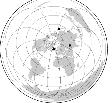
Nearby stations (2 deg radius)

| Station | Name | (Lat, Lon) | Start / End | Elevation |
| HOT15 | Finnafjordur, Iceland | (66.12, -15.17) | 1996-07-14 / 1998-08-12 | 20 m |
| Crust2 Type: | C0,continental shelf, 0.25 km seds. |
| Thickness Estimate: | 26 km |
| Thickness StdDev: | 17 km |
| Vp/Vs Estimate: | 1.60 |
| Vp/Vs StdDev: | 0.15 |
| Vs Estimate: | 3.965 km/s |
| Poisson's Ratio: | 0.18 |
| Peak Value: | 0.02 |
| Assumed Vp: | 6.344 km/s |
| Ps Weight: | 0.33333334 |
| PpPs Weight: | 0.33333334 |
| PsPs Weight: | 0.33333328 |
| Residual Complexity: | 0.670 |
| Nearby stations H: | +- |
| (2.0 deg) Vp/Vs: | +- |
0 with match > 90% ( 0.0 %) and 2 with match > 80% ( 100.0 %) out of 2.
Download stack as xyz text file.
Azimuth Distribution of Events:
Prior Results for this Station
| Study | Thickness | Vp/Vs | Vp | Vs | Poissons Ratio | Extra |
| EARS | 26 km | 1.60 | 6.344 km/s | 3.965 km/s | 0.18 | |
| Crust2.0 | 29 km | 1.80 | 6.344 km/s | 3.528 km/s | 0.28 | C0,continental shelf, 0.25 km seds. |
| Global Maxima | 26 km | 1.60 | 6.344 km/s | 3.965 km/s | 0.18 | amp=0.018682064 |
| Local Maxima 1 | 67 km | 1.90 | 6.344 km/s | 3.334 km/s | 0.31 | amp=0.00900817 |
| Local Maxima 2 | 24 km | 1.77 | 6.344 km/s | 3.589 km/s | 0.26 | amp=0.00822423 |
| Local Maxima 3 | 62 km | 2.10 | 6.344 km/s | 3.024 km/s | 0.35 | amp=0.0070566754 |
| Local Maxima 4 | 59 km | 2.00 | 6.344 km/s | 3.168 km/s | 0.33 | amp=0.006049815 |
| Predicted Arrivals for vertical incidence (zero ray parameter) | |
| Ps | 2.41 SECOND |
| PpPs | 10.45 SECOND |
| PsPs/PpSs | 12.86 SECOND |
Events Processed for this Station
Download zip of receiver functions as SAC
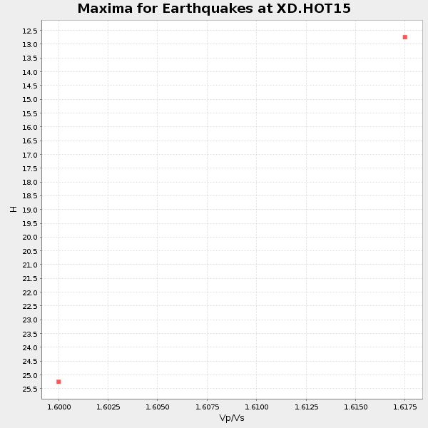
Plot maxima for each earthquake.
Events Used in the Stack
(2 events)| Radial Match | Distance | Baz | FERegion | Time | Lat/Lon | Depth | Magnitude |
| 83.16783 | 70.0 deg | 14.243 deg | Kuril Islands | 1997/07/14 16:09:35 GMT | (43.2, 146.4) | 33 km | 5.9 MB, 5.8 MS, 6.1 UNKNOWN, 5.8 ME |
| 81.99969 | 55.8 deg | 76.674 deg | Hindu Kush Region, Afghanistan | 1997/05/13 14:13:45 GMT | (36.4, 70.9) | 196 km | 6.1 MB, 6.5 UNKNOWN, 6.4 MW |
Losers
(0 events)| Radial Match | Distance | Baz | FERegion | Time | Lat/Lon | Depth | Magnitude | Reason |
