
Station XE EFS - East Fork / Sable
Network: XE99 - Broadband Experiment Across Alaskan Range
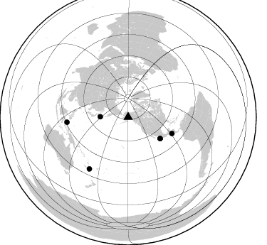
Nearby stations (2 deg radius)

| Station | Name | (Lat, Lon) | Start / End | Elevation |
| EFS | East Fork / Sable | (63.56, -149.78) | 2000-06-11 / 2001-12-31 | 964 m |
| Crust2 Type: | L8,thin continental arc, Cordilleras, 0.5 km seds. |
| Thickness Estimate: | 40 km |
| Thickness StdDev: | 9.0 km |
| Vp/Vs Estimate: | 1.90 |
| Vp/Vs StdDev: | 0.10 |
| Vs Estimate: | 3.451 km/s |
| Poisson's Ratio: | 0.31 |
| Peak Value: | 0.02 |
| Assumed Vp: | 6.566 km/s |
| Ps Weight: | 0.33333334 |
| PpPs Weight: | 0.33333334 |
| PsPs Weight: | 0.33333328 |
| Residual Complexity: | 0.674 |
| Nearby stations H: | +- |
| (2.0 deg) Vp/Vs: | +- |
1 with match > 90% ( 14.285714 %) and 6 with match > 80% ( 85.71429 %) out of 7.
Download stack as xyz text file.
Azimuth Distribution of Events:
Prior Results for this Station
| Study | Thickness | Vp/Vs | Vp | Vs | Poissons Ratio | Extra |
| EARS | 40 km | 1.90 | 6.566 km/s | 3.451 km/s | 0.31 | |
| Crust2.0 | 34 km | 1.77 | 6.566 km/s | 3.707 km/s | 0.27 | L8,thin continental arc, Cordilleras, 0.5 km seds. |
| Global Maxima | 40 km | 1.90 | 6.566 km/s | 3.451 km/s | 0.31 | amp=0.02144651 |
| Local Maxima 1 | 44 km | 1.75 | 6.566 km/s | 3.747 km/s | 0.26 | amp=0.016798332 |
| Local Maxima 2 | 30 km | 2.10 | 6.566 km/s | 3.13 km/s | 0.35 | amp=0.011245003 |
| Local Maxima 3 | 70 km | 1.98 | 6.566 km/s | 3.312 km/s | 0.33 | amp=0.009403281 |
| Local Maxima 4 | 58 km | 1.84 | 6.566 km/s | 3.564 km/s | 0.29 | amp=0.0077672717 |
| Predicted Arrivals for vertical incidence (zero ray parameter) | |
| Ps | 5.53 SECOND |
| PpPs | 17.79 SECOND |
| PsPs/PpSs | 23.32 SECOND |
Events Processed for this Station
Download zip of receiver functions as SAC
Plot maxima for each earthquake.
Events Used in the Stack
(6 events)| Radial Match | Distance | Baz | FERegion | Time | Lat/Lon | Depth | Magnitude |
| 90.85117 | 65.7 deg | 110.58 deg | El Salvador | 2001/01/13 17:33:32 GMT | (13.0, -88.7) | 60 km | 6.4 MB, 7.8 MS, 7.7 MW, 7.5 ME |
| 89.30055 | 54.2 deg | 123.851 deg | Near Coast Of Jalisco, Mexico | 2001/05/20 04:21:43 GMT | (18.8, -104.4) | 33 km | 5.5 MB, 6.0 MS, 6.5 MD, 6.3 MW |
| 87.01732 | 86.2 deg | 265.168 deg | Northern Molucca Sea | 2001/02/24 07:23:48 GMT | (1.3, 126.2) | 35 km | 6.6 MB, 7.0 MS, 7.1 MW, 7.1 ME |
| 84.668846 | 90.9 deg | 216.725 deg | Southeast Of Loyalty Islands | 2001/02/28 13:05:31 GMT | (-22.0, 170.1) | 10 km | 5.8 MB, 6.1 MS, 6.2 MW |
| 81.91267 | 54.2 deg | 123.996 deg | Near Coast Of Jalisco, Mexico | 2001/04/29 21:26:54 GMT | (18.7, -104.5) | 10 km | 5.2 MB, 5.5 MS, 6.1 MW, 6.1 MW |
| 81.38363 | 39.3 deg | 270.733 deg | Kuril Islands | 2001/05/25 00:40:50 GMT | (44.3, 148.4) | 33 km | 6.1 MB, 6.7 MS, 6.7 MW, 6.6 MW |
Losers
(1 events)| Radial Match | Distance | Baz | FERegion | Time | Lat/Lon | Depth | Magnitude | Reason |
| 84.559 | 87.8 deg | 323.768 deg | Southern India | 2001/01/26 03:16:40 GMT | (23.4, 70.2) | 16 km | 6.9 MB, 8.0 MS, 7.7 MW, 7.7 ME |
