
Station XF L21 - XF.L21
Network: XF00 - Laramie Telemetered Brad-band Array
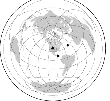
Nearby stations (2 deg radius)
| Station | Name | (Lat, Lon) | Start / End | Elevation |
| L21 | XF.L21 | (41.40, -105.86) | 2000-09-01 / 2002-01-01 | 1.8 m |
| Crust2 Type: | P4,orogen/50km, Urals, Tethian Orogen, Rockies 1 km seds. |
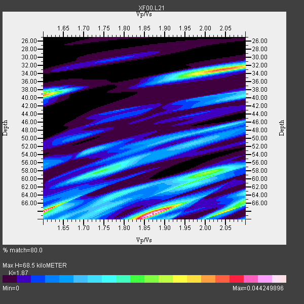
| Thickness Estimate: | 68 km |
| Thickness StdDev: | 1.8 km |
| Vp/Vs Estimate: | 1.87 |
| Vp/Vs StdDev: | 0.17 |
| Vs Estimate: | 3.372 km/s |
| Poisson's Ratio: | 0.30 |
| Peak Value: | 0.04 |
| Assumed Vp: | 6.306 km/s |
| Ps Weight: | 0.33333334 |
| PpPs Weight: | 0.33333334 |
| PsPs Weight: | 0.33333328 |
| Residual Complexity: | 0.863 |
| Nearby stations H: | +- |
| (2.0 deg) Vp/Vs: | +- |
1 with match > 90% ( 50.0 %) and 2 with match > 80% ( 100.0 %) out of 2.
Download stack as xyz text file.
Azimuth Distribution of Events:
Prior Results for this Station
| Study | Thickness | Vp/Vs | Vp | Vs | Poissons Ratio | Extra |
| EARS | 68 km | 1.87 | 6.306 km/s | 3.372 km/s | 0.30 | |
| Crust2.0 | 50 km | 1.76 | 6.306 km/s | 3.584 km/s | 0.26 | P4,orogen/50km, Urals, Tethian Orogen, Rockies 1 km seds. |
| Global Maxima | 68 km | 1.87 | 6.306 km/s | 3.372 km/s | 0.30 | amp=0.044249896 |
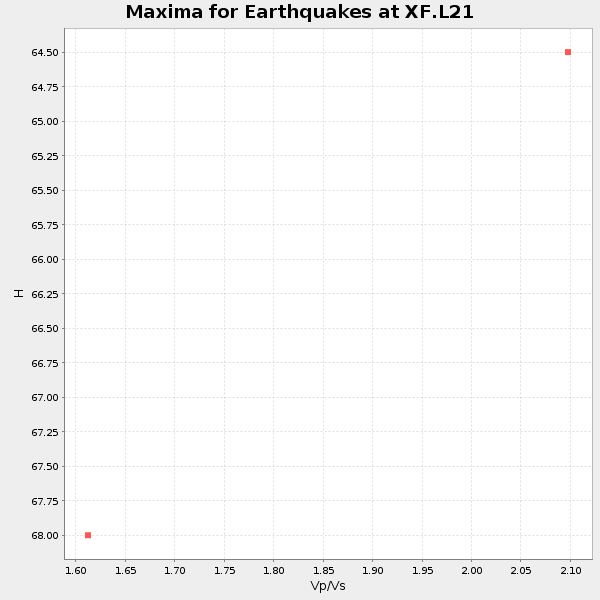
| Local Maxima 1 | 68 km | 1.60 | 6.306 km/s | 3.941 km/s | 0.18 | amp=0.043452635 |
| Local Maxima 2 | 33 km | 2.04 | 6.306 km/s | 3.095 km/s | 0.34 | amp=0.034479346 |
| Local Maxima 3 | 39 km | 1.60 | 6.306 km/s | 3.941 km/s | 0.18 | amp=0.030642442 |
| Local Maxima 4 | 68 km | 2.04 | 6.306 km/s | 3.087 km/s | 0.34 | amp=0.027991436 |
| Predicted Arrivals for vertical incidence (zero ray parameter) | |
| Ps | 9.45 SECOND |
| PpPs | 31.18 SECOND |
| PsPs/PpSs | 40.63 SECOND |
Events Processed for this Station
Download zip of receiver functions as SAC
Plot maxima for each earthquake.
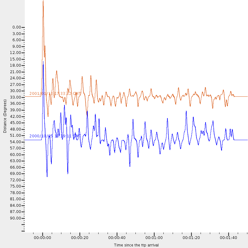
Events Used in the Stack
(2 events)| Radial Match | Distance | Baz | FERegion | Time | Lat/Lon | Depth | Magnitude |
| 93.77379 | 32.0 deg | 147.052 deg | El Salvador | 2001/01/13 17:33:32 GMT | (13.0, -88.7) | 60 km | 6.4 MB, 7.8 MS, 7.7 MW, 7.5 ME |
| 80.81327 | 51.9 deg | 78.6 deg | Northern Mid-Atlantic Ridge | 2000/10/05 13:39:11 GMT | (31.7, -41.0) | 10 km | 5.4 MB, 6.1 MS, 6.0 MW, 5.9 MW |
Losers
(0 events)| Radial Match | Distance | Baz | FERegion | Time | Lat/Lon | Depth | Magnitude | Reason |
