
Station XH RS13 - Ross Ice Shelf - RS13
Network: XH14 - Dynamic Response of the Ross Ice Shelf to Ocean Waves and Structure and Dynamics
Nearby stations (2 deg radius)
| Station | Name | (Lat, Lon) | Start / End | Elevation |
| RS13 | Ross Ice Shelf - RS13 | (-78.75, -144.01) | 2014-11-21 / 2017-02-09 | 5.0 m |
| Crust2 Type: | N8,highly extended crust, 1.5 km ice |
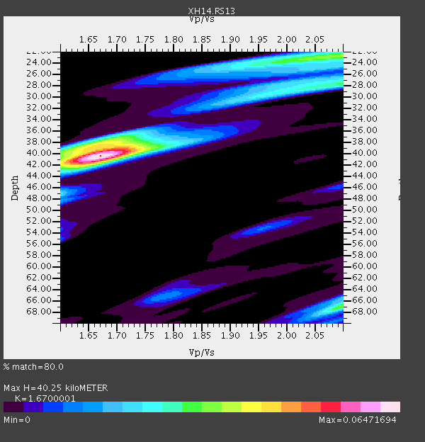
| Thickness Estimate: | 40 km |
| Thickness StdDev: | 0.7 km |
| Vp/Vs Estimate: | 1.67 |
| Vp/Vs StdDev: | 0.01 |
| Vs Estimate: | 3.675 km/s |
| Poisson's Ratio: | 0.22 |
| Peak Value: | 0.06 |
| Assumed Vp: | 6.138 km/s |
| Ps Weight: | 0.33333334 |
| PpPs Weight: | 0.33333334 |
| PsPs Weight: | 0.33333328 |
| Residual Complexity: | 0.664 |
| Nearby stations H: | +- |
| (2.0 deg) Vp/Vs: | +- |
2 with match > 90% ( 25.0 %) and 2 with match > 80% ( 25.0 %) out of 8.
Download stack as xyz text file.
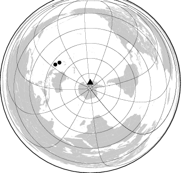
Azimuth Distribution of Events:
Prior Results for this Station
| Study | Thickness | Vp/Vs | Vp | Vs | Poissons Ratio | Extra |
| EARS | 40 km | 1.67 | 6.138 km/s | 3.675 km/s | 0.22 | |
| Crust2.0 | 27 km | 1.78 | 6.138 km/s | 3.447 km/s | 0.27 | N8,highly extended crust, 1.5 km ice |
| Global Maxima | 40 km | 1.67 | 6.138 km/s | 3.675 km/s | 0.22 | amp=0.06471694 |
| Local Maxima 1 | 67 km | 2.10 | 6.138 km/s | 2.926 km/s | 0.35 | amp=0.033985518 |
| Local Maxima 2 | 22 km | 2.10 | 6.138 km/s | 2.93 km/s | 0.35 | amp=0.03395908 |
| Local Maxima 3 | 38 km | 1.67 | 6.138 km/s | 3.67 km/s | 0.22 | amp=0.02976863 |
| Local Maxima 4 | 28 km | 2.10 | 6.138 km/s | 2.926 km/s | 0.35 | amp=0.029616587 |
| Predicted Arrivals for vertical incidence (zero ray parameter) | |
| Ps | 4.39 SECOND |
| PpPs | 17.51 SECOND |
| PsPs/PpSs | 21.90 SECOND |
Events Processed for this Station
Download zip of receiver functions as SAC
Plot maxima for each earthquake.
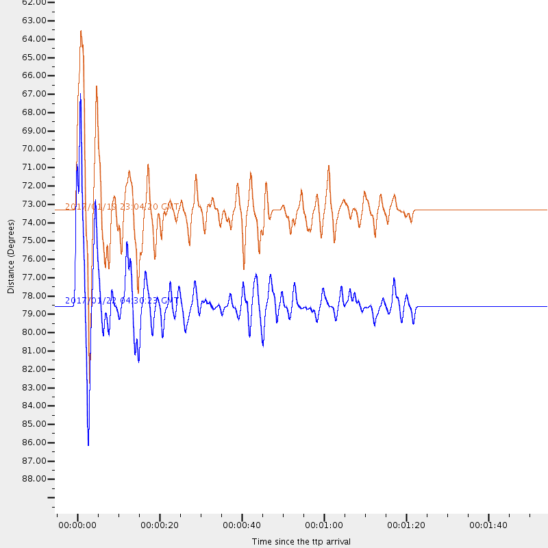
Events Used in the Stack
(2 events)| Radial Match | Distance | Baz | FERegion | Time | Lat/Lon | Depth | Magnitude |
| 96.40717 | 78.4 deg | 297.575 deg | Solomon Islands | 2017/01/22 04:30:23 GMT | (-6.2, 155.1) | 136 km | 7.9 mww |
| 95.828094 | 73.3 deg | 303.04 deg | Solomon Islands | 2017/01/19 23:04:20 GMT | (-10.4, 161.3) | 34 km | 6.8 mwp |
Losers
(6 events)| Radial Match | Distance | Baz | FERegion | Time | Lat/Lon | Depth | Magnitude | Reason |
| 63.760864 | 65.0 deg | 328.959 deg | Samoa Islands Region | 2017/01/28 22:32:51 GMT | (-15.3, -173.0) | 10 km | 5.7 mb | |
| 63.30252 | 50.9 deg | 321.958 deg | Kermadec Islands, New Zealand | 2017/01/29 14:59:51 GMT | (-30.1, -177.5) | 14 km | 5.7 Mwb | |
| 61.87336 | 68.0 deg | 308.276 deg | Vanuatu Islands | 2017/01/30 23:35:23 GMT | (-14.8, 167.2) | 78 km | 5.8 Mwp | |
| 61.453228 | 78.2 deg | 295.933 deg | New Britain Region, P.N.G. | 2017/01/22 04:44:52 GMT | (-6.7, 153.6) | 10 km | 5.6 mb | |
| 54.434944 | 89.4 deg | 69.079 deg | Colombia | 2017/02/06 13:02:45 GMT | (3.4, -74.7) | 38 km | 5.5 Mww | |
| 52.84552 | 71.3 deg | 203.091 deg | Southwest Indian Ridge | 2017/01/29 16:42:26 GMT | (-29.2, 61.1) | 10 km | 5.8 mb |

